Showing posts with label Cochise Stronghold. Show all posts

Monday, November 07, 2011

GASSED UP THE RIG AND HAD A BIN DOOR GAS SHOCK REPLACED

DSC_0007

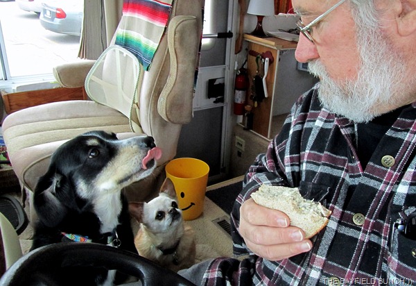
With the approaching inclement weather in a few days I figured it was best to gas up the rig now rather than later.  Pheebs, Motor and I headed off to Goderich and loaded up with $260.00 worth of fuel.  With McDonald's tempting us just across the road we turned our backs on that idea and instead I zipped into the mall beside the gas bar and got us Turkey salad sandwich for breakfast.  Happy little tummies all around. 

IMG_1193

From there it was over to CTC (Canadian Tire) to have all the tire pressures checked.  A-OK.  Headed back to Bayfield for a stop at STORMRUNNER RV SALES AND SERVICE.   Our main bin door on the rig was not remaining up anymore and I suspected the gas shock was shot.  It was.  Had emailed Diane at Stormrunner earlier in the morning to see if they had those types of shocks in stock and they did.  Rolled into Stormrunner's and it took one of the fellows there all of about 3 minutes to replace the worn out shock and I was good to go.  Dianne hadn't met Pheebe or the Motormouse (Cora) before and after following our blog for the past 3 years she was anxious to to meet the guys.  Dianne and husband Harry usually head for Florida every year in one of their nice high end Carriage Fifth Wheels but this year they are breaking with tradition and heading West with a truck camper on their big new Ford dually.  Di had told me awhile ago that after reading our blog and seeing all the photos of our travels over the past few years she wanted to head West for a welcome change and see all that great scenery for herself.  Good for you Di and maybe we'll meet up with you guys somewhere in the Southwest for a good old dust and sage brush infested desert coffee somewhere:))
IMG_1195   IMG_1181
HARRY’S BIG SHINY FORD DUALLY AND THE GAS SHOCK WE HAD TO GET REPLACED

Forgot to mention a few things in Sunday night's post regarding Kelly being able to help a neighbour gain access to our blog site again.  A link in our Shout Box last week from Bob set the gears in Motion for Kelly in tracking down the culprit that was not allowing Monica's computer access.  I also mentioned it was a DNS problem and forgot to explain DNS.  I know how annoying it is when people put clusters of letters in their blogs and then expect everyone to know what they are.  You know, ROTFL, LMAOUISMP, PMPTIOD, etc.  DNS could have meant, Damn Nasty Soup or Disco Night Shuffle for all anybody knew.  Here's what DNS really means......WHAT IS A DNS SERVER.  Had an email this morning from Cindy in Ohio also saying she suddenly couldn't access our site so I have no idea what is going on.  A second email from Cindy said she tried it again later and all is well.  Just seems odd that this has never been a problem until the last couple of weeks. 

DSC_0003

And I seem to recall a question from SAM last week wondering what porridge is.  I had mentioned having porridge for supper one night.  Some may remember these words from a Mother Goose Rhyme..."Peas porridge hot, peas porridge cold...Peas porridge in the pot 9 days old.  Some like it hot, some like it cold... Some like it in the pot 9 days old."  When I was a kid we always called porridge, porridge, but nowadays it may simply be known as a bowl of Oatmeal.  Whatever you call it, it's yummy with brown sugar and milk.....hot or cold:))
DSC_0010

OUR RIG IS ONE OF THE FEW ON THE ROAD WITH A BIG NATURAL BUILT IN HAPPY FACE FOR A FRONT END

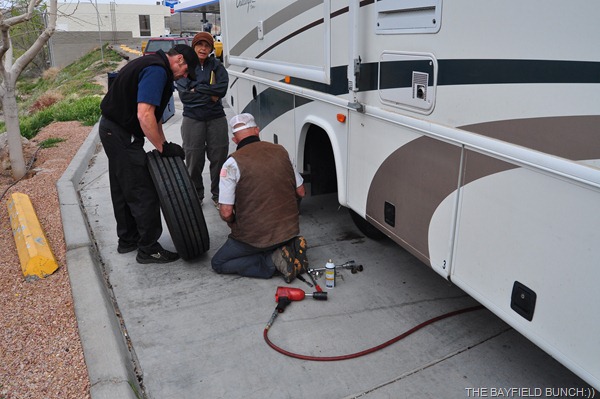
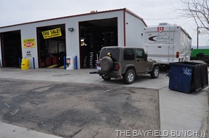
So reassuring this year to know we are heading out with all practically new tires on the rig.  We put two new front tires on the coach a year ago before heading south with the idea of replacing the 4 back tires this year before we left.  By the time we reached Flagstaff Arizona on our way home last March we knew we could not chance going any further with the rear tires in the condition they were.  Reluctantly, we pulled into a tire place and had 4 new tires put on.  I took a few pictures that day at the tire shop but I never posted the photos to the blog that night.  It was just one of those tired frustrating days.  Below are those pics I never published.  It sure tore the heck out of a $3000.00 bill:((

 DSC_0290

DSC_0289 DSC_0288 

I especially liked the photos in JOHN AND BRENDA'S INCREDIBLE JOURNEY recently.  They trailered their horses from near Phoenix to a beautiful area of the Dragoon Mountains near Tombstone Arizona.  Kelly and I are familiar with the area where Brenda and John rode and camped. 

Click on any of the following colored links and they will take you to my posts about each of these places we have been in and around the Dragoon Mountains.  We have hiked both COUNCIL ROCKS and the COCHISE STRONGHOLD nearby and driven over the MIDDLE MARCH PASS.  We have also Jeeped some ROUGH AND DUSTY TRAILS on the northeast side of the Dragoons ending up at the site of 5 Confederate soldiers killed by Apache Indians.  Spent 4 enjoyable hours at the GRAPEVINE CANYON RANCH nestled into the side of the Dragoons near the Cochise Stronghold.  Also visited 3 old western ghost towns on the east side of the Dragoons as well.  PEARCE, COURTLAND, GLEESON 1 and GLEESON 2.   And yep, I reckon we’ve been to TOMBSTONE a time or two as well.  Great historical area for sure and it was nice to see some familiar territory in John and Brenda's photos:))

I am so looking forward to heading for the Southwest once again and I will be so glad to have something else to write about other than this daily same old-same old routine sitting at home stuff.  This past seven and a half months have been such a loooooong haul.  Looking forward to those big west winds blowing all these old tired cobwebs out of my head again…………… 10-4:))

IMG_1197  DSC_0004

OUR TAIL GUNNER IS READY TO RUMBLE AS ARE OUR BISBEE KIDS UP IN THE WINDSHIELD

GROANER'S CORNER:((  The pastor had launched into one of his "Best Ever"messages. He was about half done, at the 45-minute mark and just getting to the "good part," when a member of his congregation died.
Rushing to his office, he dialled 911. When the ambulance arrived, the paramedics carried out 51 people before they finally got one who didn't wake up when they got him to fresh air.

---------------------------------------------------------------------------
-Tourists see the world, travelers  experience it.
-Until one has loved an Animal, their  soul remains un-awakened.
BAYFIELD BUNCH PHOTO ALBUMS https://picasaweb.google.com/117858411710794543295
The only thing better than right now  will someday be the memories of
right  now...AL.

Friday, January 01, 2010

TOMBSTONE TO PEARCE THROUGH THE DRAGOON MOUNTAINS

DSC_5173 

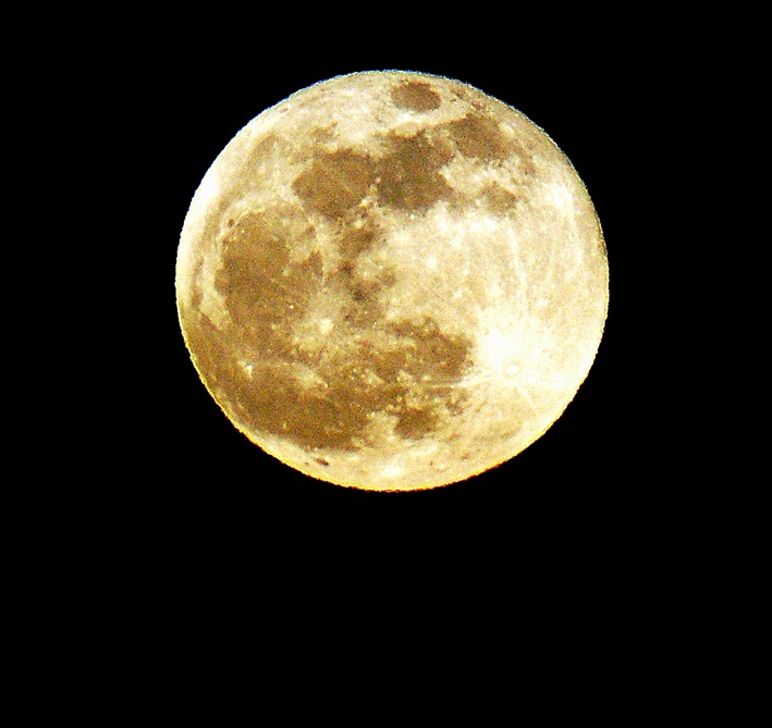
NEW YEAR’S EVE FULL MOON ………………from the ranch:))

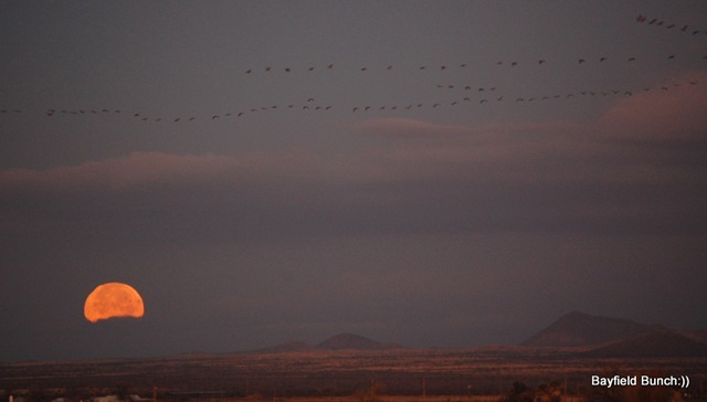
No frost on anything this morning so I was outside at dawn running around in my pajamas taking some photos of the Moon setting in the west somewhere over in the direction of Tombstone.

 DSC_5132

THE MOON SETTING IN THE WEST THIS MORNING

Kelly had an exercise class at 9 so we loaded the computer in the car & off we went.  While Kelly was pumping iron I uploaded a bunch of updates that we had been getting behind on because of our Verizon megabyte limit.  What a big pain in the assparagus that Verizon 5 Gig cap is!!!!

DSC_5135

From the Elfrida library we headed up the highway & turned west heading for the little old ghost town of Gleeson.  We had never traveled the dirt road from Gleeson to Tombstone before so figured to-day was a good day to do that.  Always so nice to see new scenery.  Rolled right through Tombstone & headed north a couple miles before turning east onto the rough & washboardy MIDDLEMARCH ROAD.  Our destination was another little ghost town on the other side of the DRAGOON MOUNTAINS.  Wanted to see the route Tombstone residents took over a hundred years ago to Pearce after gold was discovered there.

DSC_0015

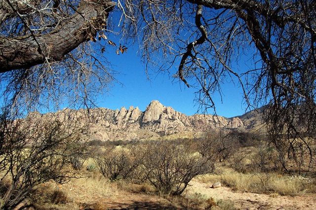
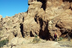
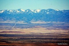
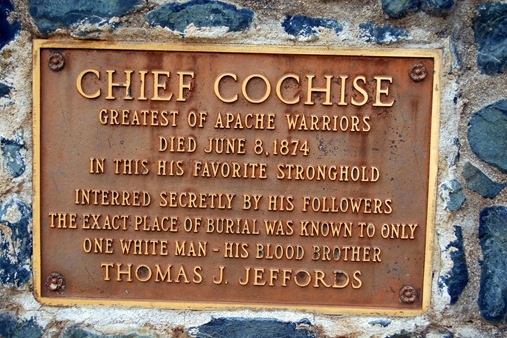
The Dragoon mountains ahead of us stood majestically in the high noon sun & I was reminded of our hike to the COCHISE STRONGHOLD this past March from the east side of the mountains.  (OUR COCHISE STRONGHOLD PHOTOS)  The Dragoons ahead marked the very spot where Cochise's many Apache lookouts took up posts on high rocks scanning the valley we were currently driving through.  Troops from Fort Huachuca on the west side of the San Pedro valley would set out across the desert floor in force to chase Cochise & his men down.  The Indians could see the troops coming for miles & miles & always had the advantage in any battles that took place & Cochise was never captured.  Thought about all that as we approached the natural rugged mountain fortress ahead.

DSC_0019DSC_0022  DSC_0021

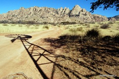
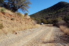
Turned off the Middlemarch Road onto a smaller dirt road & headed north past a sign saying, Coronado Forest.  Road was a bit rough for a short distance then smoothed out reasonably well.  We had gained some altitude so Agave, Yucca, Prickly Pear began appearing along with a lot of trees that we couldn't identify.  These trees stand about 15 feet high with a spreading canopy but we just don't know what they are.  Alongside the road we saw campfire rings where people have pulled in & set up camp.  Saw a windmill slowly turning in the breeze amongst a cluster of trees.  A road led in that direction so we followed it stopping to take some windmill photos.  A cluster of tents marked the end of that road but we didn't see anyone around.  Could have been a group of rock climbers.  We backtracked to the main dirt road & headed a little further north before taking another road which led us a short distance right to the very foot of the beautiful Dragoon Mountains. 

DSC_0027DSC_0042 DSC_0043 DSC_0046 DSC_0051   DSC_0033 DSC_0037 DSC_0038 DSC_0039DSC_0032

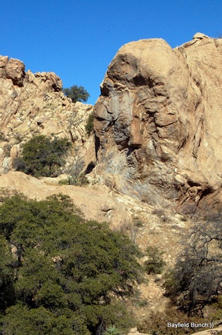
CAN YOU SEE THE INDIAN HEAD PROFILE LOOKING TO THE LEFT IN THE LARGER PHOTO?

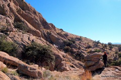
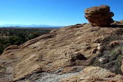
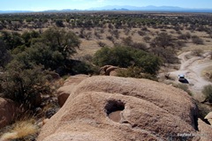
Parked the car & looked up at the large rounded rocks climbing into the sky.  It was so beautiful here that you just wanted to jump out of the car & run right up those huge boulders into the canyons beyond & the towering heights above.  It was a perfect place for rock scrambling because the rocks had a sandpapery surface & with good hiking boots the traction was phenomenal & I just felt like I could walk straight up the mountain.  Didn't take us long to scramble up a hundred feet or so just reveling in our great fortune to have found such a perfect camping spot for future days.  We could see the darkened Huachuca mountains probably 40 miles to the southwest & Bisbee's Mule mountains as many miles to the south.  Sunlight glinted off distant rooftops in Tombstone.  The towering Whetstone mountains led north to Benson which we could also see at the far end of the valley.  Beyond Benson the Rincon mountains spread across the horizon.  Just wanted to stay at this place forever.  It is days like these & places like this that remind me of how truly fortunate Kelly & I are.

DSC_0053

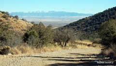
We continued our journey back to Middlemarch Road & wended our way along the bumpy dirt trail winding it's way up & over the summit of Middlemarch Pass.  Patches of snow & cooler temperatures marked the highest point but overall it wasn't that high & it wasn't that cold.  Nice views of the Sulphur Springs Valley far below as we began our descent & I could see the town of Sunizona way out on the valley floor to the northeast.  Finally rolled through sleepy little Pearce east of the Dragoons around 3, picked up highway 191 & headed for home with a quick stop in Sunsites for a very late 2 o'clock coffee.   Awwwww, my kinda day:)))))))

(click on photos below for captions)

A BIT OF SNOW AHEAD  DESCENDING DOWN THE EAST SIDE OF THE DRAGOONS ROAD BLOCK MOOOOOVE ROAD WAS GOOD THROUGH THE PASSACROSS THE SULPHUR SPRINGS VALLEY RISE THE MIGHTY CHIRICAHUA MOUNTAINS   SCENIC ROADTHE SUMMIT OF THE MIDDLEMARCH PASS DINOSAUR MOUNTAIN GOAT 

ALIEN DINOSAUR MOUNTAIN GOAT

Well, it's New Year's Eve & the thing I am most happiest about to-night is that I don't have to do all that silly New Year's Eve stuff anymore!!  I have now been over 30 years free from New Year's Eve's parties.........yaaaaaaay:)) 

DSC_5163

JUST HAVING A LAZY AFTERNOON IN THE DRAGOONS

BELLE’S UPDATE

Emails have been rolling in again to-day with questions, suggestions, & offers.  We plan to go over to the Silverado Ranch in the morning & have us a sit down with Belle & talk about all the positive things that have been happening the past couple of days & her vision for the ranch.  Some decisions will have to be made & a direction forward found.  Emails have to be answered & work has to be started.  Again, Kelly & I thank everyone for their encouragement & support & I will post updates as they happen............................:))

GROANER'S CORNER:((  A man was telling his neighbor, "I just bought a new hearing aid. It cost me four thousand dollars, but it's state of the art. It's perfect." "Really," answered the neighbor. "What kind is it?" "Twelve thirty."

BLOGGER WEBSITE http://thebayfieldbunch.com/

OUR PHOTO ALBUMS  http://picasaweb.google.com/stargeezerguy/

The only thing better than right now will someday be the memories of right now....AL.

ALL THE BEST TO EVERYONE IN THE NEW YEAR FROM THE BAYFIELD BUNCH:))

Wednesday, October 21, 2009

A QUIET & REFLECTIVE MORNING WALK

DSC_0027 I RESCUED THIS CEMENT DALMATIAN FROM A LANDFILL SITE ABOUT 10 YEARS AGO & BROUGHT HIM HOME:))

Click any photo to enlarge it.

There wasn't a sound in the morning air.  No wind to rustle the autumn leaves, no rain to patter on the pond.  Only the sounds of Max & I shuffling along the quiet forest path.   No twittering songbirds in the trees & no scampering squirrels gathering food for the long winter ahead.  Looking about I remembered that old saying, "the lull before the storm."  A saddened sort of feeling came over me as we meandered along the trail.  Not quite the way we used to meander years ago when we were both younger.  Max is aging & finding it harder to keep up now despite my own slower pace.  I am saddened by inner thoughts & concerned for the quiet forest knowing it too has difficult winter storms ahead.

DSC_0001MY BOY MAX SCOUTS THE TRAIL AHEAD

The rain held off all day so that was good for loading more things into the motorhome.  I slipped up to Goderich this morning & picked up a few things at the grocery store we knew we wouldn't find in the States.  Filled the van with gas for it's long winter's stay in the carport.  All & all a moodily quiet day.  This is our lull before the long journey ahead soon...............

DSC_0004TIM HORTON'S COFFEE & SHREDDED WHEAT WITH BRAN ARE RARE COMMODITIES SOUTH OF THE BORDER

Kelly & I in our travels like to head out on day trips that take us to places where we can walk, hike, & do a bit of rock scrambling .  We're not really serious long distance hikers loaded with back packs nor are we into rock climbing as such.  We're generally comfortable for maybe a 4 mile round trip hike, & rock scrambling to us is climbing over rock strewn trails & maybe the odd jaunt up on top of a bolder to have a look around.  We generally like to go by ourselves because that way we can move at our own pace & enjoy our surroundings.  I try to get a feel for where I am & that requires quiet thinking.  I  try to imagine & remember those who have gone before us. 

DSC_0012 The legendary Indian Chief Cochise, leader of the Chiricahua Apaches was one of those figures whose trails we walked upon in February of this year.  Too follow in the footsteps of history has always been a favorite thing of mine.  To walk the same trails & paths as historical figures I read about as a kid is very special to me.  And here on these very paths we walked,  the mighty Indian Chief Cochise & his band of mighty warriors had walked many moons before us.

DSC_0008A LAST LINGERING FLOWER STANDS ALONE IN OUR FLOWERBED

The old dusty rock strewn trail leading into the Dragoon Mountains was long & steep at times as we headed out in search of what is known as the Cochise Stronghold.  Our blog for that day is HERE & you can find our pictures for the Cochise trail in this WEB ALBUM.   Come with us for a hike in the Dragoon Mountains of Arizona.

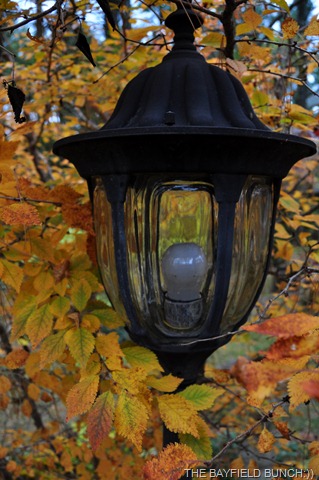
DSC_0021 AUTUMN'S COLOR IN A NEIGHBOR'S YARD TO-DAY

GROANER'S CORNER:((  Did you know that a raisin is just a grape with a sunburn & a secret is something you tell to just one person at a time.

FACEBOOK READERS GO HERE FOR OUR ACTUAL BLOGGER WEBSITE WITH PHOTOS & MORE:))

http://thebayfieldbunch.com/

OUR PHOTO ALBUMS  http://picasaweb.google.com/stargeezerguy/

The only thing better than right now will someday be the memories of right now....AL.

Wednesday, March 11, 2009

THROUGH THE APACHE PASS TO HISTORIC FORT BOWIE

FORT BOWIE'S HORSE & STABLE AREA

A bit of cloud cover this morning but by 9 a.m. it had given way to a big bright sun filled Arizona day. Kelly had a Yoga class this morning scheduled for 10:30 but decided to cancel it because I was whining so much about having to sit around doing nothing for another day. By 9:30 I was happily in the car & we were headed north up Sulphur Springs Valley to Apache Pass & Fort Bowie. Ya know guys, sometimes whining really helps:))FORT BOWIE'S CEMETRY

It's about an hours drive from Elfrida & after we turned east off highway 181 the road changed to a red clay made soft by the rain a couple days ago. Hadn't been graded yet & a bit rough in spots but no problem for the Santa Fe. To reach Fort Bowie we had to go through the historic Apache Pass. What a beautiful place this is. Stopped at the spot where a massacre had taken place when a band of Apache Indians had ambushed a wagon train on the old Butterfield Stage route. Check our web album for details & pictures.
http://picasaweb.google.com/stargeezerguy/ The Pass led down a winding dirt road to a parking lot trail head & it was from here that we began our scenic hike along an easy trail for one & a half miles to Fort Bowie. This is a totally beautiful area of hills, canyons, plains, grasslands, & towering mountain ranges. Arizona is a fascinating place & around every corner is a new adventure.
KELLY LOOKS DOWN AT THE APACHE SPRINGS
We left the parking lot on foot & hit the trail about 11. It would be about 5 hours before we would made it back to the car again. The trail to the fort is rich in history. The Fort Bowie Cemetery, the ruins of the Apache Pass Stage Station, site of the Battle of Apache Pass, & Apache Springs which was the focal point for hundreds of years for people moving through the area needing water. It is this very spot where the whole history of the area revolves. Cochise drank water here, Geronimo drank water here. The spring is alive with the ghosts of countless parched & dusty travelers. All these points are along the trail & at the Apache Pass Stage Station you can see where Cochise met with the American Calvary's 2nd Lt George Bascom & where an ensuing battle took place. Further up the trail is the site where the Apache's attacked the rear of a wagon train & another major battle took place. All these historic sites are clearly marked with reader boards so I photographed each reader board & then took a picture beside it of the area the reader board was describing. This is one of the things that made this hike the best one we've been on so far because everything is so clearly marked. I hesitate to tell you how many photos I took to-day but if you go to our web albums you will see all the things I have described. This is truly a great hike & if your into old west history I recommend you walk this trail from the parking lot north of the fort.
STONE WALL RUINS OF THE ORIGINAL FORT BOWIE
After Apache Springs it's a short distance to the ruins of the first Fort Bowie so we took a side trail & hiked up the hill. Many old stone foundations & the 2nd Fort Bowie is about three quarters of a mile beyond. The photos of the reader boards tell the stories of why the Fort was first built here & why it was later decided to move it's location. We moved on from the old ruins & ghosts to the 2nd Fort Bowie. It was far bigger than I had imagined & we spent an hour just walking around looking at what's left of the Fort. Foundations & sections of walls that have been sealed to prevent further deterioration. All the ruins are clearly marked so you don't have to guess what things are. The surrounding hillsides & mountains form a perfect backdrop to the old legendary ruins. Geronimo once walked these grounds. He was brought here after his surrender in Skeleton Canyon to the south & there is a photograph of him on the parade ground talking to his people. Many soldiers were stationed here & I'm sure their ghosts still roam the ruins. A DOOR LEADS INTO THE CALVARY'S BARRACKS AT THE SECOND FORT BOWIE


We stopped into the visitor's center/ranger station for a brief rest before starting the long trek back to the car on a different trail. The return path starts behind the visitors center & is a steep rocky climb up to a summit point that overlooks the Fort below. Beautiful views in all directions from up there. We stopped at a bench beside a bronze plaque & had our last look back on the Fort far below. I always feel sad at times like that because I know it's not likely I will ever pass that way again. From this point we stayed on the ridge trail & headed down from the summit via a bunch of switch backs. We were beginning to tire by this point because we had been on the trail for over 4 hours. Took us about 40 minutes to finally reach the parking lot & our car. As usual the last 2 or 3 hundred yards were the toughest. Flopped into the soft Santa Fe seats, unwrapped our peanut butter sandwiches, poured the thermos coffee, cranked up the car & headed for home.
ALL THAT'S LEFT OF THE COMMANDING OFFICERS STATELY HOUSE
What a great day this turned out to be & I think it was the best hike we have had so far on our trip. The scenery was spectacular & the history just reaches out & grabs you every step of the way. This was my favorite kind of day & to-night as I sit here typing this my legs are so sore I just might have to trade them in for new ones, but no matter, what a great day, what a great day. And it all started out with a little whining..................................:)) A LAST LOOK BACK AT FORT BOWIE BELOW