Showing posts sorted by relevance for query Camp Rucker. Sort by date Show all posts

Sunday, March 15, 2009

IN SEARCH OF OLD FORT RUCKER

RUINS OF OLD FORT RUCKER


No improvement in the back & leg this morning but it was a nice day & I didn't want to sit around again. Kelly picked up a cane at the Thrift Store awhile back so I threw that in the car & we headed off for Rucker Canyon in search of old Fort Rucker. THIS WAS THE COMMISSARY


While at the Coronado National Park a few days I got to talking with a ranger who told me where the ruins of old Fort Rucker (formally Camp Supply) were in the Rucker Canyon. We had been through that area a week ago but didn't know about the Fort then. From the ranch we headed east about 9:30 through McNeal to Leslie Canyon. Skirted around the south end of the Swisshelm mountains into the sweeping picturesque hills of Leslie Canyon. The flat dirt road led us north until we intersected with Rucker Canyon road. We swung northeast into the Chiricahua mountains & drove until we reached the junction with Tex Canyon road. This is where we began our search. Parked the car beside a rock & boulder strewn creek bed & headed up the creek for a hundred yards or so then headed left through an area of trees & shrubs. I was glad I had the cane with me. Continued through the brush until we came to a road but still no sign of the fort. Kelly walked back to the car & brought it around to the road. We drove up a rocky narrow path into a grassy tree lined area but still no Fort. Drove back down to theTex Canyon road junction & headed south for a bit when I spotted what looked like an old adobe wall through a bunch of trees on the east side of a dry creek bed. Saw a clearing ahead & pulled over. There on a barbed wire fence hung a small faded sign that said, Camp Rucker U.S. Army 1872-1880. We had found the Fort!!

http://www.arlingtoncemetery.net/jarucker.htm
http://en.wikipedia.org/wiki/Camp_Rucker
http://forums.ghosttowns.com/showthread.php?t=16136
http://www.ghosttowns.com/states/az/camprucker.html
FORT RUCKER'S BAKERY

It was about a quarter mile walk from the road to the first building. An old log pole barn....with a new roof. There were cattle here as well. We could see some old adobe ruins farther on so we headed in that direction. I was surprised when we came across our first reader board. It was obvious no one had been here for a long time but I remembered the Ranger telling me there are plans afoot to restore this old Fort so I am assuming the reader boards are maybe the first step. Noticed later that a couple old buildings had new roofs on them to protect against further weather deterioration. Fort Rucker is actually in better shape than Fort Bowie because it has some buildings with actual walls still standing. One building like the officer's quarters still has glass in the windows & wooden doors . When Fort Bowie was decommissioned people came in & basically ripped the Fort to pieces for it's lumber, etc. That didn't happen here at Fort Rucker but Fort Rucker is only about a quarter the size of Fort Bowie. A much smaller outpost.

REAR ENTRANCE OF THE OFFICER'S QUARTERS

We spent the best part of a couple hours wandering around the grounds looking at the ruins. Once again, with the help of the reader boards I was able to take a lot of photos & you can follow the story of Fort Rucker through the story boards & my pictures in the web album. http://picasaweb.google.com/stargeezerguy/ Standing there on the grounds it's hard to imagine what the day in a life of a trooper was like 135 years ago. There is an old water tank still standing, a bake shop, & officer's quarters still intact. Looking at the open door of the bakeshop I tried to imagine the soldiers coming & going through there. The smell of fresh bread baking in what's left of the large oven at one end of the old adobe building. Ruins of the original commissary are there & another adobe building with two rooms but no roof. No idea what that building was. The officer's quarters building is still in remarkably good shape & a person could move right in there. The tin roof has saved it from decay & the floor felt solid. A couple closet doors hung open where officer's uniforms once hung. A raised platform for the wood stove looked like it was waiting for another stove to be placed on it. It was as if the officer's had just stepped out for a moment. CATTLE BARN & CORRAL

But, the strangest building of all was the house. You will have to go to the web album & see the pictures because it's a bit hard to describe. It's an old adobe house but the interior looks like it's from about the 1930's or earlier. No reader board anywhere to tell anything about it. Might have been part of Fort Rucker & then renovated in the early 1900's or something. After the Fort was decommissioned the land was used for ranching so maybe it was built as a ranch house. Many small rooms inside & on different levels. Best have a look at the pictures. STRANGE OLD HOUSE

The temperature had dropped while we were there & a cloud cover moved in as we departed old Fort Rucker & headed back down the long dusty road through Rucker Canyon to civilization. I took a few pictures from the car window as the dark clouds moved in & before long it was raining. It was good to get back to the rig, crack on some heat, & grab ourselves a bite to eat. It had been another good day....sort of.
My leg had given me a lot of trouble for about the first 40 minutes of our hike but then the pain went away while we were walking around the old Fort's grounds. Felt so good I was bouncing around like a ping pong ball but by the time we got home & I tried to get out of the car, the pain was back full force on the outside thigh of my right leg. Seems that sitting bothers it the most. Oh well, not much I can do about it until that nerve decides to unpinch itself I guess. Maybe to-morrow I'll take Roger Miller's advice & try rollerskating in a Buffalo herd................................

RAIN MOVING IN

OUR PHOTO ALBUMS http://picasaweb.google.com/stargeezerguy/

Tuesday, September 08, 2009

SEARCHING THE CHIRICAHUA MOUNTAINS FOR OLD FORT RUCKER

OFFICER'S QUARTERS AT FORT RUCKER

Our beautiful warm sunny weather continues here in southwestern Ontario & what a treat that is for everyone as we head into the finest time of the year. A month from now we should be peaking with our splendid autumn colors. Two months from now it will probably be dull, depressing, drizzly, wet, & cold, with long gray days back to back. Three months from now Christmas will be just around the corner so who cares & four months from now if you go outside without being all bundled up.......you will probably freeze up & die!! Some of you may remember this past winter that we had ourselves a cushy little 7 week ranch sitting job in southeastern Arizona. We were located in a great area rich with western history & were able to take many interesting day trips in the car. Located just a couple short miles from McNeal, Arizona we were about twenty minutes to Bisbee or 25 to Douglas. Tombstone was about half an hour & another 15 minutes took us to Sierra Vista. The Chiricahua Mountain range started about a half hour's drive to the northeast of the ranch & that's where we headed off one sunny wild west morning in search of the elusive & hard to find old Fort/Camp Rucker. BUILDING RUINS

Before we had ever heard anything of a Fort Rucker though we had taken a drive one day along a scenic winding road up into RUCKER CANYON. We told some folks later about that drive & they said, "did you find the Fort??" We were lucky to find our way back to the main road let alone a Fort but our interest was peaked at the thoughts of finding an old army camp somewhere in the Chiricahuas. Looked on the internet for information regarding Fort Rucker's location but it was vague. FRONT DOOR TO FORT RUCKER'S BAKERY

It was a couple weeks later while touring around Coronado National Memorial (OUR CORONADO BLOG) (OUR CORONADO PHOTOS) south of Sierra Vista on the Mexican border that a chance encounter with a park ranger shed some light on the exact whereabouts of old Fort Rucker. RUINS OF THE COMMISSARY WITH BAKERY BUILDING IN THE BACKGROUND

Click on this FORT RUCKER BLOG for our search in the Chiricahua Mountains & FORT RUCKER PHOTOS for our web album of pictures that day. OLD BARN IS STILL USED TO HOUSE CATTLE

Shortly we'll have us a look at the ghost towns of Gleeson, Pearce, & Fairbank.

GROANER'S CORNER:(( A woman is like a tea bag......you don't know how strong she is until you put her in hot water!!

OUR PHOTO ALBUMS http://picasaweb.google.com/stargeezerguy/
The only thing better than right now will someday be the memories of right now...AL.

Tuesday, December 27, 2011

IN SEARCH OF THE CHIRICAHUA SNOW

DSC_0034

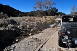
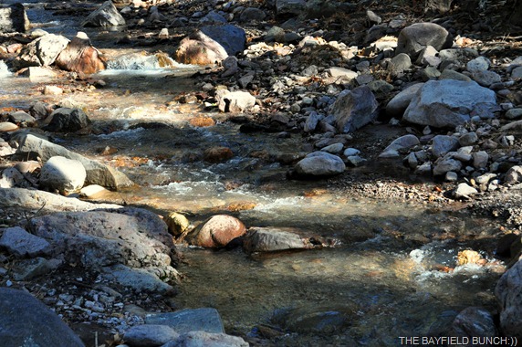
WE CROSS A STREAM OF MELTING SNOW WATER

Well, let’s get off the future Florida options and get ourselves back to the here & now in good old Arizona.  Since arriving at the Ranch a couple weeks ago we basically haven’t done much and have hardly left the property.  Today, we went in search of ‘snow’.

DSC_0005

From the first day we rolled into the Sulphur Springs Valley I noticed a fair bit of snow in the distant Chiricahua Mountains.  Had a nice sunny day going for us so we loaded up the Pheebs and headed for the snowy peaks.  Wanted to get Pheebs out playing in the snow plus I was curious about the damage caused by the devastating forest fires early last summer.

DSC_0011 

PHEEBS CHECKS OUT A HERD OF CATTLE ALONGSIDE THE ROAD  
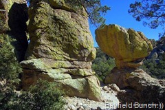
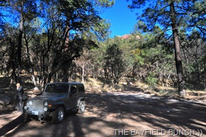
North of Elfrida we turned right on Rucker Canyon road and headed east for the Chiricahua Mountains.  Could see a fair bit of snow had already melted but we didn’t let that deter us.  This is familiar territory for me, having made about half a dozen trips into Rucker Canyon over the past 4 years.  One of my favorite places.  Anyone typing ‘Mary Kidder Rak’  or ‘Fort Rucker’ into our blogs search bar can read of our trips to old Camp Rucker and Mary Kidder Rak’s homestead.  Mary Kidder Rak wrote the book, ‘A Cowman’s Wife’ and after reading the book a few years ago, her and Charlie’s old homestead took on a nice bit of meaning for me.

DSC_0028

DSC_0008 DSC_0009

CROSSED A FEW MOUNTAIN STREAMS TODAY

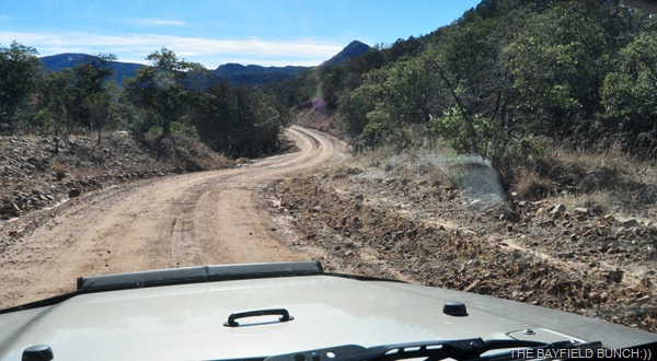
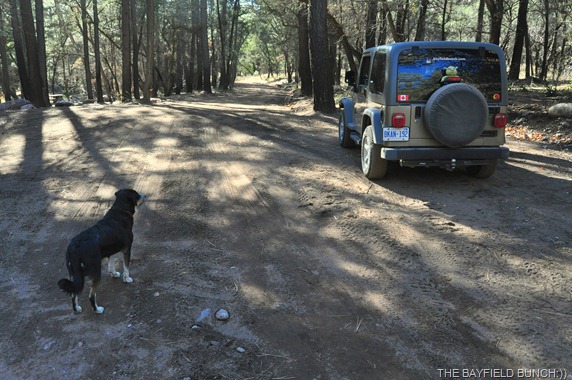
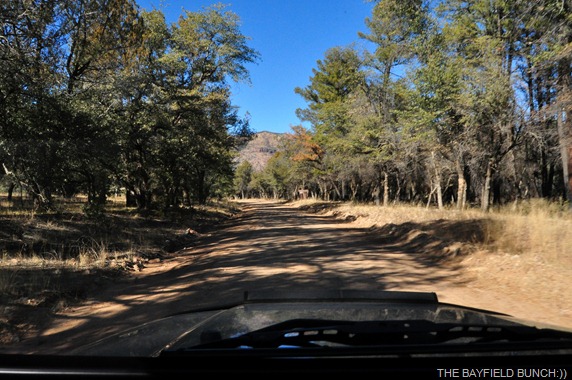
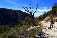
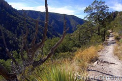
We made our way along the winding and scenic gravel road up into Rucker Canyon.  Didn’t stop at the Fort or Homestead today but rolled on by into Tex Canyon.  We saw evidence of fire damage along the road from near Fort Rucker all the way into Tex Canyon.  Not severe damage and you had to look hard to see the burn marks at the base of some trees.  Overall, everything looked fine with no change to the great scenery.

DSC_0021

DSC_0040 DSC_0024 

DSC_5339 

THIS HILLS WERE ONCE FORESTED WITH 'PINE TREES, AGAVE, PRICKLY PEAR CACTUS, MESQUITE TREES, ETC.

About 10 miles past the Fort we did begin to notice whole hillsides off to the east that had been burnt.  In some places right up to the road we were driving on.  Must have been quite a fire line they had along this road because the fire was beaten back and never jumped across the roadway.  We also noticed there was not a speck of snow to be seen anywhere.

DSC_0020

IN THIS AREA THE FIRES SWEPT DOWN THOSE HILLSIDES AND WAS STOPPED AT THE ROAD IN THE FOREGROUND

Made a U-turn and headed back to the Fort Rucker area & made a right turn heading up to a camp ground we knew to be at the end of a dead end road.  Still no snow and we began to realize we were not going to find any either.  The snow was on the higher peaks to the North. 

DSC_5345

DSC_5344 DSC_5343

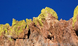
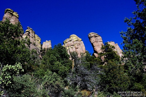
A CURIOUSLY GREEN TIPPED SET OF ROCKS ALONG A ROCKY RIDGE

Last time I had been up this road was last winter when I led a couple car loads of Bisbee hikers into the area to scout out some new trails for their Mule Team Hiking Club.  You can read my post about that day here at….MULE TEAM.

DSC_0018

DSC_0031 DSC_0016

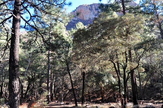
ALWAYS BEAUTIFUL SCENERY IN ANY MOUNTAIN RANGE

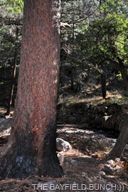
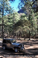
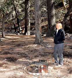
This Rucker campground is really secluded and we have never seen anyone here.  A mountain stream runs right through it and it is completely forested with tall Pine trees.  It is also at the extreme end of the road.  Picnic tables, BBQ grills, steel containers for food and garbage.  Keeps the Bears away.  Wouldn’t recommend bringing a big Motorhome up the road but truck campers, Class B campers, and small Class C’s would be just fine.  I think smaller 5th wheels would be fine too.

DSC_0047

DSC_0038 DSC_0064

DSC_0053 DSC_0049

DSC_0065

A LAST LOOK AROUND……. AND THEN WE WERE GONE 

Time was getting on so we slipped quietly back down Rucker Canyon road and out of the Chiricahua Mountains into the long ranging & rolling grass fields of Leslie Canyon.  Just another super great scenic drive.  By 3:30 we were back at the Ranch and an hour later I had the chores done for another day.

DSC_0066

Ranch dog Gleeson stayed for a sleep over last night and Pheebs thought that was pretty special.  I thought it was pretty special too:))  And, who knows what Motor is thinking half the time.  Pheebs really gets along well with Charlie the Cat over in the Ranch house too.  But then again, Pheebs just gets along with everything……..:))

DSC_0023

Couple things regarding Monday night’s post.  I mistakenly put in our own link for Deb’s FIND AN OUTLET.  I have since corrected that.  Thanks Pat:))  Question about where we buy our travel insurance….Canada.  Wild Blue Yonder left a very informative comment on Monday’s post about medical insurance and dealing with hospitals, etc.  Thank you….couldn’t seem to locate your blog site.  Another question about family members.  When I referred to two family members left I meant my Aunt and Uncle.  Yes, I have one Son and 3 Grand Children.    But, that’s a whole blog or two in itself which I may write about at some point in the future.

DSC_0059

TRYING TO GET PHEEBS TO POSE FOR A PICTURE

Three new Blog Followers to welcome today. Kathleen, AVERY'S WANDERINGS, and Mary Sprow. Welcome aboard and thanks for reading our blog.  It’s you folks who give me the inspiration at the end of each day to keep the blog current on a daily basis:))

DSC_0073

ROLLING HOME THROUGH SCENIC LESLIE CANYON

GROANER’S CORNER:(( Five-year-old Becky answered the door when the census taker came by. She told the census taker that her daddy was a doctor and wasn't home because he was performing an appendectomy.
"My," said the census taker, "that sure is a big word for such a little girl. Do you know what it means?"
"Sure do! Fifteen-hundred bucks, and that doesn't even include the anesthesiologist!"

---------------------------------------------------------------------------
-Tourists see the world, travelers  experience it.
- Home is where your pet is:))
BAYFIELD BUNCH PHOTO ALBUMS https://picasaweb.google.com/117858411710794543295
The only thing better than right now  will someday be the memories of
right  now...AL.

Saturday, November 20, 2010

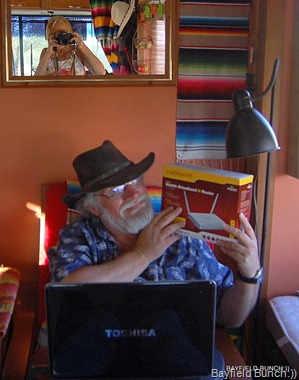
INSTALLED OUR CRADLEPOINT ROUTER TODAY:))

DSC_9487

DSC_9488DSC_9489DSC_9490

DSC_9493

KELLY SETS UP THE CRADLEPOINT ROUTER…..YAAAAAAY KELLY:))

We slipped over to Jeannie & Ray’s place at the ranch this afternoon to pick up our Cradle Point Router which was delivered Friday by UPS.  When we ordered it from the 3G store in Chicago we didn’t know if UPS would come out on the bumpity roads so had it shipped to the ranch.  Silly us!!  This is the wild & wooly west of course & UPS would have brought it in by stagecoach if they had to.

DSC_9361

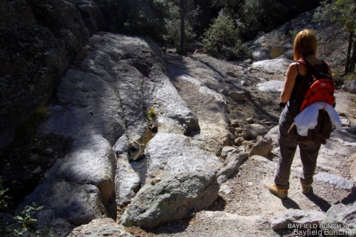
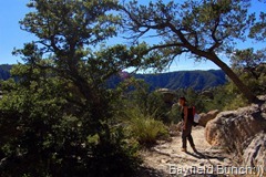
ALL FOLLOWING PHOTOS ARE FROM OUR ECHO CANYON HIKE FRIDAY

DSC_9360 DSC_9374 DSC_9369

ALONG THE ECHO CANYON TRAIL

From the time Kelly pulled router out of the box to the time we had both computers successfully on line spanned a short period of 20 minutes.  We could not believe how simple it was to hook up & that it actually worked right off the bat without a lot of cussin & swearin!!  There was a time when I would have hooked it all up myself but with my dwindling patience with techno things I just let Kelly do the set-up.   I’m sure that is probably why there were C & S problems:))  So, long story short…..the in-house internet connection wars are over.  I’m hoping my knees will begin to heal now because I had to spend a lot of time on them begging for computer time this past couple weeks!!  We also brought back a load of firewood & Ed’s book from the ranch as well. 

DSC_9434

THE SMALL PUDDLE OF RIVER WATER ON THE LEFT INDICATES WE HAVE REACHED THE CANYON’S BOTTOM

DSC_9396DSC_9419DSC_9420DSC_9425DSC_9451DSC_9435

Had an interesting email Friday from a couple I remember reading a bit about last summer on Ara’s, OASIS OF MY SOUL blog.  This is the couple who have been traveling with a wagon, four horses & two chickens.  Their blogsite is,  RON DAKOTAH...ON THE ROAD AGAIN.  I’m sure we RV’ers sometimes take for granted our somewhat cushy lifestyles.  Some of us still have the security of sticks & bricks living for half the year but not so for the ‘On The Road’ folks.  Security is not an operative word for them as they desperately search for a place to put down some roots for awhile.  I suggest you all take some time to read their interesting story.  They are presently in the Las Cruces area slowly making their way west to Arizona. 

DSC_9468

Note to Emjay…I remember hearing about the book, ‘A Cowman’s Wife’ last year but had forgot about it.  Hadn’t realized some of the story involved the ranch house at Camp Rucker.  Am now wondering if it is the very same abandoned ranch house that we walked through & photographed when we found Camp Rucker a couple years ago.  We will definitely find that book now & thanks so much for the reminder.  To read the blog about our day there click, CAMP/FORT RUCKER & for photos in & around the abandoned ranch house click, RUCKER RANCH HOUSE.

DSC_0051

Since we repositioned the rig I am now able to sit in my chair, computer on lap, camera at hand & look to my left  watching the sunrise over the Swisshelm Mountains.   Pretty darn nice way to start the day I’d say & thanks for the correct name configuration of Swisshelm, Ed)

DSC_9448 DSC_0055 DSC_9457

Looks like our warm 70F days are slowly coming to an end as a cool front approaches dropping day time highs into the high 50’s next week.   That means night time temps of freezing & below.  We love ya Arizona but could you please keep that  thermostat turned up a bit while we’re here:))

DSC_9450

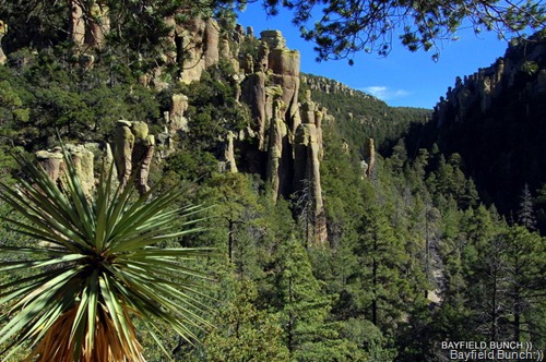
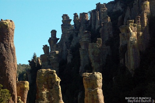
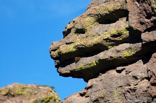
As predicted, after yesterday’s tiring hike, we had kind of a lazy day.  I should mention that the Echo Canyon hike trail is a well worn & easily navigable trail.  Some grades, loose rocks sections, step overs & some stone hewn stairs.  Not wheel chair accessible but fine for all ages.  The Ranger Station even has a shuttle every morning at 8:30 that will drive folks up the Park’s highest point & drop them off.  People can then follow the trails downhill all the way back to the Ranger Station about 4.5 miles below through some of the greatest rock formations you will ever see.   The trail also wanders along beautiful forest paths as hikers descend into the lower canyons.  If you have a readily handy imagination you will see countless faces & animals etched into the very rocks themselves. 

DSC_0057

This area is steeped in Indian history, folklore, myth, mystery & legend.  Many ancient chiseled rock faces watch out for you as you make your way along the well worn Chiricahua trails.  Cochise & his Apache braves hunted these Canyons & aptly named this area, ‘land of standing rocks.  If you come to the Chiricahua National Monument you will soon see why the Indians gave this area that name.  All roads leading to the Monument & within the Park itself are paved.  There is a small RV Park as well but maybe check that out on the Park’s website.  I think there is a 29’ limit.

DSC_0035

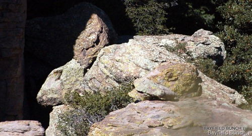
LEFT PHOTO…NOTICE LARGE RABBIT WITH BROWN EARS CENTER LOOKING LEFT, GOLD HEADED DUCK IN RIGHT FOREGROUND LOOKING LEFT & A PUPPY DOG BEHIND RABBIT LOOKING RIGHT

DSC_0014 

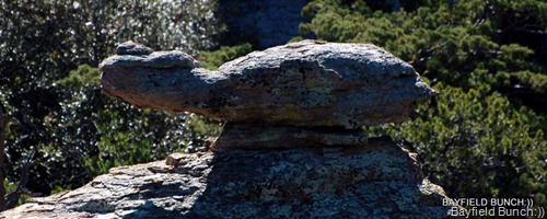
KELLY SAW A PUFFER FISH GOING RIGHT & I SAW A TURTLE GOING LEFT
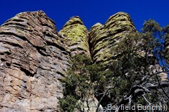
DSC_0037

FACES ARE EVERYWHERE
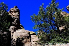
And, like I mentioned yesterday, be sure to wander into the Faraway Ranch within the Park’s borders near the entrance.  And no, this is not a tourist trap!!   Original barns & real horses.   Volunteers will give you a guided tour of the ranch house, the history & the way it all used to be….oh so many years ago. (third & final Echo Canyon Trail photos will be in Sunday’s blog)

DSC_9465

GROANER’S CORNER   An optimist is someone who goes after Moby Dick in a rowboat and takes the tartar sauce with him.


--------------------------------------------------------------

Tourists see the world, travelers experience it.

BLOGGER WEBSITE http://thebayfieldbunch.com/

OUR PHOTO ALBUMS http://picasaweb.google.com/stargeezerguy/

The only thing better than right now will someday be the memories of right now...... AL.