Wednesday, November 23, 2011
FROM A FREEZING 32F THIS MORNING IN NEW MEXICO TO A SWELTERING 81F THIS AFTERNOON IN ARIZONA:))
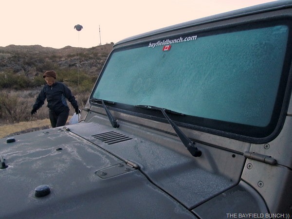
FROST ON THE JEEP’S WINDSHIELD AND FROM A FREEZING 32F THIS MORNING WE HEADED FURTHER WEST TO A SWELTERING 81F THIS AFTERNOON
After double checking the areas weather again this morning in Truth Or Consequences New Mexico we made a snap decision to change our plans and make some fast tracks further west into Arizona. On Thursday we had planned to do laundry and take a drive over to Elephant Butte State Park to see if we could locate RV SUE AND HER CANINE CREW as well as another couple she knows there. Friday we had planned to head up into the Silver City area to Glenwood and do the ‘Catwalk’ that John and Judy at RV LIFE ON WHEELS had done last week. With the incoming storm front packing possibly heavy rains we just did not feel like sitting here in this areas colder temperatures for the next 3 or 4 days with a poor Verizon connection, no cell phone and few TV channels. We also received an email that required attention so needed a strong Skype connection. Our plans are to slide back this way on our return journey later this winter and do the Glenwood area and some other New Mexico spots then. Just gotta love New Mexico:))
WE QUIETLY TIPPY TOED THROUGH DOWNTOWN TRUTH OR CONSEQUENCES EARLY THIS MORNING
Due to our poor Verizon connection in T or C I have not been able to access photos in some blogs or leave comments in others. My ‘Shout Box’ and ‘Blog Followers’ list wouldn’t open either. Fell asleep waiting for my blog to publish Wednesday night so it may have taken nearly an hour or maybe more.
THIS ONE PHOTO ABOUT SUMS UP THE CHILI PEPPER NEW MEXICO TOWN OF HATCH
I had unhooked the Jeep Wednesday night in preparation for our stay in Truth or Consequences but first thing this morning at 32F I scraped the ice off the Jeep’s windshield and hooked it back up to the Motor Home. Total distance driving the Jeep while unhooked…oh maybe 30 feet!! We were back on the road by 7:20 heading for that big old Arizony State and the Sonoran Desert. I programed Tucson into my computer head, pulled my hat down, fixed me a stare on the western horizon, wiggled my ears, twitched my nose and we were off. Oh, how we are looking forward to warmer temps and big Saguaro Cactus again:))))))))
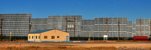
NOW, THAT IS A LOT OF SOLAR POWER
Ok, before I go any further, here’s something I messed up in Tuesday’s blog. I mentioned about a self guided audio Auto Tour at Valley Of Fires. That is incorrect!! I got the Auto Tour mixed up with the Bosque del Apache National Wildlife Refuge. No driving tours over the Lava Flow!! I have since made the correction in Tuesday’s post.
I THINK SOMEBODY HAS A ‘MAD ON’
Once again a beautiful clear morning for driving. Heading south on I-25 the surrounding distant mountains looked majestic wrapped in their early morning blue gray haze. Took the shortcut to Deming through Hatch and rolled through there at 8:10. A distant wave and hello to fellow RV Blogger BOONIE somewhere in the desert south of Hatch. We met Boonie up in Silver City one time.
THE TEXAS CANYON REST AREA ON I-10 JUST EAST OF BENSON ARIZONA
About 25 minutes later I recognized a familiar mountain ridge looming out of the desert floor on the southwestern horizon. It was the razor backed ridge of the Little Florida Mountains. I knew Deming was just to the northwest of them and by 9 we were in downtown Deming itself.
LOOKING WEST ALONG I-10 IN THE DIRECTION OF BENSON
An hour later we were westbound out of Deming with a full fuel tank, full propane tank and 4 full tummy tanks. I was able to share a couple McDonald’s Burritos with the Kids:)) Looked southward as we left Deming to see another favorite set of mountains. The 3 Sisters just north of Columbus were still there so all was still right with the world.
Two heads are better than one and not long after leaving Deming we had another example of that again. First, let me say, just as I always have….I believe women are far smarter than men…period!! At normal highway speed our rig’s tachometer usually runs about 2100 rpms. I noticed after awhile we were running at 32 and 3300 rpms and the rig didn’t seem to want to shift into it’s final gear. I spent a fair bit of time thinking about this, slowing down, speeding up, shifting gears and just basically grumbling to myself with all kinds of worse case scenarios. Finally mentioned it to Kelly who took all of 3 seconds to diagnose the problem. She said, “is that overdrive switch in the right place?” BINGO!! Seems a little Pheebs nose, paw or happily wagging Bum had clipped that switch which is low on the dash. I flicked the overdrive switch back to where it should be and the rig immediately shifted into it’s normal drive mode and the revs dropped back down to 2100. Let me tell you folks, I happen to know a few things about the fair opposite sex and when I tell you they have it all over us guys I know what I am talking about. Trust me:))
THESE TWO LITTLE DOGGY BUMS ARE FOCUSED ON MY TURKEY SANDWICH WHICH JUST CAME UP FROM THE RIG’S GALLEY
East of Lordsburg I began scanning the mountain ranges to the south because we were approaching some very familiar territory and it wasn’t long before I spotted the long hulking grey shape of the mighty Chiricahua Mountains towering higher than the closer Peloncillo Mountains.
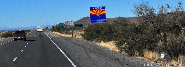
A big wave to John and Judy at RV LIFE ON WHEELS who we knew were just down the Animas Valley at RUSTY'S RV RANCH near Portal Arizona. Crossed the Arizona State line 5 minutes later. If any of you folks have not been to the Portal Arizona area, mark it down in your travel plans because you are going to want to go there. Type Portal or Paradise or even John McAfee into our ‘Search’ bar.
As we headed west on I-10 between Wilcox and Benson Arizona my head was awhirl with countless great memories from our time spent here in the Sulphur Springs Valley between the Chiricahua and Dragoon Mountain ranges. There was Bowie peak which brought back our hike to Fort Bowie a couple years ago. Remember to type these places into our Search bar. The twin peaks of Dos Cabezas brought more memories. Passed the Cochise Stronghold exit at 12:20 p.m. Caught a distant glimpse of the Swiss Helm Mountains and the memories in my head just rolled on and on. Tombstone, Elfrida, The Ranch, Sierra Vista, Douglas, Paws and Hooves, Pearce, Grapevine Canyon Ranch, the Lazy W Ranch, Bisbee, Rucker Canyon and on and on and on. I am already looking forward to getting back to this whole area later this winter. The very area that has been so good to us these past 3 years and an area I definitely consider our second home.
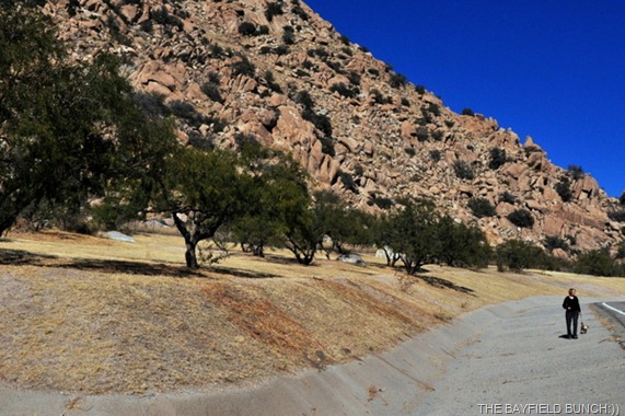
KELLY AND THE MOTORMOUSE ARE DWARFED BY THE HUGE ROCKS AT THE TEX CANYON REST AREA
A big Hi-Ho Silver wave to JERRY AND SUZY as we rolled past Benson Arizona at 1 o’clock. See you guys later this winter:)) Noticed the traffic really picked up at Benson and was steady all the way to Tucson.
PICKING OUR WAY WEST ON THE AJO WAY IN SOUTHWESTERN ARIZONA
There is a stretch of I-10 where we always closely watch for our first Saguaro Cactus every time. Watch for the small sign that says Davidson Canyon and look immediately down to your right. Saguaros:)) Yaaaay, we are in the Sonoran desert once again.
PHEEBS KICKS UP DUST AS SHE RACES FOR THE MOTOR HOME AFTER KELLY CALLED HER FOR SUPPER…WEST OF TUCSON ARIZONA NEAR THE AJO WAY
It’s the day before Thanksgiving and one of the heaviest traffic days of the year so I wasn’t wasting any time as I swung the rig off I-10 onto the Ajo Way. Traffic was heavy stop and go from traffic light to traffic light with a couple jamming stops for amber lights which re-arranged some furniture for us. But, it wasn’t long and we were free of the City’s grip and out onto the desert floor.
SUDDEN STOPS HAVE A WAY OF RE-ORGANIZING THINGS IN RV VEHICLES
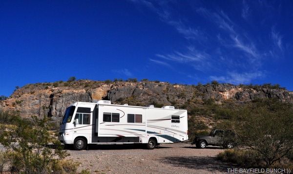
A few years ago we had spotted a boon docking area on the northeast corner of Ajo Way and San Joaquin road so that is where we headed and that is where we are right now nestled up against a large rock face with the whole city of Tucson just on the other side. It’s 81F and we are just a cookin. Didn’t take me long to haul off my too warm T-shirt and get myself into a light cooling shirt. Looking forward to the cooler desert nights. Yep, we are finally in nice warm air and that’s a big 10-4:)) In the morning we will be on the road again for another hundred miles and tomorrow night we’ll be all set up in one of our all time favorite boon docking areas. But, if there is poor or no Verizon service there we will have to move on. It is imperative that Kelly has a good Verizon and cell phone connection for her Deer Park Lodge work.
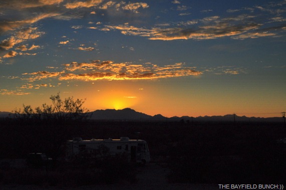
WE ARE ALL SNUGLY TUCKED AWAY FOR THE NIGHT UNDER WARM ARIZONA SKY’S
While typing this tonight I suddenly remembered something. We have 4 boxes of Shreddies cereal packed away for an RV couple camp hosting at the Kartchner Caverns. We totally forgot to drop those off today and blew right by that exit back in Benson. I hope those folks can hold out until we get back in the area later.
THIS IS A 300mm SHOT OF KITT PEAK ABOUT 45 MILES AWAY FROM WHERE WE ARE BOON DOCKED…YOU CAN SEE A COUPLE OF THE OBSERVATORIES JUST LEFT OF CENTER…I SPENT A COUPLE HOURS UP THERE 4 YEARS AGO AND REMEMBER TOURING THE TALLER ONE VISIBLE IN THE PHOTO…IF I WOULD HAVE HAD A STRONGER VERIZON SIGNAL TONIGHT I WOULD HAVE INCLUDED THE LINKS
GROANER’S CORNER:(( A professor was walking along a very narrow hall when he came face to face with a rival.
The passage way was too narrow for two to pass. The rival, pulling himself up to his full height, said with a sneer, "I never make way for fools!" Smiling, the gracious professor stepped aside and with a bow replied, "I always do."
---------------------------------------------------------------Tourists see the world, travelers experience it.
-Until one has loved an Animal, their soul remains un-awakened.
BAYFIELD BUNCH PHOTO ALBUMS https://picasaweb.google.com/117858411710794543295
The only thing better than right now will someday be the memories of
right now...AL.
Friday, January 01, 2010
TOMBSTONE TO PEARCE THROUGH THE DRAGOON MOUNTAINS
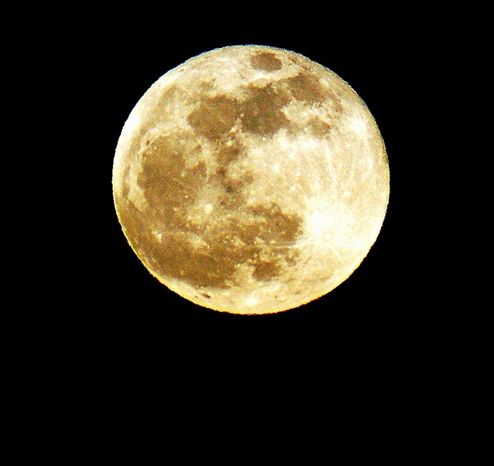
NEW YEAR’S EVE FULL MOON ………………from the ranch:))
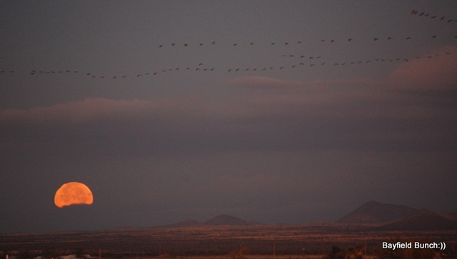
No frost on anything this morning so I was outside at dawn running around in my pajamas taking some photos of the Moon setting in the west somewhere over in the direction of Tombstone.
THE MOON SETTING IN THE WEST THIS MORNING
Kelly had an exercise class at 9 so we loaded the computer in the car & off we went. While Kelly was pumping iron I uploaded a bunch of updates that we had been getting behind on because of our Verizon megabyte limit. What a big pain in the assparagus that Verizon 5 Gig cap is!!!!
From the Elfrida library we headed up the highway & turned west heading for the little old ghost town of Gleeson. We had never traveled the dirt road from Gleeson to Tombstone before so figured to-day was a good day to do that. Always so nice to see new scenery. Rolled right through Tombstone & headed north a couple miles before turning east onto the rough & washboardy MIDDLEMARCH ROAD. Our destination was another little ghost town on the other side of the DRAGOON MOUNTAINS. Wanted to see the route Tombstone residents took over a hundred years ago to Pearce after gold was discovered there.
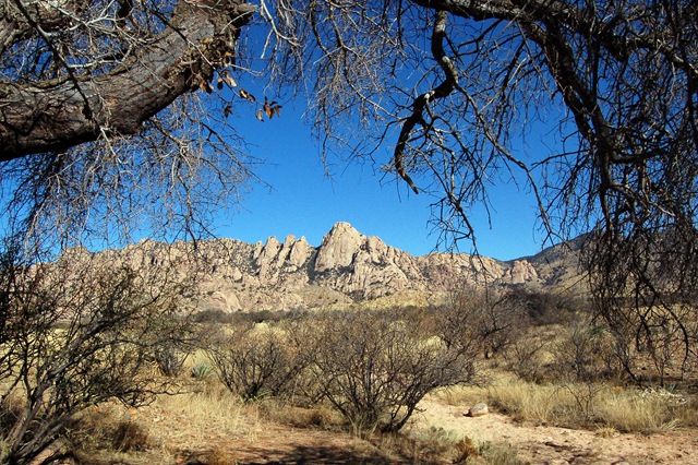
The Dragoon mountains ahead of us stood majestically in the high noon sun & I was reminded of our hike to the COCHISE STRONGHOLD this past March from the east side of the mountains. (OUR COCHISE STRONGHOLD PHOTOS) The Dragoons ahead marked the very spot where Cochise's many Apache lookouts took up posts on high rocks scanning the valley we were currently driving through. Troops from Fort Huachuca on the west side of the San Pedro valley would set out across the desert floor in force to chase Cochise & his men down. The Indians could see the troops coming for miles & miles & always had the advantage in any battles that took place & Cochise was never captured. Thought about all that as we approached the natural rugged mountain fortress ahead.
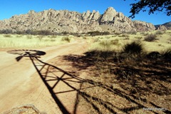
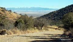
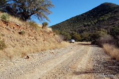
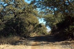
Turned off the Middlemarch Road onto a smaller dirt road & headed north past a sign saying, Coronado Forest. Road was a bit rough for a short distance then smoothed out reasonably well. We had gained some altitude so Agave, Yucca, Prickly Pear began appearing along with a lot of trees that we couldn't identify. These trees stand about 15 feet high with a spreading canopy but we just don't know what they are. Alongside the road we saw campfire rings where people have pulled in & set up camp. Saw a windmill slowly turning in the breeze amongst a cluster of trees. A road led in that direction so we followed it stopping to take some windmill photos. A cluster of tents marked the end of that road but we didn't see anyone around. Could have been a group of rock climbers. We backtracked to the main dirt road & headed a little further north before taking another road which led us a short distance right to the very foot of the beautiful Dragoon Mountains.
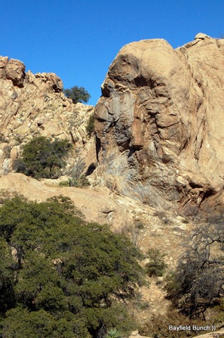
CAN YOU SEE THE INDIAN HEAD PROFILE LOOKING TO THE LEFT IN THE LARGER PHOTO?
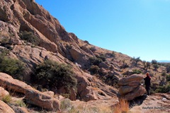
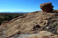
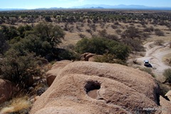
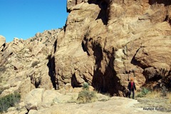
Parked the car & looked up at the large rounded rocks climbing into the sky. It was so beautiful here that you just wanted to jump out of the car & run right up those huge boulders into the canyons beyond & the towering heights above. It was a perfect place for rock scrambling because the rocks had a sandpapery surface & with good hiking boots the traction was phenomenal & I just felt like I could walk straight up the mountain. Didn't take us long to scramble up a hundred feet or so just reveling in our great fortune to have found such a perfect camping spot for future days. We could see the darkened Huachuca mountains probably 40 miles to the southwest & Bisbee's Mule mountains as many miles to the south. Sunlight glinted off distant rooftops in Tombstone. The towering Whetstone mountains led north to Benson which we could also see at the far end of the valley. Beyond Benson the Rincon mountains spread across the horizon. Just wanted to stay at this place forever. It is days like these & places like this that remind me of how truly fortunate Kelly & I are.
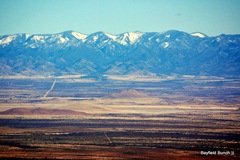
We continued our journey back to Middlemarch Road & wended our way along the bumpy dirt trail winding it's way up & over the summit of Middlemarch Pass. Patches of snow & cooler temperatures marked the highest point but overall it wasn't that high & it wasn't that cold. Nice views of the Sulphur Springs Valley far below as we began our descent & I could see the town of Sunizona way out on the valley floor to the northeast. Finally rolled through sleepy little Pearce east of the Dragoons around 3, picked up highway 191 & headed for home with a quick stop in Sunsites for a very late 2 o'clock coffee. Awwwww, my kinda day:)))))))
(click on photos below for captions)
ALIEN DINOSAUR MOUNTAIN GOAT
Well, it's New Year's Eve & the thing I am most happiest about to-night is that I don't have to do all that silly New Year's Eve stuff anymore!! I have now been over 30 years free from New Year's Eve's parties.........yaaaaaaay:))
JUST HAVING A LAZY AFTERNOON IN THE DRAGOONS
BELLE’S UPDATE
Emails have been rolling in again to-day with questions, suggestions, & offers. We plan to go over to the Silverado Ranch in the morning & have us a sit down with Belle & talk about all the positive things that have been happening the past couple of days & her vision for the ranch. Some decisions will have to be made & a direction forward found. Emails have to be answered & work has to be started. Again, Kelly & I thank everyone for their encouragement & support & I will post updates as they happen............................:))
GROANER'S CORNER:(( A man was telling his neighbor, "I just bought a new hearing aid. It cost me four thousand dollars, but it's state of the art. It's perfect." "Really," answered the neighbor. "What kind is it?" "Twelve thirty."
BLOGGER WEBSITE http://thebayfieldbunch.com/
OUR PHOTO ALBUMS http://picasaweb.google.com/stargeezerguy/
The only thing better than right now will someday be the memories of right now....AL.
ALL THE BEST TO EVERYONE IN THE NEW YEAR FROM THE BAYFIELD BUNCH:))
Monday, December 14, 2009
IN AWE OF THE SOUTHWEST
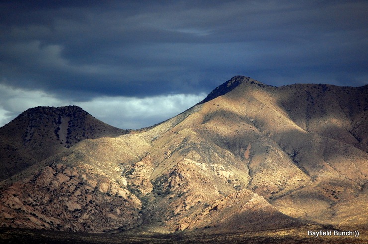
CLOUD SHADOWS DRIFT ACROSS THE SWISS HELM MOUNTAINS
I have always been in awe of the American southwest ever since my first venture to this great land in May of 1992. That trip was done in a small Mazda pickup truck with a topper on the back to sleep under at night. Frigid desert temperatures & all. No matter though because the beauty of Colorado, Utah, Idaho, Montana, & northern Arizona far overcame any hardships along the way. For the next 12 years the mountains, rivers, valleys, canyons, deserts, & endless day & night skys simmered away in my mind. I longed to one day return to the land that I felt so comfortable & at home in.
CLOUDS SITTING ON THE MULE MOUNTAINS OVER BISBEE
In late December of 2004 a rare window of opportunity presented itself. I was driving school bus at the time & Christmas Holidays were coming up. With another driver filling in for me I was able to extend those holidays to 2 weeks. Kelly had that same time frame off as well. We had just purchased a small Class C (too small) about a month before so we quickly formulated a travel plan. Looking at our Wal-Mart atlas I figured the closest mountains & cactus to our place in southern Ontario would be in the south end of Texas. Big Bend National Park. To make a long story short we jumped into our Class C & with the pedal to the metal & Max sitting between us we made a bee line for Texas. I remember straining my eyes looking for mountain tops south of Stockton.
SOUTHERN END OF THE DRAGOON MOUNTAINS
We were only able to spend about 5 days in Big Bend & surrounding areas before we had to race back to Canada. But, those 5 short days clinched the deal for us in our desire to return once again to the land of mountains & canyons. It had been Kelly's first trip to the magic land of desert sand & towering mountains & she was hooked. As much as we loved Big Bend I knew that it wasn't enough though. Next trip we were going to have to head further west where the whole land is mountains & canyons & not just a small part of it. Texas is basically.......flat!! I knew that what we saw & experienced in Big Bend we would find a hundred times over once we headed west into New Mexico, Arizona, & California.
SNOW TIPPED & CLOUD SHROUDED CHIRICAHUA MOUNTAIN RANGE
Two years later we were able to fulfill our southwest dream as we rolled into Colorado, Utah, New Mexico, Arizona, & California. We knew then that we had found our winter home & we have been returning to these States ever since. Wouldn't even remotely consider going anywhere east of New Mexico!! The reasons for coming to the southwest are too numerous to mention but to-day reminded me once again of why we love it so much here.
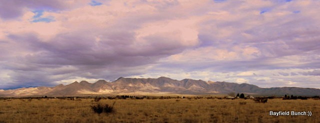
It was another fiery sunrise with tentacles of reds, gold, & pinks, splashing across the undersides of dark rolling clouds. Distant mountains silouetted against the rising sun on the eastern side of the valley with slivers of light highlighting rocky tips of the Mule mountains on the western side. As the sun climbed higher, clouds began casting their slowly moving shadows across the mountain faces & that continued for the rest of the day. Sun splashes crossed the valley floor lighting large & small areas alike with their passing. On our morning walk we saw clouds to the west sitting on the Mule Mountains over top Bisbee. To the south were the dark mountaintops of Mexico. A glance to the southeast brought into view the far distant mountain tops of the Pedregosa mountains & immedIately to the east was the Swiss Helm mountain range. Beyond the Swiss Helms loomed the mighty & legendary Chiricahua mountains with their high snow encrusted peaks. A hundred miles or so up the Sulphur Springs Valley to the north we could make out what was probably the southern tips of the Winchester mountains east of Tucson & to our northwest was the forboding & also legendary Dragoon mountain range with it's southern edge stretching all the way from I-10 down to the ghost town of Gleason about 20 miles from us. And, all this from just standing in one spot here at the ranch turning in a slow 360 degree circle. And, all this under a big beautiful cloud studded sunny Arizona sky. Is it any wonder we are in awe every single day of the majestic American southwest..............:))
GROANER'S CORNER:(( How is a man like the weather? Nothing can be done to change either one of them.
BLOGGER WEBSITE http://thebayfieldbunch.com/
OUR PHOTO ALBUMS http://picasaweb.google.com/stargeezerguy/
The only thing better than right now will someday be the memories of right now....AL.