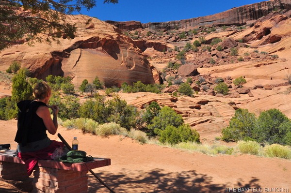
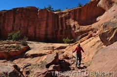
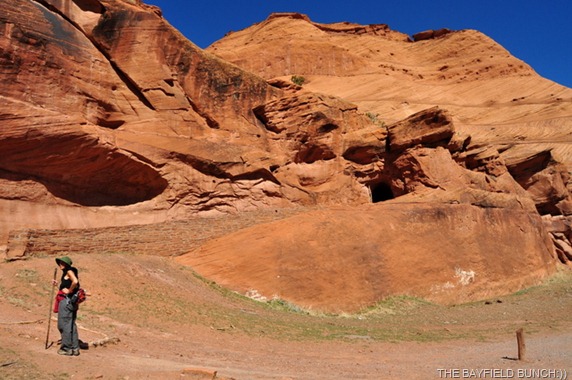
REST STOP FOR A LUNCH BREAK WHILE ON OUR WAY TO THE TOP OF THE CANYON RIM IN THE DISTANCE
How nice it was once again to see that big old sun creeping up over the horizon & beaming through the Cottonwood trees. Nights are still down around freezing here but daytime temps are perfect for hiking.
Poured over some more travel plans this morning again. Had hoped to do Monument Valley but will probably save that for another trip when the weather is warmer & we can combine it with some time in the 4 corners area of Colorado, Utah, Arizona & New Mexico. Would like to do that trip in the early fall sometime. We have switched our ‘going home’ priority to simply a ‘warmer weather’ priority so will head in a southeasterly direction Thursday seeking out a warmer pocket of air maybe in New Mexico or Texas. No need for us to hurry home. I just get a little ‘antsy’ sometimes traveling long distances between points A & B. Just like to get out there & ‘git er done:))
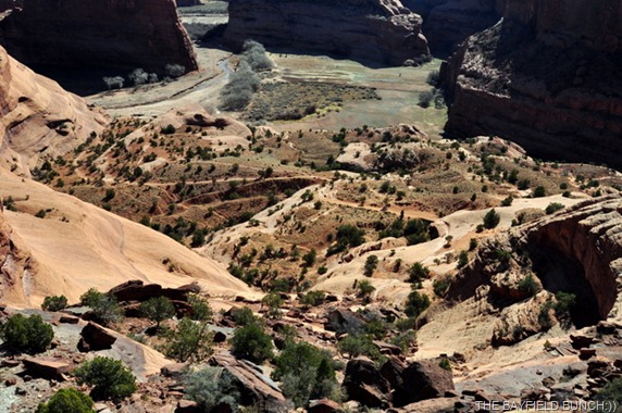
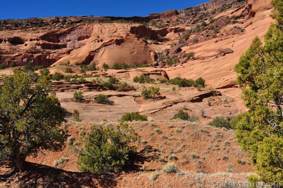
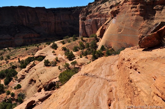
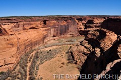
SECTIONS OF THE TRAIL CAN BE SEEN WINDING DOWN TO THE CANYON FLOOR….WE ARE HEADED FOR THE TOP LEFT OF THE PHOTO & TURNING RIGHT
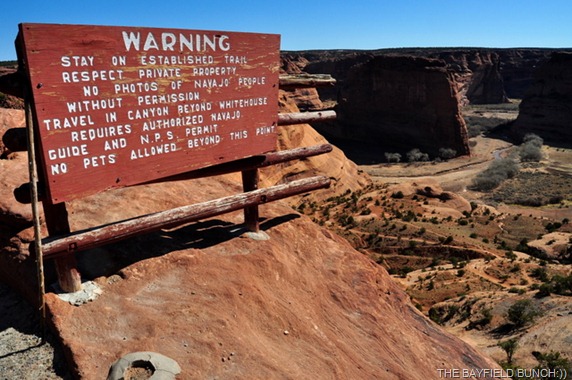
It was the ‘no wind’ factor this morning that put the icing on the cake for a beautiful sunny clear day. Out the door & off we went to the Canyon’s South rim & a place called the Whitehouse Ruins Overlook. No, nothing to do with the Whitehouse in Washington!! It is here where the 3 mile round trip begins & it’s approximately a 600' descent to the Canyon’s floor.
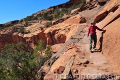
WE ARE ABOUT HALF WAY DOWN
Right from the beginning one is awed by the sweeping scenic views of the Canyon. The words, marvelous & spectacular come to mind. Yes, even awesome:)) We quickly realized this trail will now go into our travel books as the most breathtaking scenic trail we have ever been on.
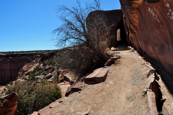
The trail winds it’s way to the bottom using switchbacks. Steps have been cut out of solid rock in places while other sections contain loose gravely stones & sand. Parts of the trail lead over the very rock that forms the Canyon’s walls. By hiking standards it is an easy trail with no hand over hand rock scrambling involved. If height bothers you it might be advisable to bring a blindfold as you navigate some of the narrower sections along the cliff face. But, you don’t really want to do that & miss all the incredible beauty every foot of the way. This is a trail to be done slowly because there is just sooooo much to see as you descend.
We started the hike at 9:40 a.m. & set foot on the Canyon floor at 10:40. A nice leisurely walk of 40 minutes with lots of photo stops along the way. Now, instead of looking down into the Canyon we were now at the bottom looking up at the massive & towering rock cliffs all around. Have I used the word magnificent yet.
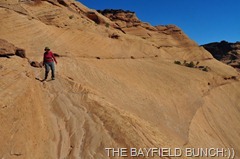
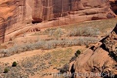
TRAIL IS CUT ACROSS THE STONE FACE IN CENTER OF THE PHOTO
It was a short walk across the valley floor to a foot bridge crossing a small flowing stream. We could only imagine how beautiful it is here when the many Cottonwood trees are dressed in their summer coats of green. Horses leisurely crazed under the trees amid cactus, cholla & Juniper trees. We could see the distant Whitehouse ruins nestled into the cliff face just on the other side of the Cottonwood trees. The Navajo people were here too with their tables of many Indian crafts. Some were working on their art pieces as we walked by on our way to look at the fenced off ruins.
COMING & GOING PAST THE NAVAJO VENDOR’S TABLES
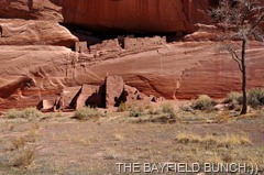
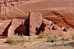
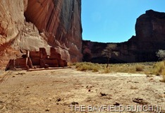
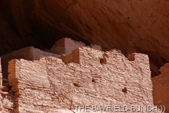
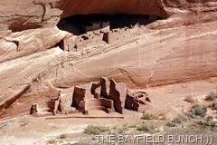
The Whitehouse Ruins are similar to what we saw at the GILA CLIFF DWELLINGS in New Mexico a couple years ago except that these Whitehouse Ruins were a bit more intact. Again, just Google Canyon de Chelly for all the historical info on this very historical Navajo land. Tragedies in this Canyon date back many years to the day Spaniards arrived & killed many of the ancient people living here. It happened again in the late 1800’s when U.S. Cavalry soldiers entered the land & killed many of the Navajo natives who called this Canyon their home.
THE WHITEHOUSE RUINS AS SEEN FROM GROUND LEVEL
THE WHITEHOUSE RUINS AS SEEN FROM A HIGHER VIEW POINT OVERLOOK WITH A TELEPHOTO LENS
Made our way back through the Native Craftspeople, crossed the stream & at 11 a.m. & began our daunting 600 foot climb back up & out of the Canyon. We had dressed warm in the cooler morning air coming down but it wasn’t long & we had peeled off jackets & shirts heading up. Our first stop along the way was at a wooden bench under a Juniper Tree. Out came the Turkey sandwiches & bottled water.
I once again marveled at our great & good fortune to be here where we were, doing what we wanted to do at a time in our lives we are still able to do it. Sitting on that bench surrounded by indescribable beauty made me wonder aloud where we would be a year from this day at this same moment of time. Sometimes, it’s just not best to wonder aloud.
WE BEGIN OUR LONG HIKE TO THE TOP
It was onwards & upwards as we put one foot in front of the other & concentrated on the climb ahead. With a few more break stops along the way & a few seconds here & there for photos we steadily closed in on the high rim of the Canyon. And then there it was, the final few yards to the top. It was 11:50 a.m & our ascent had taken us 50 minutes, which surprisingly was only 10 minutes longer than our descent. We both felt it was an easier climb than we had both anticipated & was not as strenuous as some of our other hikes in the past.
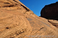
A LOT OF HARD EFFORT HAS GONE INTO MAKING THESE TRAILS
Canyon de Chelly is a long but narrow Canyon. Not as long, deep or wide as the Grand Canyon but just as stunning in it’s own beautiful uniqueness. This is a Canyon where the ordinary person can hike to the bottom & hike themselves back out again in a matter of hours. For anyone traveling in Northeastern Arizona do not miss Canyon de Chelly. It will not disappoint you.
AT LAST……. WE NEAR THE TOP
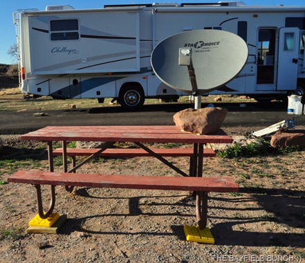
We were back at the rig shortly after noon & just cruised through the rest of the afternoon. Had to reset up the tripod a couple times in the last couple days because my duct tape fix continued to become weaker with each puff of wind. Finally, it was beyond setting up anymore so I had to revert to option number 2.
GROANER’S CORNER:((
A tutor who tooted a flute,
Tried to tutor two tooters to toot.
Said the two to the tutor,
"Is it harder to toot, or
To tutor two tooters to toot?"
--------------------------------------------------------------
EMAIL THE BAYFIELD BUNCH:))
stargeezerguy@gmail.com
BISBEE PHOTO ALBUM
http://picasaweb.google.com/stargeezerguy/BISBEEARIZONAAFEWFINEPHOTOMEMORIES
Tourists see the world, travelers experience it.
BLOGGER WEBSITE http://thebayfieldbunch.com/
OUR PHOTO ALBUMS http://picasaweb.google.com/stargeezerguy/
The pessimist complains about the wind; the optimist expects it to change; the realist adjusts the sails -William Arthur Ward
The only thing better than right now will someday be the memories of right now...... AL.











Glad you guys took that hike...It had to be one of my greatest moments of this past winter season...Except for the fall I took just before the trail head.(Beard shaving day)In fact Kelly is sitting on the same bench where I took my lunch break.Small world huh?
ReplyDeleteToo bad you are going to miss Monument Valley this trip.As an old western movie buff Al,you would really appreciate standing out surrounded by those magnificent buttes that were backdrops for so many movies.
The dish looks great, but isn't that rock going to take up lot of space in the RV. Be safe out there. Sam & Donna...
ReplyDeleteLooks to me like yer StarBand dish is havin' a rocky time of it. :)
ReplyDeleteWhat a great hike to top off your trip this year! :)
ReplyDeleteLooked at your spot on our Atlas and it looks like the middle of nowhere...just where you and Kelly love to be...Yea!! Let's go somewhere warm!!!
ReplyDeleteI am going to use the word you don't like..'simply awesome'!..what a fabulous hike and the scenery was worth every step!..thanks for sharing your day with us..but where were the 'egg sandwiches?'
ReplyDeleteWhat a beautiful spot! Glad you stopped there to show those of us who will probably never see it in person!
ReplyDeleteSimply beautiful. You are indeed blessed to be able to make that hike. Not sure we will be able to do more than look down from the rim so thank you for taking us along with you today.
ReplyDeleteOne of my favorite hikes in all the world, Al. Been doing that one since 1988. Hope I am never to old to make that climb back out. So much loved seeing your photos. Mine are old film shots in a box somewhere from my Canon A-1 days. NOT AE-1. LOL
ReplyDeleteAbsolutely Awe inspiring! A must see on our trip this year. Thanks fer all the pics.
ReplyDeleteGreat looking hike for sure Al... how do you find all this stuff???
ReplyDeleteI think I may make a project of trying to watch some of the old cowboy movies in getting ready for our someday adventure. It will make working on the house seem more worthwhile!
ReplyDeleteThink I'll put that hike on my short list for this summer, thanks for sharing it.
ReplyDeleteI have not been to Canyon de Chelly for a long time. Your wonderful pictures have made me want to go back again soon!
ReplyDelete