OUR RIG & MOTORMOUSE ARE OUT THERE SOMEWHERE
ATOP HARQUAHALA PEAK
Had us a high thin cloud cover today which meant slightly cooler temps this morning & kept us under the 80F mark for the day. I was happy about that because for me 80 is too hot & uncomfortable.
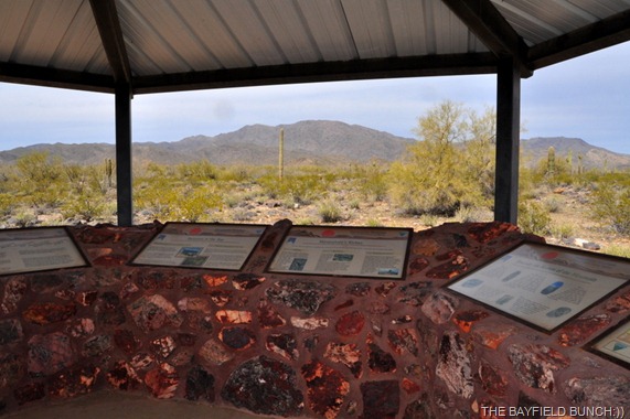
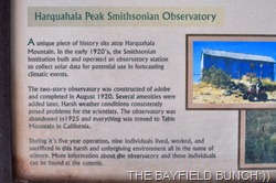
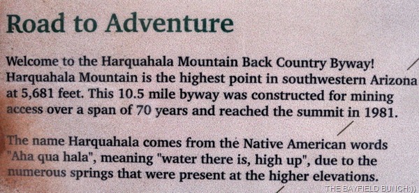
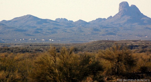
We loaded up the Pheebs & were on the road before 9 a.m. heading for the highest mountain range in southwestern Arizona. Harquahala Peak sits atop the HARQUAHALA MOUNTAINS just southwest of a small Arizona town called Aguila. Atop that peak sits the remains of the Smithsonian’s solar HARQUAHALA OBSERVATORY dating back to the years from 1920 to 1925.
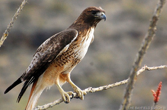
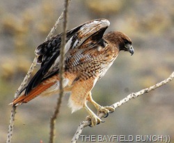
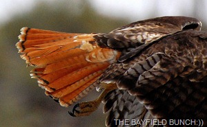
SPOTTED THIS RED TAILED HAWK ON THE WAY UP THE MOUNTAIN
We used this LINK as our basic instructions to find the trail head to Harquahala Peak although we left from Congress & not Wickenburg. Keep in mind this article was written in 2000 & when the writer talks about driving up to the peak in an ordinary car….that no longer applies!! Maybe in 2000 it was somehow possible but it is definitely a 4 wheel drive high clearance road now.
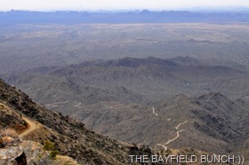
HARQUAHALA PEAK SITS ATOP THAT MOUNTAIN IN BACKGROUND
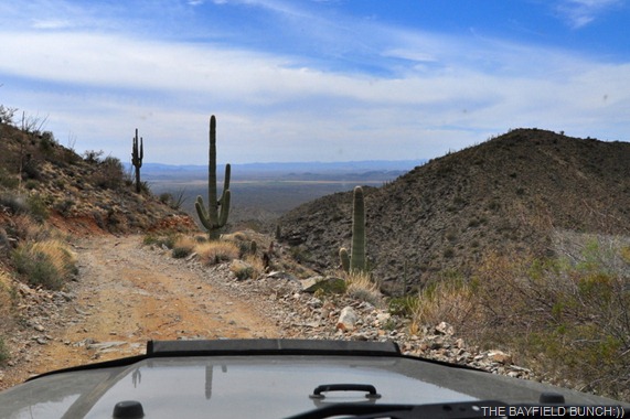
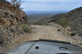
This 10.5 mile rugged drive to the top is not for the faint of heart. If you have a fear of heights, hairpin curves, steep drop offs & a lot of rocky jouncing & jostling which will bounce you around like a ping pong ball, you had better stroke this destination off your list.
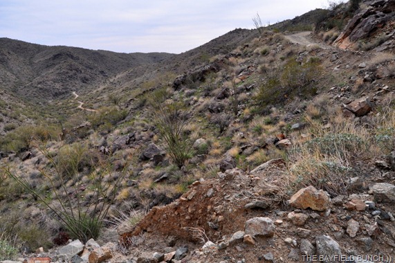
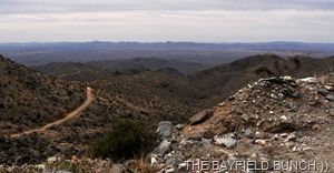
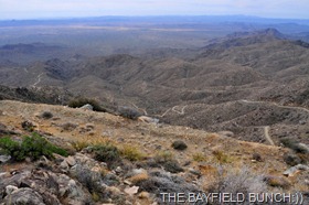
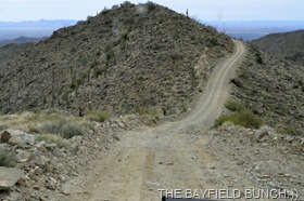
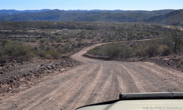
COMING FROM THE DISTANT ROAD ON THE LEFT WE ARE HEADED UPWARDS ON THE SAME ROAD TOP RIGHT
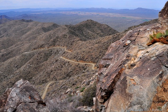
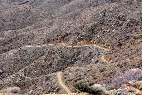
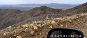
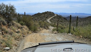
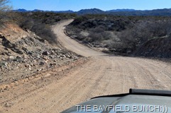
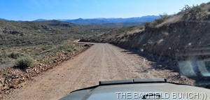
HAIR PIN TURNS, SWITCHBACKS, SHEER DROP OFFS, STEEP GRADES & PLUNGING DROPS, THIS NARROW ROCKY ROAD HAD THEM ALL
The first third of the climb is reasonably good. The second third is where things begin to get a little scary & the last third to the top will have you questioning what & why are you doing this. We had a couple brief little ‘discussions’ about turning back. (as if there was anywhere to turn around) The pressure was on but I decided to push for the top anyway. We were down into first gear for much of the climb & it eventually took us over an hour & a half to finally reach the summit. Couple scenic stops along the way with a couple water breaks for Pheebs. By the way, this road is single lane only & meeting another vehicle would truly put both drivers ‘between a rock & hard place’!!
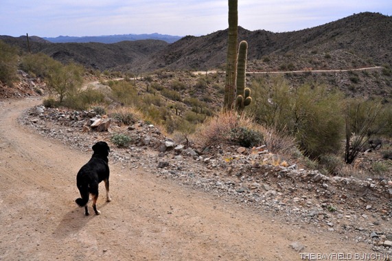
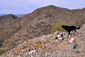
WATER BREAK FOR MOUNTAINEER PHEEBS
My biggest worry was tires. Having had two flats in two years I am always aware of the tires on these rough rock infested back roads. We climbed up & over rocks today that were pointed and jagged. The Jeep itself performed flawlessly, never hesitating for a second to haul us over any of the many rocks, whether imbedded in the road or lying loosely scattered about on the steep grades or deep gulley's.
AT JUST ABOUT THE ROUGHEST POINT IN THE CLIMB THE PHONE RINGS & WE STOP AS KELLY HANDLES A DEER PARK LODGE CALL
We were so surprised to find a short stretch of concrete road right near the summit. Must have been a section where water frequently washed the road out years ago. With all the switchbacks it was hard to tell how close to the top we were but how great to finally see a man made structure ahead & then there was the large communications towers. Seconds later we saw the old tin clad Smithsonian Observatory itself standing tall against the cloudy sky.
WE FINALLY SPOT THE OBSERVATORY AHEAD & THE MICRO WAVE TOWERS TOP RIGHT
KELLY TAKES A COUPLE SHOTS OUT THE WINDOW BEHIND US
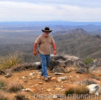
We passed a parking area & parked right up top alongside a large bank of solar panels. What a relief it was to finally shut the Jeep down & step out onto solid stable ground. The jouncing & bouncing was over for awhile….at least until we had to begin our steep journey back down the mountain.
WHAT A RELIEF IT WAS TO FINALLY REACH THE TOP AFTER OVER AN HOUR & A HALF OF STEADY CLIMBING WITH THE JEEP
It is said on a clear day from this point the views are spectacular. {Quote} This mountain rises about 3,360 feet from the desert floor. Since this peak sits between Phoenix and LA, smog can often fill the valleys obstructing good views. Although, on a good day the views can be extraordinary. One could see the Four Peaks east of Phoenix, Hualapai Peak just south of Kingman, Signal Peak and all the way down to Yuma, the Colorado river basin and clear into California. The views can be about 1/3rd of the state of Arizona. {Unquote}
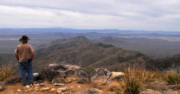
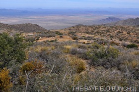
Well, unfortunately we didn’t pick the clearest day & yes, there was some smog in the valleys. The 360 degree views are still spectacular & we could see for miles & miles. We could also see large tracts of green farmland far below on the valley floor to the northwest.
THE CURVY MOUNTAIN ROAD IS CLEARLY VISIBLE
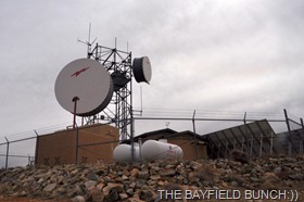
Lots of room for Pheebs to run around & explore everything as we walked around the summit looking at a large newer building at the base of the huge microwave tower near the bank of solar panels. The building is enclosed by a high wire fence but I noticed a picnic table in the enclosure as well as a stone made BBQ. Couple large propane tanks as well. Can’t imagine how hair raising it must be for a propane truck driver having to navigate the steep narrow cliff hanging road to the top & refill those tanks. Now, that is scary!!
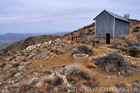
One of two buildings remain at the Smithsonian Observatory site & it is fenced off to prevent vandalism. It’s a tall rectangular building clad in tin with no windows & only one door. Can’t imagine how the people worked in there for months at a time in the long hot summers. Back in those days there was no road up to the summit & everything came up along a trail on burrows & mules. Just another one of those things from yesteryear that just seem so incomprehensible to me. Just can’t imagine how people did the things they did back in those days.
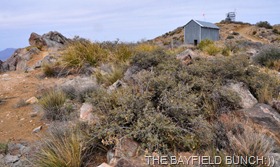
LAST REMAINING BUILDING OF THE OLD SMITHSONIAN SOLAR OBSERVATORY FROM THE EARLY 1920’S.
While standing atop a rock outcropping I heard the distant strain of an ATV below making it’s way along the winding road up the mountain.
IN THE CENTER OF THE PHOTO YOU CAN SEE A DOT ON THE ROAD & THAT IS THE ATV MAKING IT’S WAY TO THE TOP
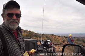
About 10 minutes later an older couple rolled in & pulled into the parking lot. This was their 3rd trip up & were here today to replace a Geocache they had left here a few years ago. The folks live in Bouse. We never thought to get their names but we did have ourselves a pleasant chat for nearly half an hour before it was time for us to depart. Gave them a ‘Bayfield Bunch’ card & snapped a last picture at the summit of them eating lunch by their ATV.
AN ATV COUPLE ARRIVE AT THE PEAK
THE NICE BOUSE FOLKS WE MET AT THE PEAK TODAY
The drive down the mountain was a bit harrowing & we hardly got out of first gear until at least half way down. Gears & brakes, brakes & gears. Again, the Jeep remained as sure footed as a mountain Goat despite the loose gravel & sideways tipping motion along some stretches. Kelly didn’t say much most of the way & hung tightly to a handle on the dash. I was able to eat half a peanut butter sandwich along the way & like I have said before, these situations are always far more stressful for the passenger than it is for the driver. At least the driver is in control & has his attention focused on the driving part. A passenger has nothing to do but contemplate their possible very short future while helplessly staring out at the 1,000 foot drop off just a few feet from their door.
We finally got ourselves down to a level where the roads smoothed themselves out a bit & we were soon back to the trailhead. Time to get down off the mountain…1 hour.
How nice it felt to get the Jeeps tires back onto smoooooooth pavement as we turned north out of the desert onto Eagle Eye Road & put the hammer down for home. Couldn’t believe how tired we both felt. More of a mental tired from the mountain drive than a physical tired.
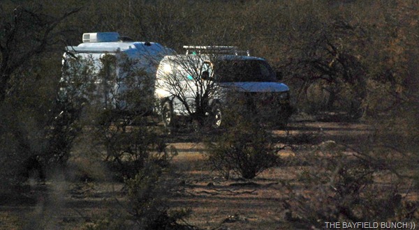
As soon as we pulled up to the rig I knew something was amiss. One of our outside chairs was upside down, my tripod was on the ground, another chair moved & Kelly’s little ‘keep the desert clean’ sign was knocked down & strewn about. It was obvious we had some destructive Visitor’s while away. Our detective like minds immediately went to work searching for clues. And, clues were soon forthcoming. Several curious round wet spots on the ground was a good indication of our intruders. And then, there it was. The prime clue that instantly solved the mystery. A big huge cow plop!! And then another & another. Pheebs friendly Cow Pals had paid us a visit while away, probably looking for the Pheebs to come out to play. Luckily no damage done & I wasn’t long in removing the plops before the Motormouse came out & ate up all the evidence……………10-4:))
GROANER’S CORNER:))
Q.what’s the best time to go to the dentist?
A.tooth-hurty
Q.What do a tree and a dog have in common?
A.Bark!…
- I’m sorry, I refuse to have a battle of wits with an unarmed person.
Q. What time is it when ten elephants are chasing you?
A. Ten after one!…
-“The difficult thing with quotes on the internet is verifying them”– Abraham Lincoln
- A retired husband is often a wife’s full-time job.
- Always remember you’re unique, just like everyone else
- I get enough exercise just pushing my luck
- Every time I find the meaning of life, they change it.
- I don’t suffer from insanity. I enjoy every minute of it.
---------------------------------------------------------------------------
-Tourists see the world, travelers experience it.
- Home is where your pet is:))
- The only thing better than right now will someday be the memories of
right now...AL.
stargeezerguy@gmail.com
