Showing posts with label White Sands National Monument. Show all posts

Sunday, November 20, 2011

FROM PETROGLYPHS TO A VALLEY OF FIRES

DSC_0032
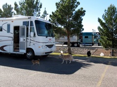
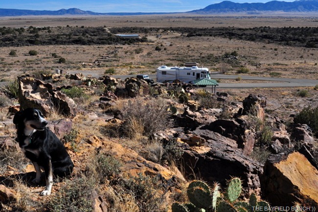
WE HAVE GREAT PANORAMIC VIEWS ALL THE WAY AROUND US AT VALLEY OF FIRES AND PHEEBS (at left) HAS ADAPTED SUPER WELL TO HER NEW ENVIRONMENT
A warming sun blended harmoniously with a cooling breeze to create what I would call another beautiful southwest morning.  Not long into our walk we both commented on the peaceful quietness enveloping us.  No human sounds anywhere, not even a train whistle in the distance.  Just a slight breeze whispering through prickly Mesquite shrubs for as far as one can see.  This is one of the all time favorite things that attracts both Kelly and I to the Southwest.  We enjoy the peace and tranquility of the natural settings we find.  It is as if the surrounding mountains wrap us in their welcoming arms and shelter us from the daily noise and hub-bub of the modern world.  Yes, Marshal South, I understand your ways:))
DSC_4767
And a final few words about the THREE RIVERS PETROGLYPH SITE.  Both Kelly and I highly recommend this small campground with it’s two pull through sites, 6 shelters, one family unit, one handicapped unit, tables, barbecue's and trash cans.  You can also dry camp here as well and there is lots of room to turn any big rig around.  There is a small dog walking area and ‘lots of room to walk your dog out through the endless miles of mesquite shrubs.  The camp hosts, who have just signed on for a two year stint have not seen any wild animals around.  A few miles further down the road past Petroglyph there is a larger primitive area for camping and RVing as well.  Road is a bit rougher so we stayed put where we were.  Deer, Mountain Lions and Bears can be found closer in to the White Mountains.  And, Jerry had a comment question wondering if someone actually counted all those 21,000 Petroglyphs.  Well Jerry, don’t know the answer to that one but the little brochure we have here tells us that “Three Rivers Valley contains over 21,000 Petroglyphs including masks, sunbursts, wild life, hand prints, and geometric designs.  The number and concentration of petroglyphs here makes this one of the largest and interesting rock art sites in the Southwest.”
DSC_0011
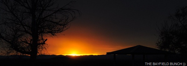
ADIOS THREE RIVERS PETROGLYPH SITE 
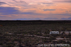
A little info on the new header photo.  Our rig is facing east/southeast and about a quarter mile north of us is a rock strewn tall round top hill.  Pheebs and I hiked up to the top of that hill and I took the header photo facing south west late Sunday afternoon.  The flat spot on the horizon at left is where Tularosa, Alamogordo and White Sands National Monument are located.  About a third of the way across the distant San Augustine and San Andres Mountain Range from the left is highway 70 cutting up and over between the mountain ranges to Las Cruces New Mexico on the other side. (hope I got that right:))  Photo was taken with my Nikon D90.
DSC_0020 DSC_0001-1
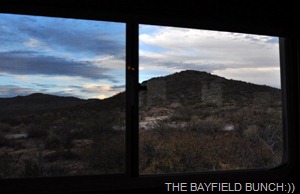
THAT IS THE HILL WHERE I TOOK THE HEADER PHOTO FROM
We had a leisurely morning packing up the rig and enjoying the abundant sunshine.  Soaked up a few rays and I couldn’t help but marvel at how truly lucky we are to be where we are.
DSC_0012
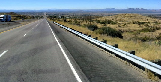
Had the big wheels rolling by 10:30 a.m. and headed back to highway 54.  A right turn at the little Trading Post, which also has RV accommodations set us on a northerly course for the town of Carrizozo and Valley Of Fires.  And yes it is plural with an S.  The beautiful sunny morning had us in shirt sleeves as we followed the excellent road in an arrow straight line across the valley floor.  Construction zones along the way showed where this two lane highway is currently being upgraded to a 4 lane highway.
DSC_0039
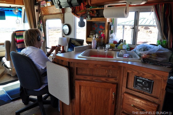
KELLY USING SKYPE TO TALK TO DAUGHTER SABRA TODAY
Another thing that has always attracted me to the Southwest is the numerous dusty little western towns.  They begin in Texas and can be found all the way into California.  They are full of character and characters.  Some of them are pretty well tumbled down and boarded up but that’s what gives them there own uniqueness and style.  We rolled into the small historic New Mexican town of Carrizozo about 11:15.  It was Sunday morning and the tiny streets were quiet.  Not a creature was stirring, not even a mouse. Two main highways intersect at Carrizozo’s north end with highway 54 crossing highway 380 here.  Remember 380, that’s my favorite stretch of road between Jacksboro and Ruidoso.  We fueled up the rig at one of 3 gas stations and picked up some lettuce and apples at the local grocery store.  While fueling the rig a car came around the corner with the thumping boom box sounds of a favorite 60’s group of mine pouring out of the windows.  Santana’s ‘Black Magic Woman’ reached my ears instantly transporting me back in time.  It was kind of a special moment for me:))  Following that we took ourselves into Willies (formally Elsie’s) char broiled hamburger place for some grub.  Ate enough in there to last us 6 weeks.
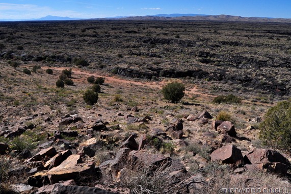
DSC_0025
LOOKING ACROSS THE BLACKENED LAVA FIELDS TO THE DISTANT MOUNTAIN RANGE WHERE THE FIRST ATOMIC BOMB WAS EXPLODED 
Four miles west of Carrizozo on highway 380 we we made a left hand turn into the Valley Of Fires Recreation Area.  Right away we could see it was going to be another great scenic spot and we were relieved to see there were spots available.  We generally like to move to the back or fringe section of a Park and we soon found us a fine quiet spot next to a tall craggy and rock clustered hill.  Site number 17 is a dry camping site and that suited us just fine.  It was more private than the serviced sites.   All roads and sites are paved.  Some have electricity and water but we preferred the more private dry camping site that we have.  There are hot showers here as well as a dump station and visitor’s center.  Also an area for tenters and a couple group areas.
DSC_0018
THE LITTLE ‘BEANS’ IS JUST WAKING UP
Our site has a slight slant to the east so with great apprehension I decided to try leveling up the coach using our problematic hydraulic jacks.  I was surprised to see the jack’s control panel light’s come on when I hit the ‘on’ switch.  Buoyed by that bit of positivity I slipped outside and positioned my homemade wooden blocks under the two driver’s side levelers and headed back inside.  Put out my two dump levers and moved the joystick to the left and holy smokes the jacks deployed and 10 seconds later the rig was totally level.  Will wonders ever cease eh.
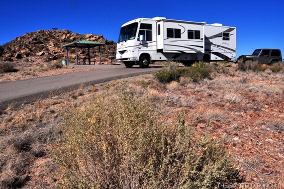
 DSC_0034
THE ROCKY HILL IN THE BACKGROUND IS WHERE I TOOK SOME OF TODAYS VALLEY OF FIRES PHOTOS FROM TODAY
Now, here’s the big surprise.  We had been told by a couple people and also read that this area was a black hole for communications and there would be no Verizon signal, cell phone or television.  Guess what, we have a strong Verizon signal and Kelly’s Deer Park Lodge phone works fine as does Skype.  We can get 4 TV channels with our rig’s antennae too.  (2 clear and 2 fuzzy) What a bonus eh:))  Maybe tomorrow we’ll try our luck at setting up our new ‘Shaw Direct’ satellite dish for the first time.
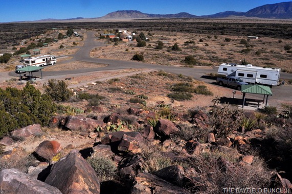
DSC_0028
AN OVERVIEW OF VALLEY OF FIRES PARK LOOKING NORTH SHOWING THE ENTRY ROAD TOP LEFT WITH VISITOR’S CENTER AND WASHROOM SHOWER BUILDING TO THE RIGHT OF THE ROAD.
First thing Pheebs and I did once we had the rig set up was clamber up the rocky hill beside us to see what we could see.  Beautiful sweeping vistas for miles upon miles in all directions.  It is plain to see how the huge lava flows years ago flowed south down this valley sweeping around the high area that makes up this Park.  I can see why the word Fire has an S on the end because at the time there would have been multiple fires going on in the flowing lava fields.  Here are the rates for one night to stay here….Developed Sites with electric and water – $18.00.  Developed Sites with tap water nearby- $12.  We are in the latter and with Kelly’s Golden Age pass our site is half price at $6 a night.  Tenting sites with water available are $7 a night.  No dump fee if you are camped here but $15 if you come in to dump.  The Park is clean and well maintained and again we would definitely recommend it.
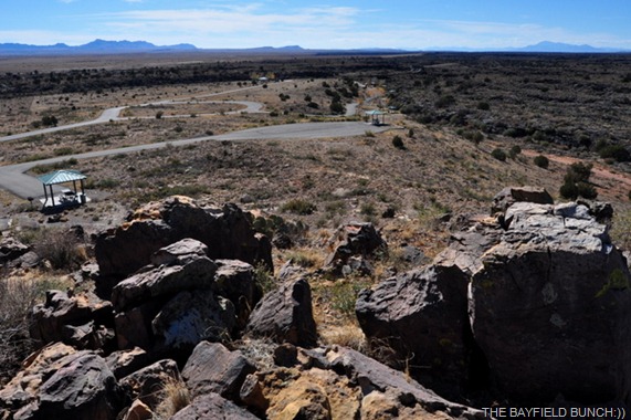
DSC_0022
LOOKING SOUTHWARD OUT OF THE PARK AND DOWN THE TULAROSA VALLEY TOWARDS ALAMOGORDO…JUST ABOVE CENTER IS WHAT I CONSIDER TO BE THE BEST SITE IN THE PARK, #19.  NO ELECTRICITY OR WATER THERE THOUGH
Had ourselves kind of a lazy afternoon just enjoying the sunshine and sweeping scenery.  Soft ambient music on our Sirius Satellite Radio. (channel 68 the Spa) Doors and windows open as Kelly worked on some Deer Park Lodge stuff and made a few Skype calls to her daughters.  I worked away on the blog in my comfy red Ikea POANG CHAIR.  Kelly phoned neighbor Ingrid back in Bayfield and it’s a cold gray damp day there.  Soooooooo glad we are where we are………10-4:))
DSC_0033
SSHHHHHH, DON’T TELL THE PHEEBS SHE IS SITTING RIGHT NEXT TO A BIG PRICKLY BEAVER TAIL CACTUS
GROANER’S CORNER:((  
Blog joke
---------------------------------------------------------------
Tourists see the world, travelers  experience it.
-Until one has loved an Animal, their  soul remains un-awakened.
BAYFIELD BUNCH PHOTO ALBUMS https://picasaweb.google.com/117858411710794543295
The only thing better than right now  will someday be the memories of
right  now...AL.

Saturday, October 31, 2009

THE BAYFIELD BUNCH BRIEFLY RETURNS TO COLUMBUS, NEW MEXICO…….’SI SENOR’

DSC_3853 

BOOT HILL RV PARK WITH MOUNT SIERRA BLANCA IN BACKGROUND

(Click any photo to enlarge)

Kelly's Ontario body clock told her last night it was 10 o’clock so she headed for bed at 8.  Or, was it nine.  She was back up at 3 thinking it was 5.  I went to bed at 11 thinking it was 7 & was back up at 2 to shut the computer off because I had fallen asleep waiting for the blog to upload.  I was back up at 3:30 because Kelly was up at 3.....or was it 5 Ontario time.    We have passed through 2 time zones & one Texas time warp so far & our internal clocks are in turmoil.  To-night, or was it last night the clocks are turned back but to-morrow we'll be in Arizona where time never changes anyway so we haven't a clue if we’ll be on time, in time, or overtime for anything.  By the time we get up it might be time to go to bed again.   Right now I think it's 5 p.m. New Mexico time, or was it really 7 o’clock Arkansas time.  Well, whatever it is I’m sure it will be subject to change of course!!  About time I moved on to something else I’d say…………………………….

IMG_1010

I TOT I TAW A PUDDY TAT!!

Neither one of us had enough energy to climb out our pajamas this morning until nearly 9 a.m.  And even then it was struggle as we puttered around in slow motion.  Finally got things organized enough to get the big wheels rolling again about 11:20.  Stopped at the office & signed up for a Passport America membership.  Geeeeez, could it be I'm coming down with a bad case of RV Parkitus!!  The nice Boot Hill folks gave us the Passport rate for our stay & less than 6 hours later we would use it again for additional mega savings....more about that later.

IMG_1014 

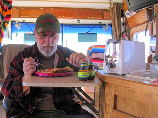
DON’T HAVE A DINETTE SO WE EAT ANYWHERE WE CAN

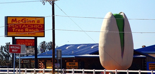
Should mention that we had a great Verizon connection at Boot Hill & were able to get 4 channels with the rigs TV antennae.  Directly across from Boot Hill is McGinn's Pistachio Tree Ranch so when your cruising along number 70 just look for the huge Pistachio out front on the west side of the road.  Your Boot Hill turn off is across from the big Pistachio:))

DSC_3852

THE BIG PISTACHIO ACROSS FROM THE BOOT HILL RV PARK

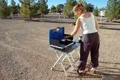
WE WERE A TIRED BUNCH THIS MORNING OVER THE TOP IN SAN AUGUSTIN PASS KELLY TRIES OUT THE COLEMAN STOVE FOR THE FIRST TIME
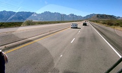
HOLDING ON WITH BOTH HANDS DESCENDING INTO LAS CRUCES RUDE CAR BLOCKS THE GAS PUMPS NEARING THE TOP OF SAN AUGUSTIN PASS
K-MART PIT STOP IN DEMMING NM IT'S A LONG GRADE UP 'BEST RV PARK COLUMBUS NEW MEXICO

(HOVER YOUR MOUSE OVER ABOVE PHOTOS FOR CAPTIONS & CLICK TO ENLARGE)

We slipped around busy Alamogordo on the by-pass & headed southwest past White Sands National Monument.  We were there last year so have a look at our photos at  WHITE SANDS.  Between Alamogordo & Las Cruces just south west of White Sands lies the jagged peaked San Adreas mountain range.  Highway 70 runs up & over the mountains through the San Augustin pass & it's a long haul of a grade to reach the peak.  Luckily it's two & 3 lanes.  By the time we crested the peak we were down to 35 mph with Kelly out behind pushing.  The descent on the west side is steep so we had to deploy the drag shute to slow our descent into Las Cruces:))

IMG_1022

DESCENDING INTO LAS CRUCES NEW MEXICO

It's pretty straight forward rolling through Las Cruces, just pay attention to the road signs, swear at the appropriate times, & keep your foot on the gas.  By 2:30 we were.....or was it 3:30 we were rolling into Deming New Mexico for a fuel stop ($2.89 a gallon) & Wal-Mart groceries.   Parking lot was really jammed up with big 18 wheeler rigs so had to park next door at K-Mart.  Parking lot there was so empty you could have landed a Jumbo Jet sideways..........twice!!

DSC_0016

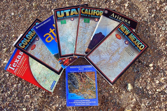
THESE ARE SOME OF THE GREAT BOOKS WE USE IN OUR TRAVELS

Decided at this point to head down to Columbus New Mexico near the Mexican border.  We have fond memories of our previous 2 times there 3 years ago.  That is where we both got to sit on Santa's knee on Christmas Day 2006.  We also had some dental work done & eye glasses made over the border in Palomas.  And, of course we totally loved the Pink Store.  I blogged & included photos of our time at the PINK STORE just this past April 26th & for the day we got to sit on Santa’s knee just click HERE:))

DSC_0013

FULL HOOK-UPS FOR $7 AT ‘BEST RV PARK’ IN COLUMBUS NEW MEXICO

Had originally planned to boondock near the train station museum but Kelly noticed in our new Passport America book that there was an RV Park affiliate right here in Columbus.  So, because we now have joined PM the site would be half price.  And half price it was at $7 with full hook-ups.  I remember driving through this park 3 years ago & I wasn’t too impressed but there has been a big change.  I seem to recall old trailers before but they are gone now.  It was a tired old park but the tired has been replaced with new energy & this park has really been cleaned up.  Young pine trees have been planted with attention paid to watering.   They have 55 RV sites & the park is large enough to accomodate any rig.  Big turn around area.  14 full hook-up pull through sites, 41 water/sewer sites ,& 30 amp electric.  Excellent Verizon coverage here though & we can get  about 14 clear television channels with the rigs antennae & about half of them are in English.   Free Wifi as well plus showers & laundry.  Something tells me we are going to have a rooster getting us up early to-morrow morning or maybe, just maybe, it will be us getting up that rooster.  Now, let me see..........what time is it anyway!!

IMG_1011

“BOO!!”        “TRICK OR TREAT:))”

GROANER'S CORNER:((  Old people shouldn't eat health foods. They need all the preservatives they can get!!

FACEBOOK READERS GO HERE TO SEE OUR ACTUAL WEBSITE COMPLETE WITH PHOTOS & MORE INFO.  BLOGGER WEBSITE http://thebayfieldbunch.com/

Wednesday, November 26, 2008

DOG CANYON HIKE & WHITE SANDS NATIONAL MONUMENT

THE ROCKY DOG CANYON TRAIL

Decided yesterday we would leave for Las Cruces on Tuesday afternoon instead of early Wednesday morning. Figured it was better to be at Recreation America/Sunland RV well in advance rather than dragging ourselves in at the last moment, first thing in the morning.

Oliver Lee State Park has a steep rock strewn trail running 5 miles into Dog Canyon just behind the ranger station so we decided to at least see if we could maybe get a mile's climb in first thing this morning. Apache Indians used the steep canyon as a stronghold because of water located there. The Cavalry led 5 different raids into this canyon in pursuit of the Indians. On one of the those pursuits, the Indians escaped & the only thing left behind was a stray dog, thus......Dog Canyon.
KELLY GETS AL TO POSE FOR A PICTURE
The trail was very steep in many places with a lot of loose rocks so we had to pay attention to what we were doing. Didn't take long for the huffing & puffing to start but it felt great to be getting into some good healthy exercise again. Rock scrambling like this is one of my favorite things because of the moderately easy challenges it presents. Not life threatening but not just a boring walk on a hard flat surface either. Following the switch backs Kelly made it up about 800 feet & went a few hundred more beyond that. What a perfectly great way to start the day. The view out over the valley floor easily stretched for 70 or 80 miles. Maybe more. And, not a sound in the canyon, not even a bird. Only the beating of one's own heart. Prickly pair cactus, Agaves, & Ocotillo, were but a few plants that filled the rocky landscape sweeping up the canyon walls to the towering mountains above. Be sure to check the photo album for some of the photos I took along the rocky path. http://picasaweb.google.com/stargeezerguy/ WE COULD HEAR A SMALL CREEK TUMBLING DOWN THROUGH THE TREES

The descent is always much harder than the ascent. It's on the descents that most accidents happen for hikers. The legs are in a totally different dynamic situation when feet are pointing downhill instead of uphill. I sure was glad Kelly had made me get a new pair of good Merril hiking boots before we left on our trip. Had I been wearing my old smooth bottomed Rockports this morning I very likely would have been upside down at some point for sure. Our rock scramble lasted about an hour & a half & by the time we made it back to the parking lot my legs were beginning to feel rubbery. I was glad we hadn't pushed ourselves any further on our first real hike of the trip. COMING DOWN IS ALWAYS THE HARDEST PART
The climb had really spiked our appetites so a bit of breakfast was high on the priority list when we reached the motorhome. Began packing things up for departure. Slides in, furniture squared away, satellite dish dis-assembled & put away, doggies loaded up, bins locked etc. Always so much to do but it sure beats sitting at home watching television & looking out the window. We stopped at the dump station & emptied our gray & black water tanks & it was at this point I made a little mistake that would embarrass me later in Las Cruces.

Rolled out of Oliver Lee State Park about 11 a.m. & headed for the White Sands National Monument which was on the highway to Las Cruces. An overcast cloud cover had rolled in on our way there & I figured things might not look as nice at White Sands but upon arriving I immediately realized the stormy skies were perfect for some great photos. We drove the motorhome on the 8 mile drive through the dunes stopping only one time for pictures & the rest of them I shot from the rig's window. Especially the people ones. This is quite a place to see & I'm glad we took the time to stop here.

Photos here... http://picasaweb.google.com/stargeezerguy/

WHITE SANDS NATIONAL MONUMENT 8 MILE DRIVE The highway between Alamogordo & Las Cruces is a straight & flat drive until you reach the base of the San Andres mountains & the hefty climb over the mountains begins. It's a long uphill grade to the summit & we were down to about 40 MPH & sluggin it. Then, all of a sudden it's over the top & hang onto your shorts Lucy, we're heading for the bottom. The descent into Las Cruces is like an inverted rocket ride. Gear down, short bursts of brakes, more gears, more brakes, more "holy craps!!

Las Cruces is a very spread out city but we found our way through the 8 lane highways, ramps, & turn offs alright & were able to drive right to the Sunland RV dealer in the southwest end of town with no problems.
Pulled into the parking lot & checked into the service department. They said it would be ok for us to stay right in their lot for the night & they would supply us with electricity. Shut the rig down & decided to go out for supper for a change because we had spotted a Crackle Barrel a few blocks away. Grabbed myself a nice long hot shower in the rig & thought about life & everything great & wonderful. A few minutes later I noticed a couple workers walk by looking under the rig. Remember me saying I made a little mistake earlier in the day that would later embarrass me. Yep, I did alright. I had forgot to close the gray water valve back at the dump station at Oliver Lee so all of my shower water went down the drain, into the holding tank, out the holding tank pipe & right out into the parking lot. There was so much hot soapy water under our rig that I swear I saw a flock of ducks coming in for a landing!!

It's the first time I've ever had supper at Cracker Barrel & "wow" was it great. Roast beef & real live mashed potatoes with gravy. Kelly makes me eat a lot of ho-hum leafy green healthy stuff all the time so this was a real great blow-out for me. Yes Toto, there is a yummy food God afterall.

So, here we are, tucked away in the Sunland RV parking lot for the night awaiting our financial fate in the morning when they check out our hydraulic leveler problem. If you don't hear from us for a very long time it just means we are sitting on a corner in downtown Las Cruces selling pencils to pay off our mammoth repair bill here at Sunland................... wish us luck:((

OUR OVERNIGHT SPOT AT SUNLAND RV IN LAS CRUCES

OUR PHOTO ALBUMS http://picasaweb.google.com/stargeezerguy/