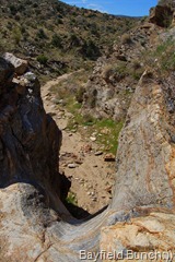
STANDING AT THE BRINK OF A 30 FOOT DRY WATERFALL IN BOX CANYON NEAR BLAIR VALLEY
We had a high cloud cover this morning & it was on the cool side but sitting around the rig for another day was totally out of the question. I don't mind a few relaxing days back to back but for us this great RVing lifestyle is about change, adventure, discovery, seeing & doing things & being as much a part of this great land as we can. The reality of all this is simply that there will come a day when for whatever reason, this adventure will end. We would like to see & do as much as we can........... while we still can!!
MORNING WALK (click pics to enlarge)
Borrego Springs has a great little newsletter entitled, The Sand Paper that is readily picked up at the Desert Nature Store across from Jilbertos. On the cover of it's latest edition was an article about the Road to San Felipe Station. This was an area southwest of the Blair Valley & near a place close to my heart, Ghost Mountain. We had heard of Box Canyon & had driven by & through it several times over the past couple of years but had never stopped to see the place where history had seen the passage of Indians, Pathfinders, Soldiers, Gold Seekers, & the wild west's Butterfield Stage.
ALONG THE BOX CANYON TRAIL
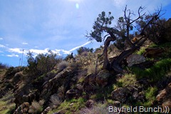
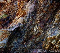
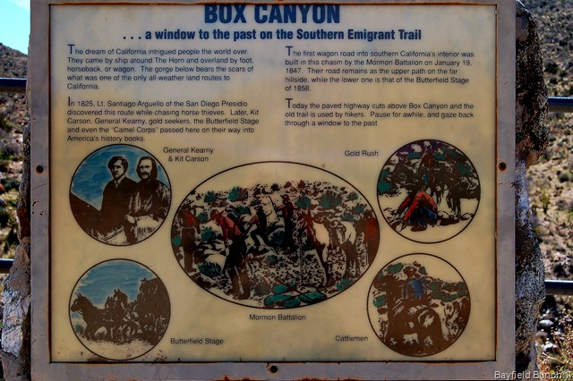
We would hike to the very spot where in 1847 a battalion of soldiers physically hacked out a rough road through the rugged rocky California landscape to bypass a 30 foot dry waterfall. The soldiers, tired, hungry, thirsty, & many of them shoeless after a long march had to move their horses, cattle, sheep, mules, & 5 wagons up over 200 feet through seemingly impossible rock strewn & insurmountable boulders. Thorny cat claw, barbed agave, & mesquite trees blocked their every way. To bypass the waterfall they had to hack away at the rocks with hand tools & axes.
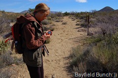
TRAIL HEAD - CHECKING THE GPS - NOTICE HOW GREEN THE DESERT IS TURNING
Because of the the soldiers determination & hard impossible work, a rough road was forged through the canyon & opened up a southern route for people emigrating to California's gold rush. The Butterfield Overland Stage had a mail route through this passage in the 1850's & 60's. This narrow rock strewn road also allowed a few Californians to travel eastward to fight in the Civil War.
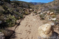
FOLLOWING THE DRY CREEK BED
Our plan today was to drive to a point north of Box Canyon, park the car, & pick up a dirt trail leading down into the canyon where the 30 foot waterfall was located. We wanted to see the narrow passage beside the waterfall where countless numbers of hardy pioneering people passed through on their way west, or east, well over 150 years ago.
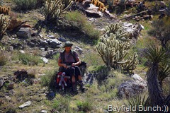
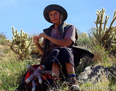
KELLY EATS HER PEANUT BUTTER SANDWICHES WHILE AL SLIPS DOWN TO THE BASE OF THE FALLS
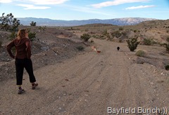
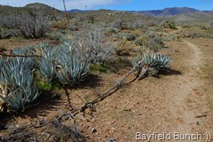
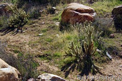
It's a 45 minute drive to Blair Valley & we had our boots on the path at 10:32 a.m. This is an easy hike that follows a path along a dry wash gradually descending into the canyon. No rock scrambling. The warming sun felt good and a cooling breeze coming up the shallow canyon made for a perfect hiking day. Pinion Juniper, Mesquite, & numerous Agave lined the trail. Very green, very pretty, & very rocky walls added to the beauty of the landscape. We could hear the occasional car above on the road that parallels the trail.
YOU CAN DRIVE RIGHT TO THE SPOT WHERE THE WATERFALL IS BUT WE CHOSE TO WALK THE 2.5 MILE RETURN TRAIL INTO THE CANYON & BACK
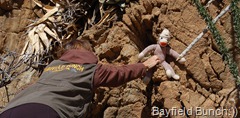
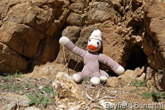
Spotted a small place among the rocks on the west side of the dry wash & decided to set up Socky Von Geepers for his very first photo adventure. Hope we can find the coordinates on the GPS later. Also placed a Bayfield Bunch card at the spot under a rock & then proceeded to write the wrong date on the back of it. Oh well. (hoping to post Socky photo co-ordinates in tomorrow night's blog because the batteries in the GPS are totally dead right now)
PLACING SOCKY VON GEEPERS FOR HIS FIRST PHOTO SHOOT.....WE LEFT A BAYFIELD BUNCH CARD HERE UNDER A ROCK
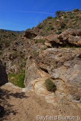
We reached the 30 foot dry waterfall about 11:15 & it was immediately apparent why it was such a formidable obstacle to the battalion of soldiers back in 1847. We stood on the very spot where so much hardship had passed, where backbreaking work was done by a shabby band of soldiers making a rough shod passage around the waterfall. Only a few heavy rocks piled together to form a road bed are visible to tell anyone what went on here so very long ago. I stood there on the path trying to imagine an old stagecoach lurching along through there. So much of history is just too unimaginable. I'll never understand how so many hardships were overcome by such simple means back in those days.
Had we not read of this spot we would have hiked right by not knowing of it's place & importance in history. Took a bunch of photos & set Geepers up for his second adventure photo at the top of the dry waterfall.
KELLY MARKS THE GPS CO-ORDINATES FOR SOCKY'S SECOND PHOTO LOCATION PEERING OVER THE BRINK OF THE DRY WATERFALL. CARD UNDER A ROCK TO KELLY'S RIGHT with the wrong date on it of course:((
The sun & wind were at our backs as we ascended the gradual mile or so back up the wash & along the trail. Many Agave plants in this area & they always remind me of Marshal South & Ghost Mountain. If you type Marshal South or Ghost Mountain into our search box you can see our blogs & pics about our hikes to that area nearby over the last couple of years.
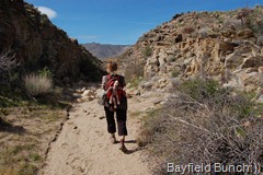
WATERFALL IS BEHIND KELLY AS SHE STANDS ON THE NARROW ROAD FIRST MADE BACK IN 1847 - ONLY VISIBLE SIGN OF THE ROAD - PATH ALONG TOP OF THE RIDGE AT LEFT WAS THE ROAD. HARD TO IMAGINE THE OLD BUTTERFIELD STAGECOACH MAKING IT'S WAY THROUGH HERE ALONG THIS TRAIL
We were back to the car at 1:30 knowing we had had ourselves a good hike. Spending a couple hours like we just did is one of my favorite things to do & the thought occurred to me on the way home that if I pushed myself to do more things like that I would be less likely to be so grumpy in my blog all the time. Boredom is not a good thing for me!!
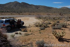
ALWAYS GREAT TO GET BACK TO THE CAR
At exactly 4 o'clock this afternoon it was like somebody flicked a switch & turned on that giant California wind machine again. The wind came suddenly down the canyon & sent me scrambling to fold up lawn furniture again, get the flags down, & secure anything that was not tied down............ I plan to put the rest of today's photos into a Picasa Web Album tomorrow.
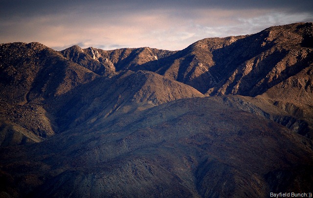
THE SANTA ROSA MOUNTAINS ACROSS THE VALLEY FROM US (Nikon D40 - 200mm)
GROANER'S CORNER:(( A farmer purchased an old, run-down, abandoned farm with plans to turn it into a thriving enterprise. The fields were grown over with weeds, the farmhouse was falling apart, and the fences were broken down. During his first day of work, the town preacher stops by to bless the man's work, saying, "May you and God work together to make
this the farm of your dreams!" A few months later, the preacher stops by again to call on the farmer. Lo and behold, it's a completely different place. The farm house is completely rebuilt and in excellent condition, there is plenty of cattle and other livestock happily munching on feed in well-fenced pens, and the fields are filled with crops planted in neat rows. "Amazing!" the preacher says. "Look what God and you have accomplished together!" "Yes, reverend," says the farmer, "but remember what the farm was like when God was working it alone!"
BLOGGER WEBSITE http://thebayfieldbunch.com/
OUR PHOTO ALBUMS http://picasaweb.google.com/stargeezerguy/
The only thing better than right now will someday be the memories of right now...... AL.


