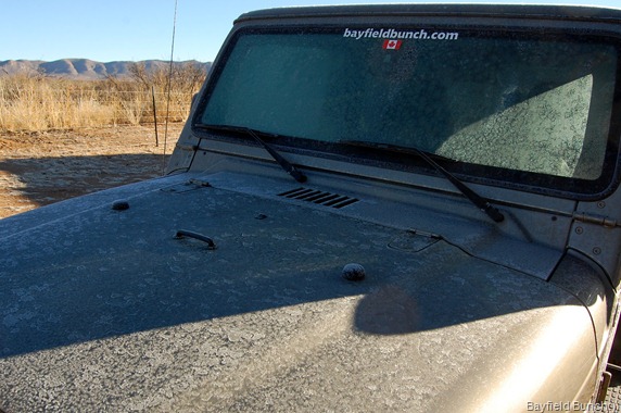
It was another cold night here in Southeastern Arizona & the ground was covered with a heavy frost this morning. Had to start the Jeep before heading out just to defrost the windshield.
YEP, IT WAS A MIGHTY COLD ARIZONY MORNING AGAIN
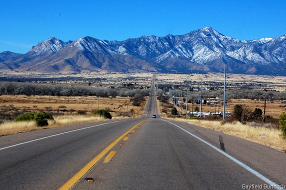
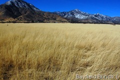
Rolled through the gate at 9:50 a.m. with our destination being Parker Canyon Lake somewhere on the west side of the Huachuca Mountains. Beautiful day for a drive with a big clear blue Arizona sky above. Grabbed a Starbuck’s coffee at the Safeway store on our way through the San Jose part of Bisbee & struck off across the San Pedro Valley heading for the snow covered Huachuca Mountains & Coronado Peak.
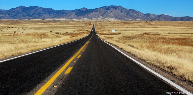
HEADING ACROSS THE SAN PEDRO VALLEY TO THE HUACHUCA MOUNTAINS
It was our third time into the Coronado National Memorial Park but it was the first time we saw warning signs of a troubled road ahead. Signs cautioned drivers to either have chains on tires or 4 wheel drive. There was obviously snow & ice ahead. That was precisely the reason for our Jeep decision last summer so off we went heading for the summit at Coronado Peak.
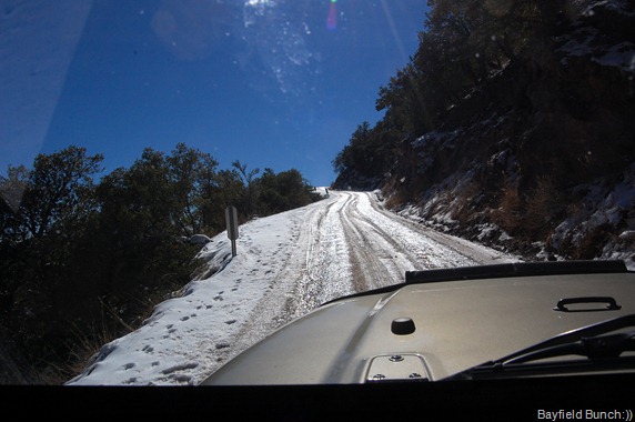
IT’S ONLY NERVE WRACKING IF YOU ARE THE PASSENGER
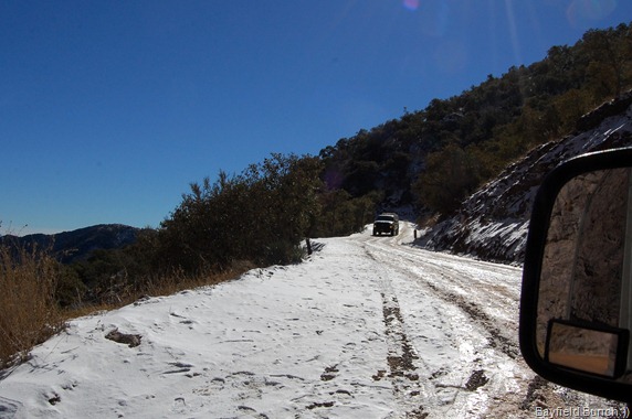
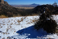
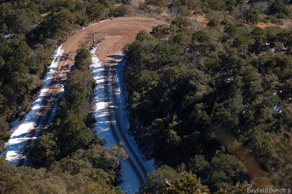
Pavement ended not too far past the Visitor Center & the road turned to a wet hard packed mud surface but no problem. As we ascended the twisting road it wasn’t long before we began picking up skiffs of snow alongside the road. We noticed the road was frozen in the shady areas so we knew to be extra careful in those spots . I had already shifted into 4 wheel drive so the hard packed icy snow was not a problem. The road is narrow in spots & we met a pick-up truck coming down on a snowy stretch. I knew there was not room enough for us to get safely by each other so I stopped & backed down the hill about a hundred yards until I could get over far enough to let him by. Backing up anything has never been a big problem for me & figured it made more sense for me to back down the slippery surface than for him to try backing up a slippery surface. The drop off on his side at this point was about 5 feet away with a 200 foot drop into into the canyon below. This may all sound very scary, but only if you are a passenger, as Kelly will shakily attest to.
JUST A FEW FEET TO THE LEFT & YOUR OVER THE EDGE
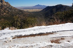
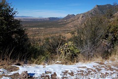
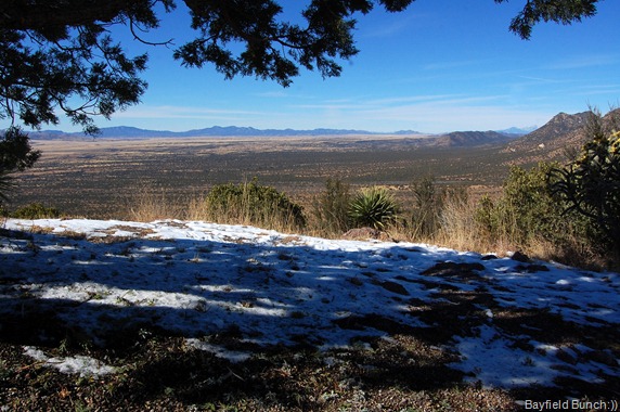
A few more icy sections & we were at the top. Nice big paved parking area here with views for miles & miles. Last time here a couple years ago we saw Border Patrol guys scanning the territory below with high powered binoculars & it was the same today. The field of view is easily 40 or 50 miles. The Mexican border is just below Coronado Peak & there is heavy illegal alien traffic in the area.
THE SAN RAFAEL VALLEY…WE WILL HEAD NORTH ALONG THE HUACHUCA MOUNTAINS ON THE RIGHT
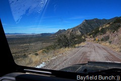
THE ROAD WE JUST CAME UP
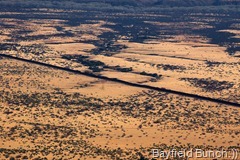
THE MEXICAN BORDER FENCE IS VISIBLE RUNNING ALONG THE DESERT FLOOR
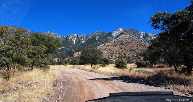
Without further ado we started back down the west side of the mountain range into the beautiful San Rafael Valley. Noticed right away the absence of ice & snow on the road & figured the warm afternoon sun on that side of the Huachuca’s had melted it all off in the last couple days. A long & wide beautiful valley stretched before us as far as the eye could see with mountain ranges rimming the distant horizons. Somewhere off to the left lay Nogales about 60 miles away & somewhere straight ahead a hundred miles or more lay the city of Tucson.
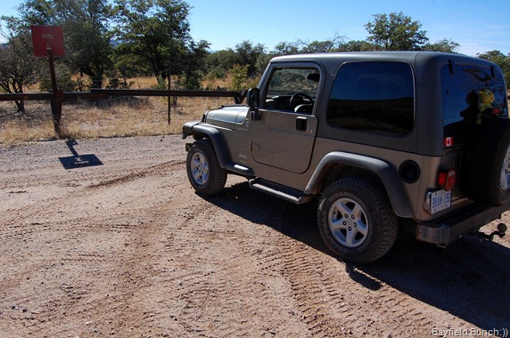
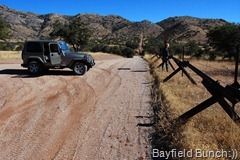
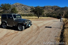
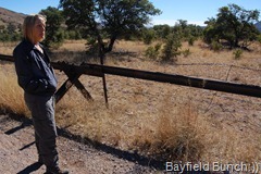
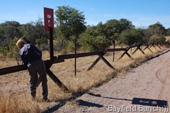
There were no road signs on the dirt road to tell us where we were going & about 20 minutes after coming down off the peak, the road forked. Ahead was a sign saying Copper Canyon so we figured Parker Canyon Lake must be off to the left. It wasn’t!! We had a hunch we were on the wrong road when it arced back around to the south & headed directly for Mexico. Minutes later we were stopped at a T-intersection & head to head with a long horizontal steel beamed low fence running east & west. Barbed wire alongside the steel beams told us we were stopped just a few feet away from the Mexican border. We could have easily stepped over the steel beams & through the old loosely & trodden down barbed wire right into Mexico. Didn’t try anything silly like running over & back again just to say we had been to Mexico this trip. I knew we were probably already under surveillance from somewhere high atop Coronado Peak to our left.
NOSE TO NOSE WITH THE MEXICAN BORDER!!
OK, HOW DO WE GET OUT OF HERE
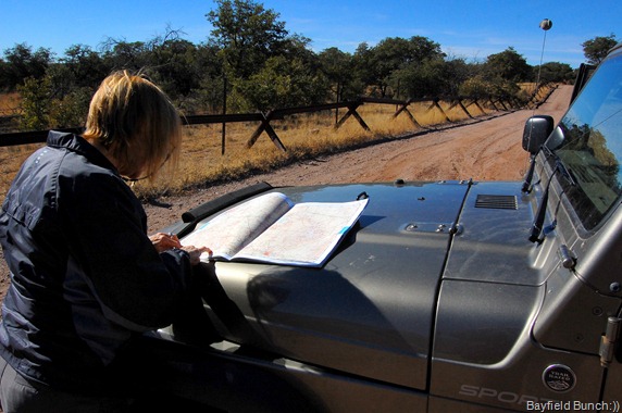
We were not exactly sure where our destination was now so out came our big Arizona Road & Recreation Atlas to figure things out. With an idea where we were we headed back from whence we had come & turned left onto the Copper Canyon road. Within a few hundred yards we felt we were back on track again. There are absolutely no signs in this whole area to tell you where you are, where you have been or where you are going. No matter, this whole area was just to beautiful to stop & complain about it. Even for me!!
RETRACING OUR STEPS BACK TOWARDS THE HUACHUCA MOUNTAINS
We drove a lot of miles on twisting roads always keeping the Huachuca mountain range on our right hand side & the sun on my left shoulder. I knew that would keep our nose pointed in a northerly direction where our destination lay….somewhere.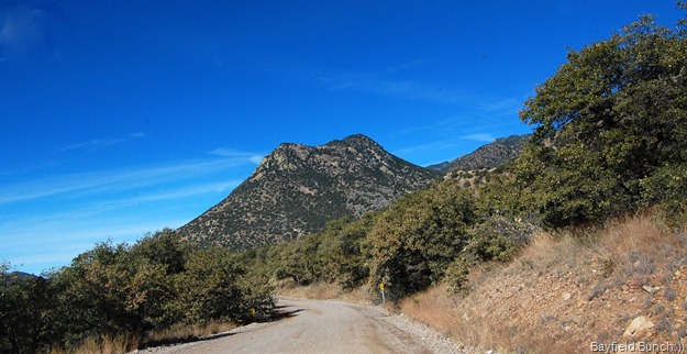
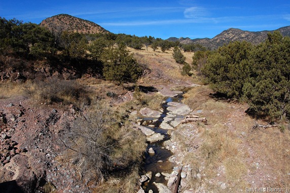
Hadn’t seen another vehicle since the 3 border patrol trucks just after leaving Coronado Peak so when a pickup truck appeared coming our way I stuck my hand out the window for him to stop, which he did. Asked him if we were on the right road to Parker Canyon Lake & he said, “yep, you got about 8 miles to go.” Needless to say, that was a bit of a relief as we continued our gravely & bumpy journey through some of the most beautiful scenery we have seen. But then again, where isn’t the scenery beautiful here in the Southwest. Ok, well maybe if your in a city or something:((
IT WAS NICE TO STOP & HEAR WATER BUBBLING IT’S WAY ALONG OVER THE ROCKS
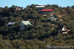
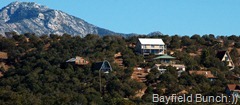
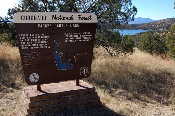
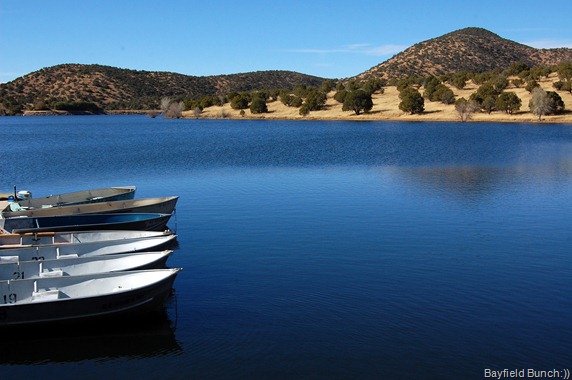
I first caught sight of PARKER CANYON LAKE below us to the northwest through a bunch of trees. An aqua blue splash of water in a small picturesque valley oasis about a mile away lay framed by yellowed grass, green leaved white Pines, Agave, Yucca & varied rock formations. Interspersed among all the flora & fauna were were tiny houses & cottages scattered about in the rolling hills.
OUR FIRST GLIMPSE OF PARKER CANYON LAKE
It was nice to reach solid pavement again as we turned left on highway 83 & headed the short distance down to the Marina. So unusual to see a beautiful 132 acre lake way out here in the middle of what you might call rolling hill country in a semi-desert like setting.
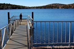
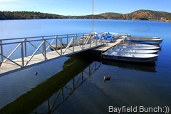
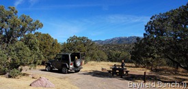
Nice marina, boat launch, small dock & general store. Bright yellow Kayak rentals are also available. About a mile from the Marina is the Lakeview Campground where Kelly & I stopped & ate our turkey salad sandwiches. The campground is RV accessible with a few pull though sites but I wouldn’t really want to bring a 40’ diesel banger in there. I would say 30’ or less would be far more comfortable. I will post a few site photos in a later post.
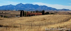
It was 2 o’clock when we left the campground & headed back out highway 83 for home. Again, beautiful rolling hills & winding roads with mountains on all horizons. At one point I could the Huachucas, the Mules, the Santa Ritas, the Whetstones, the Dragoons & the distant snow covered Chiricahua mountains. Have I told you today how beautiful this part of the country is.
PICNIC SNACKS IN THE RV LAKEVIEW CAMPGROUND
Missed a turn off at a place called Elgin & ended up heading northwest to the town of Sonoita before picking up highway 82 east. This wasn’t our first time in Sonoita for we had passed through here in late December of 06 on our way from Tombstone to Patagonia Lake. We were driving a truck & fifth wheel at that time.
THE MUSTANG MOUNTAINS
It was getting late in the day so we didn’t waste any tine making our way past the Mustang mountains to the town of Whetstone. From there we continued east past the ghost town of Fairbank to highway 80 where we hung a right into the town of Tombstone. South of Tombstone we picked up Davis road to McNeil, & hung a left to Elfrida’s Jefferson Road. East on Jefferson heading for the Swiss Helm Mountains & home. Our trip had lasted just under 7 hours & we put on something like 175 miles. What a great day it was & I was once again so happy to see things I had never seen before. Aside from asking the one person we saw if we were on the right road to Parker Canyon Lake we never really had occasion to talk to anyone else. Now, that is my kinda day:))))))))))
HEADING BACK ACROSS THE SAN PEDRO VALLEY WITH THE DRAGOON MOUNTAINS DEAD AHEAD
GROANER’S CORNER:(( A jumper cable walks into a bar. The bartender says "I'll serve you, but don't start anything."
--------------------------------------------------------------
EMAIL THE BAYFIELD BUNCH:))
stargeezerguy@gmail.com
Tourists see the world, travelers experience it.
BLOGGER WEBSITE http://thebayfieldbunch.com/
OUR PHOTO ALBUMS http://picasaweb.google.com/stargeezerguy/
The only thing better than right now will someday be the memories of right now...... AL.























I can understand what Kelly must have been going through when you had to back down a snowy, slippery road. I might have gotten out and walked it, but then again, you must be a good driver.
ReplyDeleteI noticed that you don't take your dogs with you anymore on your hiking adventures. I realize it's because they are getting on in years and it's too hard on them. But, I'm wondering, are they ok to be in the rig all that time while you're gone? I know you said the Max has to use the bathroom a little more frequently now that he's older. That is always one of our problems even though it's not potty breaks they need. Jackson, the younger one, just gets antsy being cooped up for hours and I feel bad for him. We try and not be gone for more than about 5 hours at one stretch.
ReplyDeleteLooks like it took a while to get to the lake but it is a nice one. It is surprising to see ice and snow in AZ...
ReplyDeleteGreat photos!
Great trip,Thanks for taking us along with you, those mountains are really beautiful. Be safe out there. Sam & Donna.
ReplyDeleteWhat a great day thanks for the ride..
ReplyDeleteI don't think I'd try driving that road with the ice and snow, but then I don't have a jeep or truck. :)
ReplyDeleteAnd no guard rails. I've noticed the western US has a lot less of them than the eastern and needs them a lot more. Though the road you were on is not a heavy traveled one and wouldn't have them anyway, so it's good you have the jeep.
ReplyDeleteThis is where my inner "scaredy cat" would come out. We drove up Kitt Peak to the observatory , East of Aho, when we pulled our Cougar...Up was OK, down...not so much..Also drove up Pike's peak once in just a car...I was white knuckeled all the way, with no guard rails there, either...
ReplyDeleteYour pictures were fabulous...and what a great view!!!! I was nervous just from your photos!
We wanna go there! Thanks for showing us our home state!
ReplyDeleteWhat a great tour - it was nice and safe watching from here and looking at all the terrific pictures of your drive.
ReplyDeleteThat snow covered road up the mountain looked downright scary. I know for sure Paulette would have been out of the truck and walking back down the mountain without me!!
What a great day and wonderful sights and the pictures told the story. I would have been a nervous wreck having to back down the hill, glad Kelly made it ok.
ReplyDeleteI sure didn't realize you were so close to the border.
A wonderful day. Wonderful photos too.
ReplyDeleteanother great jeep day!!..not to sure about the reversing down a slippery slope..I am pretty darn sure I would have been hanging on to the 'chicken bar'!!
ReplyDeleteHola Mexico!!..how interesting..but I guess those mexicans who are sneaking across can run faster scared than the border guards can mad!!..have a great day..and thanks for the jeep tour!!
What a great day, and thanks for taking us along! And I'm totally sure the Boarder Patrol was watching your every step when you were at that boarder fence. It wasn't even high enough to be called a fence,LOL. But then maybe it doesn't need to be any higher with a thousand eyes watching with ever form of surveylance.
ReplyDeleteAl,
ReplyDeleteI assume that you did this trip on Sunday January 2nd and you just have a date error on this blog page.
You went past me about 1/2 mile away at the intersection of AZ90 & AZ 82. I can understand why you didn't try to find me and stop; it was 'get home time'.