Showing posts sorted by relevance for query Harquahala mountain. Sort by date Show all posts

Saturday, January 09, 2016

WANDERING AROUND AGUILAS EAGLES EYE & THE HARQUAHALA MOUNTAIN RANGE

DSC_0008

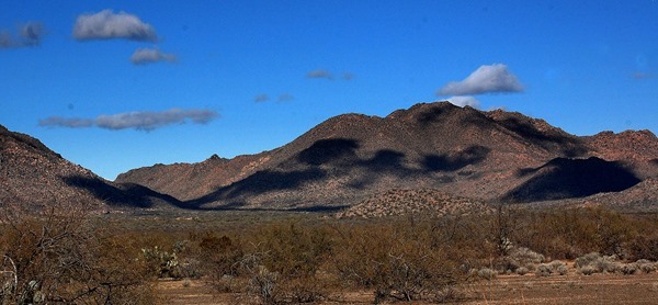
IN THE SHADOW OF HARQUAHALA MOUNTAIN

Without even looking up I knew our morning skies were clear soon as I stepped out the door this morning.  I could hear the stars laughing.

DSC_7681

ALTHOUGH LOOKING LIKE A CLOUD ON THE HORIZON THIS IS ACTUALLY A GREAT MASS OF POSSIBLY STEAM EMANATING FROM THE LARGE TONOPHA POWER PLANT SOUTH OF INTERSTATE 10

How nice to throw open our East facing living & dining room curtains & have all that sunshine pour in.  Jeep was covered with frost & I later had to run it’s defroster to thaw the windshield’s coating of ice.  A clear & cold desert night indeed.

DSC_7697

CLOUD SHADOWS LAZILY DRIFTING ACROSS THE DATE CREEK MOUNTAINS

Pheebs & I didn’t waste any time getting ourselves loaded into the Jeep & on the road.  With Libby’s heater running we made our way to Wickenburg’s Safeway store for a few groceries.  Always the same kind of staples for me with peanut butter, honey, cranbury juice, oatmeal, yogurt, & milk leading the way.  Grabbed a sandwich to go at the Deli & Pheebs & I were out of the parking lot within 15 minutes of entering it.

DSC_7694

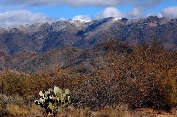
NOTICED A BIT OF SNOW ON THE WEAVER MOUNTAINS

We may be heading over to the Wickenburg Massacre site next week & seeings how it’s been a couple years since we were there last I wanted to make sure I knew where the turn off highway 60 was.  It is very easy to miss.  Well of course it was in the same place as last time we were out that way between mile markers 101 & 102.  Having verified the right hand turn off the highway Pheebs & continued west to the dusty little whistle stop of Aguila.DSC_7688

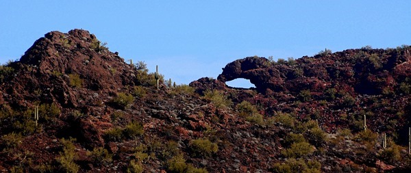
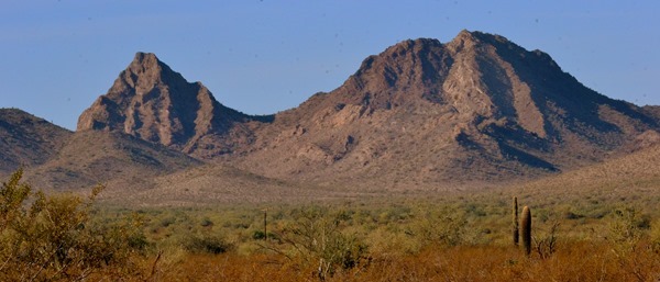
THE EAGLES EYE SOUTH-EAST OF AGUILA ARIZONA AS SEEN FIRST FROM THE NORTH THEN CLOSER UP FROM THE SOUTH

DSC_7683

There is a rocky outcropping South-east of Aguila called the Eagles Eye & I was curious to see how close we could get to the Eagles Eye itself without too much strenuous effort.  Well it turned out not to close at all but we did manage to follow a few Jeep roads in the area plus hike up a short steep rock strewn hill to have us a look around the surrounding country side.

DSC_0002

APPROACHING EAGLES EYE WE SPOTTED KING KONG 

DSC_0003

HERE YOU CAN SEE HIS PROFILE LOOKING ACROSS THE VALLEY TO HARQUAHALA MOUNTAINDSC_0005

DSC_0007

SCOUTED AROUND ON A FEW JEEP ROADS

DSC_0016

KNOWING WE WOULD NEVER GET THE LIBERTY UP THERE PHEEBS & I HIKED UP THAT STEEP ROCKY ATV TRAIL TO THE TOP

DSC_0010

THAT’S THE ROUGH & TUMBLE LITTLE TOWN OF AGUILA WAY OUT THERE

DSC_0013

THE EAGLES EYE WAS ON THE OTHER SIDE OF THAT ROCKY RIDGE BUT WE WEREN’T ABOUT TO HIKE WAY OVER THERE

DSC_0014

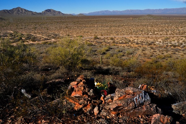
SOME KIND OF A MEMORIAL IN THE FOREGROUND LOOKING OFF TO THE WEST & THAT IS THE VALLEY FLOOR WE TRAVEL ACROSS ON OUR WAY TO QUARTZSITE, YUMA, OR BORREGO SPRINGS

DSC_0012

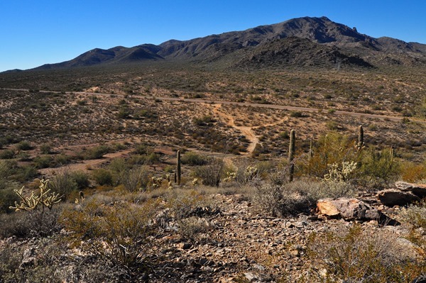
JEEP IS ABOUT IN THE CENTER OF THE PHOTO & WHEN  WE ROLLED OUT WE TURNED LEFT ONTO THAT HIGHWAY RUNNING THROUGH THE PHOTO…HARQUAHALA MOUNTAIN IN THE BACKGROUND

Eagle Eye Road running south & southwest out of Aguila is a nice quiet paved road running around the East side of Harquahala Mountain & we had traveled this road one time back in 2012.  That was the day we Jeeped ourselves up to the top of Harquahala Mountain.  Pheebs & I took a leisurely 15 mile drive to the Harquahala trailhead but we had no intention of heading up the mountain.  It was nearly noon so we turned around & headed ourselves back to Congress arrving home 45 minutes later.  Although today’s air was quite cool it was nice to be rolling along under sunny skies again with very little traffic, no people, wide open spaces, & mountain scenery all around us just stretching across all horizons & going on forever………..For the day Kelly, Pheebs, I took our Jeep Wrangler up Harquahala Mountain click here >>>>> The Day We Jeeped Up Harquahala Mountain.DSC_0024

DRIVING PARALLEL TO HARQUAHALADSC_0022

DSC_0018

THE HARQUAHALA AREA IS POPULAR WITH HORSE & ATV RIDERS

DSC_0019

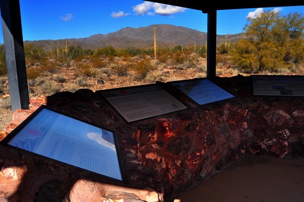
THE TRAILHEAD KIOSK & FROM HERE IT IS 10 MILES OF ROUGH & TUMBLE ROAD TO THE TOP OF HARQUAHALA MOUNTAIN IN THE BACKGROUND

DSC_0020

DSC_0021

HAD WE CONTINUED WEST AS THE CROW FLIES OVER THAT DISTANT MOUNTAIN RANGE WE COULD HAVE LANDED OURSELVES IN QUARTZSITE ARIZONA

On the way back from Aquila traveling along highway 71 I could see the Weaver Mountains ahead & noticed a lot of snow in an area I figured was somewhere between Stanton & Yarnell so in the morning Pheebs & I plan to head out that way & pick up Stage Coach Road in Stanton heading North.  Might be able to get ourselves a few nice snowy mountain photos.

DSC_0030

HEADING TOWARDS CONGRESS I COULD SEE DIRECTLY ABOVE THE HIGHWAY A STRETCH OF SNOWY MOUNTAINS & I FIGURE THEY ARE EAST OF STANTON & YARNELL

Now here's a bit of a funny thing.  I shaved off my beard late Friday afternoon & it wasn't until Kelly read my post Saturday morning that she realized I had actually shaved off my beard.  I wonder if she noticed I turned 71 last October.  Maybe not because I didn't tell her about that either:))

DSC_0031

BOON-DOCKERS UNDER SUNNY SKIES ALONG HIGHWAY 71

Steve over at Hounds, RVs And Other Stuff just a few days ago had to bid a final farewell to his beloved Bassit Hound Winston & in his latest post today shares a heartwarming story about a little boy who fell in love with Winston through Steve’s blog.  You will want to read this post as the little boy’s Mother emails Steve after Winston passes away.

DSC_7692

CONGRESS IS JUST ANOTHER 3 MILES DOWN THAT ROAD

GROANER’S CORNER:(( Two hunters got a pilot to fly them into the far north for elk hunting. They were quite successful in their venture and bagged six big bucks. The pilot came back, as arranged, to pick them up. They started loading their gear into the plane, including the six elk. But the pilot objected and he said, "The plane can only take four of your elk; you will have to leave two behind." They argued with him; the year before they had shot six and the pilot had allowed them to put all aboard. The plane was the same model and capacity. Reluctantly, the pilot finally permitted them to put all six aboard. But when the attempted to take off and leave the valley, the little plane could not make it and they crashed into the wilderness.  Climbing out of the wreckage, one hunter said to the other, "Do you know where we are?"  "I think so," replied the other hunter. I think this is about the same place where we crashed last year!"

Sunday, December 11, 2016

PHEEBS AND I SET OFF IN SEARCH OF SOME NEW SCENERY

DSC_0002

I’M GUESSING THIS MAY BE THE BELMONT MOUNTAIN RANGE ON THE NORTH SIDE OF I-10 AS SEEN FROM THE SOUTH SIDE OF HARQUAHALA MOUNTAIN

Feeling a strong need to find myself some new scenery this morning I loaded up the furry little Rug Rascal and we headed west out of Congress on highway 71 in the direction of Harquahala Valley.

IMG_0510

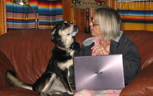
MORNING COUCH SNUGGLES

IMG_0511

We found ourselves for the second time this week rolling through the little tumble down community of Aguila on highway 60 then turning southwest on Eagle Eye Avenue.  Wasn’t until we reached the Harquahala Trailhead for a leg stretch that we began to see some new mountain ranges on the horizon.  Had been to that trail head twice before but had never followed the highway any further beyond that point.DSC_0002

DSC_0001

HARQUAHALA MOUNTAIN TRAILHEAD

DSC_0004

I had a pretty good idea there was another road ahead intersecting the road I was on and running basically north and south but didn’t know how far ahead it was until I reached it and realized it was further than I thought.  A sign said this was the Salome highway and I instinctively knew the small dusty western town of Salome would be to the right so it was a right hand turn we made.DSC_0005

OH HOW I LOVE SEEING NEW MOUNTAIN RANGES AND THOSE MOUNTAINS TO THE WEST ARE CALLED THE ‘LITTLE HARQUAHALAS’ WHICH ARE LOCATED SOUTH OF SALOME

I was a bit surprised at how flat the Harquahala Valley floor was as we made our way along ever vigilante for cattle on the road.  With a morning haze in the air far distant mountain ranges seemed to lumber up off the desert floor and stumble slowly along across the horizon.DSC_0004

A VERY FLAT HARQUAHALA VALLEY FLOOR

DSC_0006

As usual there was very little traffic on any of the Sunday morning roads and if you did meet another vehicle the other driver seemed to give a little wave as if to say “thanks for being out here in case I need some help”.  The desert in it’s subtle beauty can be very unforgiving to those unfortunate enough to find themselves in peril upon it’s sands.

DSC_0010

DSC_0007

When we finally reached Salome we were once again in familiar territory as we turned right onto highway 60 and headed East.  Over the past four and a half years we have traveled this highway many times on our way to and from our jaunts to places like Quartzsite, the Kofa Mountains, Yuma, Slab City and Borrego Springs.  Like I have said before this drive from Congress to I-10 just a few miles east of Quartzsite will go down as one of my all time favorite drives. 

DSC_0010

DSC_0013

When we reached Aguila again we in effect closed a large circle as we had driven completely around Harquahala Mountain.  From the time we drove through Aguila earlier in the morning until we returned to Aguila we had Harquahala Mountain on our right hand side every mile of the way.  A short distance east of Aguila we turned left onto highway 71 and that took us straight home to Congress.  It was almost noon when we rolled into our driveway.

DSC_0012

Early afternoon again saw us working around the rig packing, re-packing, and moving ever closer to getting ourselves organized for our possible final departure from this area soon.  Thought a lot about that this morning and am very comfortable with the ‘house sale’ decision we made back in August of 2015.  Both Kelly and I are so much looking forward to the next chapter of our ever changing lives…………….

DSC_0003

GROANER’S CORNER:(( The symphony orchestra was performing Beethoven's Ninth. In the piece, there's a long passage, about 20 minutes, during which the bass violinists have nothing to do.  Rather than sit around that whole time looking stupid, some bassists decided to sneak offstage and go to the tavern next door for a quick one.  After slamming several beers in quick succession, one of them looked at his watch and said, "Hey! We need to get back!"  "No need to panic," said a fellow bassist. "I thought we might need some extra time, so I tied the last few pages of the conductor's score together with string. It'll take him a few minutes to get it untangled."  A few moments later they staggered back to the concert hall and took their places in the orchestra.  About this time, a member of the audience noticed the conductor seemed a bit edgy and said as much to her companion.  "Well, of course," said her companion. "Don't you see? It's the bottom of the Ninth, the score is tied, and the bassists are loaded."

--------------------

You Might Be A Redneck if.…………
- Your kids are going hungry tonight because you just had to have those Yosemite Sam mud flaps.
- You fainted when you met Slim Whitman.
- You have lost at least one tooth opening a beer bottle.
- Jack Daniels makes your list of "most admired people".

Tuesday, December 06, 2016

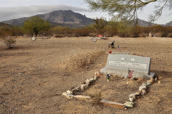
EAGLE EYE CEMETERY IN THE SHADOW OF HARQUAHALA MOUNTAIN

DSC_0090

HARQUAHALA MOUNTAIN

Brewed myself up a coffee in our ‘Bodum French Press’ one cup coffee maker, tossed the last Safeway Blueberry muffin into the microwave for a few seconds, grabbed my cameras, loaded up the Pheebs and we were off out the door into the Jeep.  Again, no idea where we were going so we just went anyway until we reached wherever it was we couldn’t think to go.

DSC_0003

HEADING WEST ON HIGHWAY 71 UNDER CLOUDY SKIES THIS MORNING

DSC_0004

THE DUSTY LITTLE TUMBLE DOWN TOWN OF AGUILA STRAIGHT AHEAD AND CAN YOU SEE WHAT IS KNOWN AS THE ‘EAGLES EYE’ IN THE SMALL MOUNTAIN ON THE LEFT

Despite an overcast sky and 45F temperatures we were fine in the Jeep.  Fired up the heater for some comfortable warm air, cranked down Pheebs window halfway for a a refreshing breeze and turned on the dome light to simulate some sunshine.  We were good to go:))

DSC_0006

CLOUDS ATOP HARQUAHALA MOUNTAIN

DSC_0008

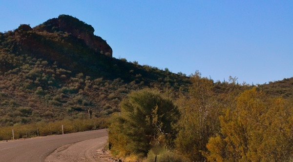
DESERT SCENERY ALONG THE SOUTH SIDE OF HIGHWAY 71

By the time we reached the end of Ghost Town Road about a minute after we left the house I decided to turn right on highway 71 and head west.  My other 2 options were heading north on highway 89 towards Yarnell or south to Wickenburg.  We have been in both those places have a dozen times or more in the last 3 weeks so west it was and off we went in the direction of Aguila. (pronounced A-gee-aa)DSC_0009

WE’RE GETTING CLOSER TO THE EAGLES EYE AS VIEWED FROM THE NORTH SIDE

It was on this same stretch of road I took the ‘Mountains In The Mist’ photos last week.  Highway 71 from Congress to Aguila covering 25 scenic miles is a favorite drive of mine simply because of how it lazily wanders along in a relative straight line across the desert floor with very little traffic on it.

DSC_0020

Harquahala Mountain loomed closer the further we went.  Toyed briefly with the idea of making a run up the mountain but thought better of it.  Had forgot to take the cell phone and with the rocky road climb up Harquahala it was no place to go alone without a cell phone or hard hat in case one fell of the road and tumbled down into a deep canyon.

DSC_0014

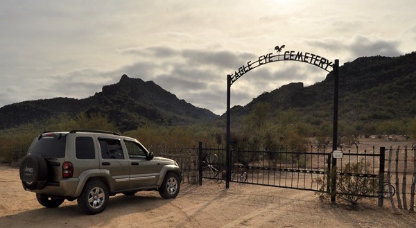
From 71 we turned right on highway 60 and drove the short distance into Aguila turning left onto Eagle Eye Road heading towards Harquahala Valley about 40 miles away.  Knowing we weren’t going to go that far we just kinda puttered along south of Aguila for about a mile until I spotted a sign saying ‘Eagle Eye Cemetery’.  I’ve always liked wandering through old out of the way cemeteries looking at things so off we went in search of it.  Luckily it was only a few hundred yards off the road.DSC_0084

WITH A GLOOMY SKY OVERHEAD IT SEEMED A FITTING DAY TO GO PROWLING AROUND IN A CEMETERY

DSC_0053

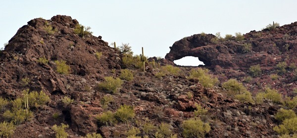
THE EAGLES EYE IS IN THAT KNOB AT TOP LEFT

DSC_0055

ALL VETERANS SITES ARE MARKED WITH AN AMERICAN FLAG

DSC_0058

DSC_0054

HARQUAHALA LOOMS IN THE BACKGROUND

DSC_0056

DSC_0057

DSC_0059

SOME MARKERS ARE SIMPLY DONE

DSC_0071

DSC_0060DSC_0061

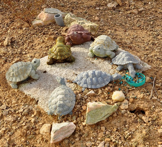
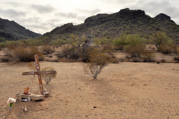
The difference in cemeteries out here in the west we have seen and the cemeteries at home in Ontario is quite remarkable and the one Pheebs and I walked through this morning was a good example of that.  Plots didn’t seem to be organized in sections or rows but were sort of scattered about in a willy-nilly fashion.  We have seen this before in western cemeteries.  I always find it interesting to read the inscriptions on the stones or old wooden crosses often just stuck in the ground.  We have come across graves in places other than cemeteries out here in the West.DSC_0063

THE TOWN OF AGUILA CAN BE SEEN IN THE BACKGROUND

DSC_0062

DSC_0064

DSC_0065

DSC_0066

I SUSPECT THE PERSON HERE MAY HAVE BEEN AN AVIATOR

DSC_0068

WONDER WHAT THE STORY IS BEHIND THIS FELLOW

DSC_0069

A HAND HEWN RESTING BENCH

DSC_0070

HARQUAHALA MOUNTAIN ALWAYS PROMINENT IN THE BACKGROUND

DSC_0078DSC_0083

Bit of a cold wind blowing through the cemetery but no matter I was dressed good and warm and of course Pheebs had her fur coat on.  A smattering of diffused sunlight began appearing as I noticed skies were very slowly beginning to clear.  We were on the east side of Harquahala Mountain and how nice Harquahala looked with a few brief morning sun splashes touching down close to her peak.DSC_0012

DSC_0072

DSC_0074

SAW THIS SET UP UNDER A COUPLE PALO VERDE TREES

DSC_0073

I’M SURE THERE ARE SOME PAINFUL MEMORIES HERE

DSC_0076

DSC_0077

DSC_0081

DSC_0080

DSC_0086

DSC_0013

From the cemetery Pheebs and headed back to Eagle Eye Road and turned left heading another couple miles or so until we saw a familiar desert road turn off for Tonopah about 40 miles away.  Tonopah is on Interstate 10.

DSC_0021

DSC_0022

A CLOSE UP 300mm TELEPHOTO VIEW OF THE EAGLE’S EYE FROM THE SOUTH SIDE

We ventured down this hard packed sandy gravel road for maybe a mile before turning around.  We had already done this desert highway in the Spring only in reverse one morning when we headed out Vulture Mine road then instead of turning left for Tonopah we turned right for Aguila.  I remember it as being a very dusty road with a lot of rumbling gravel trucks on it so we made our way back to Eagle Eye Road and headed back for Aguila as skies ever so slowly began to get a little brighter.

DSC_0018

PHEEBS AND I TRAVELED THIS LONG AND DUSTY DESERT HIGHWAY BACK IN THE SPRING COMING FROM THE OTHER WAY

DSC_0089

DSC_0093

WE HAVE ALREADY TURNED AROUND AND IT WAS FROM THE SPOT I TOOK THE POST’S HEADER PHOTO WHICH WAS BEHIND ME

Half a dozen more photo stops along the way and we were back to Congress pulling into our driveway right on the stroke of High Noon.  Another relaxing morning spent in the arms of Mother Nature again.  I sure would be lost if it wasn’t for our morning drives, walks, and short hikes whether it be back home in Bayfield Ontario or out here in the mountains, valleys and deserts of the South-west.  A few hours out with Pheebs most mornings sure shortens up what are otherwise long boring days for me sometimes.  No schedules, nobody telling us where to go or what to do or when to be home.  We are free to think our own thoughts and kibbitz back and forth like a couple of Crazy-O’s.  Stop where and when we want, grab a burg here or a Sub there.  It’s quite the life we have and for as long as we can keep doing it we are going to keep doing it……… And for anyone interested in reading about the day Kelly, Pheebs and I rough and tumbled our way up to the very top of Harquahala Mountain and made it safely back down again you can read my post about our Jeep Wrangler trip by clicking this link….. Our Toughest Jeep Challenge Yet.  You might be surprised to see what we found up there……………

DSC_0015

I HOPE TO HAVE MORE PHOTOS OF THIS MORNINGS JOURNEY IN TOMORROW NIGHT’S POST

GROANER’S CORNER:((  A famed English explorer was invited to Dartmouth to tell of his adventures in the African jungle.  "Can you imagine, a people so primitive that they love to eat the embryo of certain birds, and slices from the belly of certain animals? And grind up grass seed, make it into paste, burn it over a fire, then smear it with a greasy mess they extract from the mammary fluid of certain other animals?"
When the students looked startled by such barbarism, the explorer added softly, "What I've been describing, of course, is a breakfast of bacon and eggs and buttered toast."

---------------

“I mixed up the cardiac resuscitation equipment with the lie detector, but I will de-fib you later.”

--------------

A young lad was visiting a church for the first time, checking all the announcements and posters along the walls. When he came to a group of pictures of men in uniform, he asked a nearby usher, "Who are all those men in the pictures?" The usher replied, "Why, those are our boys who died in the service".
Dumbfounded, the youngster asked, "Was that the morning service or the evening service?"