Luckily our passing rain showers Thursday night did not hang around or turn into any kind of downpour. Just enough rain to settle the dust a bit & give us that great sweet smelling Creosote desert aroma this morning when I stepped out of the coach.
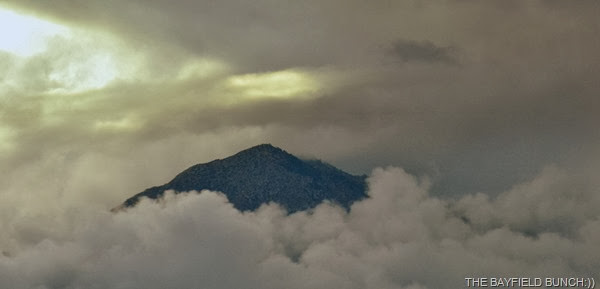
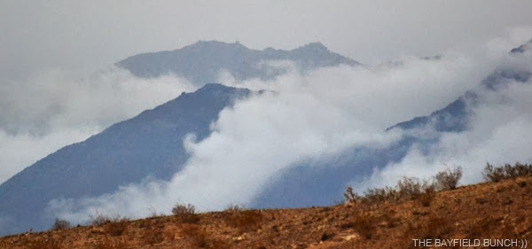
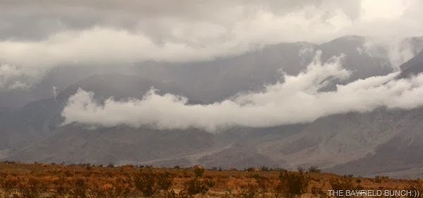
A heavy cloud cover hung over the area & looks like it will be with us for a couple more days. Not cold here & so far have not had to use our Buddy heater or fire up the furnace. A little cool first thing in the morning but it’s Okay. Just a little dismal looking outside. But of course dismal can look nice too if you look for the good side of it.
Rain started again about 7:15 this morning. We had our doubts about the Jeep tour but drove out to the meeting point just in case. Kelly had gone into Borrego Springs earlier to check out the Farmers Market on Christmas Circle. It’s held every Friday morning. Noticed this morning it was raining not only here but back in Congress Az & Bayfield Ontario as well. We were at 55F here, 46F in Congress & Bayfield was holding it’s own at 44F.
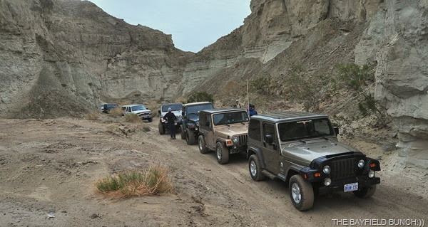
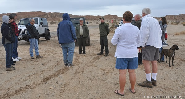
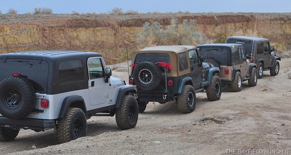
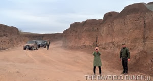
We headed for the Truckhaven Coral Wash tour about 8:35 & our hearts sank as the rain came down harder. But only for about 10 miles & it let up again. Saw a group of vehicles ahead at the designated meeting point & our spirits were lifted. Pulled in & yes the off-road tour was a ‘Go’:)) Eight vehicles in total including us. Five of the 8 were Jeeps.
OCOTILLO RANGERS GUIDING OUR TOUR TODAY WERE KEN CONWAY & MARK KAUFMAN
DON’T LET THOSE TWO FOLKS WITH SHORTS ON FOOL YOU…IT WAS NOT A SHORTS DAY!!!!
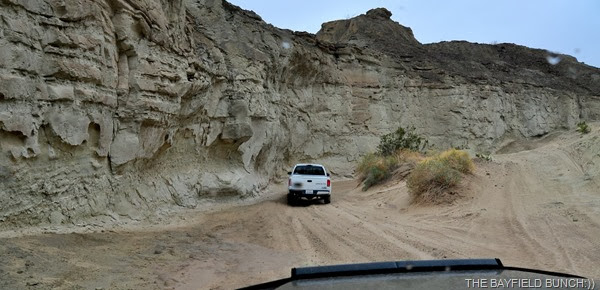
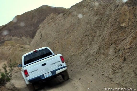
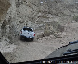
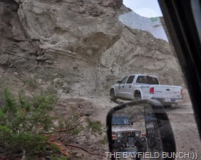
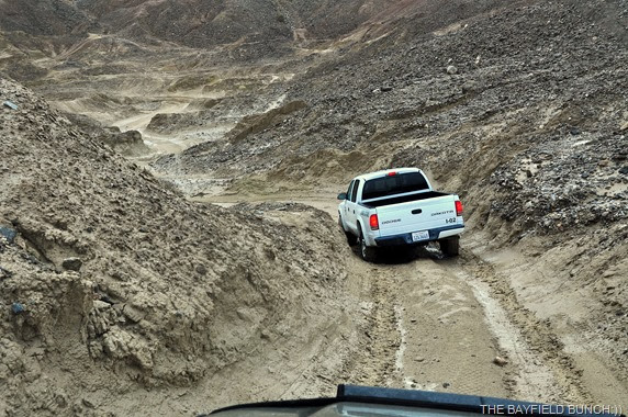
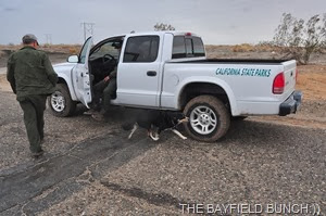
Two interpretive Park Rangers from the Ocotillo Wells division of the California State Parks system conduct the Truckhaven Coral Wash trip. Turns out it was Ranger Ken Conways last guided tour for Ocotilla Wells. He was moving on to the Yuma area. Ken’s assistant on the tour, Mark Kaufman was taking over the reins & would be conducting future Coral Wash tours from here on in. Our group was on the move by 9:10 under a heavy overcast & spits of rain. As it turned out we were the first vehicle behind the State Park truck for the rest of the day so you will see a lot of that Dodge Dakota.
WE WOULD ENCOUNTER A LOT OF SHORT SHARP HILLS TODAY
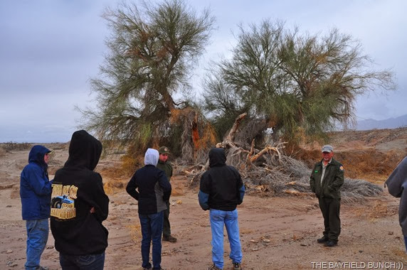
This whole area is a geological wonderment not only in the terms of history but in the fact it is continually changing itself. Through the trip we stopped at close to a dozen spots were both Ken & Mark explained what everything meant from the Salton Seas beginnings & how the Colorado River was a major factor in the areas beginnings. The San Andreas fault was talked about as well as inland lakes as recently as 300 years ago. A large Palo Verde tree was seen & did you know Mesquite tree roots can branch out underground for a hundred & fifty feet from the tree. We learned many things today & these were only a few of them.
SOME AREAS WERE DESERT SAND
Our first stop didn’t have anything to do with Geology but everything to do with a ritzy Golf Course complex just west of Salton City. Or what was once hoped to be a ritzy course. Nothing there now but sand & gravel where fairways had once been. Tall Palm trees long dead from lack of water. Big hole in the ground where a pond had once been located. This was all back in the 50’s when there were once great plans for the Salton Sea area. The continuing demise of the Salton Sea is another whole story.
THIS LARGE HOLE IN THE GROUND WAS ONCE A LARGE POND AT THE GOLF COURSE
WE DRIVE ACROSS WHAT WERE ONCE LUSH GREEN FAIRWAYS
Next stop had a lot of military history to it regarding the second World War. There is a lot of that kind of history in this part of the country. This little patch of ground with it’s remaining cement pad & concrete pillar are all that remain of something that had to do with the Atomic bombs dropped on Hiroshima & Nagasaki. The pilot & crew of the B-29 who dropped the first bomb practiced dropping dummy bombs known as ‘Pumpkins’ into the Salton Sea nearby. They were trying to determine bomb trajectories & turning radius of the B29 to have it quickly clear the area once the real bomb was released. This site with it’s concrete pad & pillar was once a building overlooking the Salton Sea to the East. It was from this site & several other sites like it that bomb trajectories could be determined, monitored, & measured.
KEN TALKS ABOUT THIS SITES PLACE IN WORLD WAR 2 HISTORY
WITH THE SALTON SEA ON THE HORIZON THIS SITE MONITORED THE DROPPING OF MOCK BOMBS INTO IT FROM B-29 BOMBERS
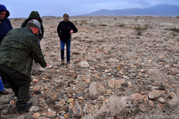
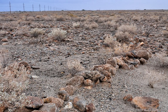
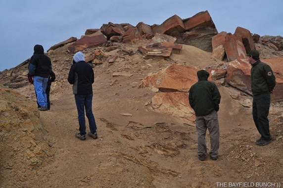
Another stop had us in a wash next to a Milkweed plant where Ken gave a talk on the particularly nasty habit of the TARANTULA HAWK WASP that frequents this area in December. This Wasp actually hunts male Tarantulas. This area was once an ocean bottom millions of years ago & in more recent history it was a fresh water lake bottom. Crustaceans in the gravel attest to the fact it was a lake full of life. Fascinating rocks on the ground & Ken showed us where Indians had piled rocks in circles centuries ago to entrap fish along the lake’s banks.
KEN & MARK STANDING IN FRONT OF A MILKWEED SHRUB TELL US ABOUT THE PARTICULARLY NASTY TARANTULA HAWK WASP
KEN POINTS OUT A ROUND BUNCH OF STONES WHICH WAS A WAY INDIANS MANY YEARS AGO CAUGHT FISH…CIRCLED STONES CAN BE SEEN LOWER RIGHT
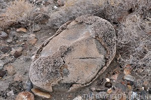
KEN HAD A GEOLOGICAL EXPLANATION ABOUT WHY THESE ROCKS LOOK THE WAY THEY DO
ANOTHER INDIAN FISH ENTRAPMENT LOCATION
MARK TELLS US ABOUT THIS AGE OLD PALO VERDE TREE
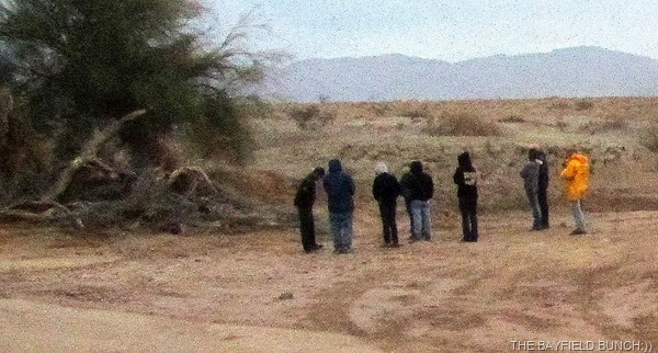
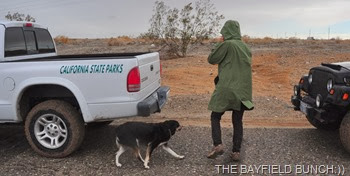
I’M THE YELLOW RAIN COATED CANARY AT THE END OF THE LINE
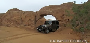
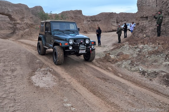
We jostled our way from one stop to another & I said to Kelly, ‘what a great way to spend the day’. At one point we came to an Arch where each vehicle drove through & had their picture taken. Kind of a tradition in the Truckhaven Coral Wash to have one’s vehicle photographed coming through this small Arch.
I HEAD THE JEEP INTO THE ARCH & KELLY IS WAITING ON THE OTHER SIDE WITH A CAMERA
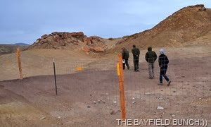
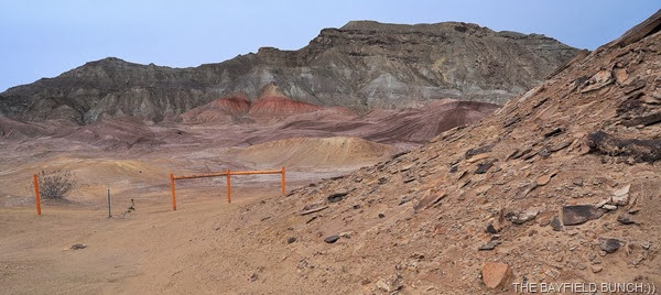
Next stop was a large recently fenced area where an attempt is being made to preserve a big area of towering ancient limestone formations. The Badlands of Borrego are heavily used as a recreational destination by many ATV’ers & Dirt Bikers. They do not stay on designated roads & tear up the landscape wherever they choose to go. It is just the way it is here. Can’t say I agree with what is being done to the landscape but that’s just me.
KIND OF A NEAT GATE TO GO THROUGH
AND THIS IS PART OF THE LARGE LIMESTONE DEPOSITS THEY ARE TRYING TO PROTECT
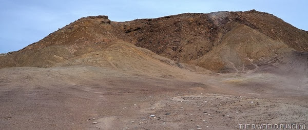
THAT LOW RIDGE LINE MOUNTAIN IS CALLED, ‘BIG DUSTY’
From the fenced in Limestone area we made our way through another wash with high rock & clay walls. Lots of tight turns, ruts, & gulley's.
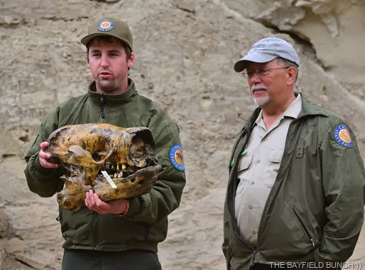
Another stop in a steep sided canyon had Mark bring out a large plastic tub container. As Ken explained how this particular area was once grasslands & marshes Rick lifted a large skull out of the container. This was a replica skull of a large Harland Ground Sloth which once roamed these parts along with many other creatures about 10,000 years ago.
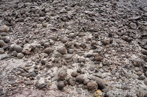
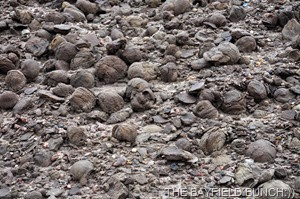
Not far from there we stopped to have a look at a hillside of round rocks commonly referred to as Pumpkins or Canon Balls. It was explained how these were formed but don’t ask me to remember that.
About this point it began raining harder as we slipped & slid our way up out of the lake bottom terrain we had been traveling in. Half a dozen twisting turning grades had us momentarily churning & sliding in the sand which was turning into mud. I could see Mark ahead of us driving the Ranger truck having a few problems here & there. A couple times on the steeper grades I held back until he was far enough ahead so I could take a bit of a run at it. Jeep handled the steep terrain with no problem & I could see the Jeeps behind us had no problems either.
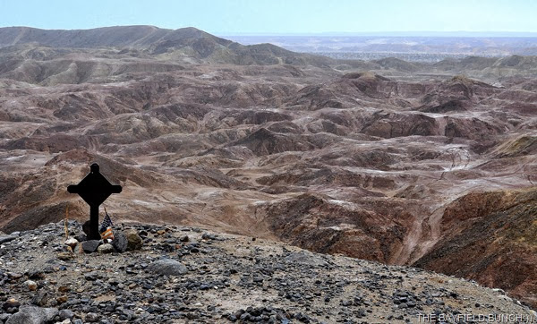
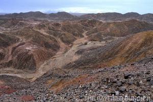
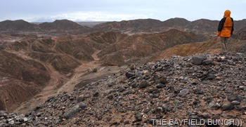
By the time we had reached our turn-around point atop a high ridge overlooking the Badlands it was raining harder. Normally this would be maybe a half hour stop to enjoy the views & eat one’s lunch but due to the rain & the wash below becoming a little greasy Ken decided on a quick lunch & 10 minutes later we were making our way back down into the ancient lake bottom & heading for home.
A FELLOW JEEPER LOOKS OUT OVER THE BORREGO BADLANDS
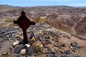
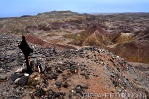
RANGER KEN SAID THIS IS A PERSONAL MARKER & HAD NO IDEA WHAT IT REPRESENTED…POSSIBLY SOMEONE DIED HERE OR NEARBY
Probably took us about 40 minutes to reach highway 86 where the days tour concluded.
EASY TO SEE THE RAIN IS BEGINNING TO TURN THE SAND INTO A SLIPPERY MUD
It was about 1:15 & we had been Jeeping for a little more than 4 hours. Still raining so we all said our quick goodbyes & thanked Ken I Mark for a great tour despite the inclement weather. All the best to Ken who is heading for Yuma & Mark who will be taking over the great geological tour of Truckhaven Coral Wash.
BYE FOLKS
AND PHEEBS FINALLY MAKES IT INTO TONIGHT’S POST:))
Good work out for the Jeep today & little Jeepers held her own amongst the other big beefed up Wranglers. I think we had the smallest tires in the group but had no problems at all bouncing over rocks & boulders or climbing steep short grades. We did slip & slide a bit in some wet sandy areas but that only added to the welcome excitement. Tours like these with interpretive guides along are excellent in learning about the history, topography, & geological points of an area. Good chance for one to get to know their vehicle better as well. Scenery is always superb & the bouncing & jostling around inside the Jeep is always great exercise for the innards.
-
Kelly & I swung east towards the Salton Sea & headed south down through Salton City. A turn to the West brought us out to the Arco Station on highway 86 where we popped into a Dollar Store for a few groceries. Heading back to Borrego Springs we were bathed in sunlight despite being rained on at the same time. That led to a great rainbow in the Northeast & beautiful skies to the West (tomorrow’s pics) heading into Borrego Springs. What a fabulous place this is here in the Anza-Borrego State Park & surrounding area.
-
Unfortunately the sunshine didn’t last & shortly after arriving back at the rig we were once again under a heavy cloud cover. But not to worry, we have good weather days heading our way starting Saturday. Full sunshine for Sunday & Monday with temps going up into the 70’s. Groovy:))
-
Note to Chris from CC & DIXIE. Asked Ken the Ranger guide about that V-22 Osprey base near here. He said those Marine pilots fly out here from San Diego & Yuma to do touch & go landings at the desert airstrip in Ocotillo Wells southeast of Borrego Springs. We know where that strip is & have seen it but have not seen any of those planes in this area.
-
Question from Sandra in the Shout Box asking if we miss the space we had in our 33’ Class A Damon. Answer to that is yes. I think it is always more difficult going from larger to smaller than it is going the other way. Of course there are many pros & cons again but as far as the comfort of actual living space bigger for us would be nice. When I think of those nice big fifth wheels with their spacious floor plans & those big 45’ Diesel Bangers & all their room I am envious of course. Yes, it would be nice having all that space…..but at what cost. Knowing me I would love all the living space but also know I would find something to grumble about. Too big to get into small gas stations, too big to go the places we like to go, too much technical & mechanical stuff to go wrong, etc. Leave it to me…………I can always find the pros & cons in anything!!
=
Mike McFall over there at that North Ranch place asked, ‘Do you have a meter to tell you how many amps you are using? Yes I think we do Mike & it is the same meter that you see the red numbers in. That number toggles back & for showing amps coming in I think. Mike also wondered how I know the names of Mountains etc. I use Benchmark Atlas’s & have one for California, Arizona, Utah, Colorado, New Mexico, & Texas. These Atlas’s also have topographical maps. I don’t always get the names right but I do enjoy sitting down with a magnifying glass going over the maps trying to locate geographical points. No easy feat for aging eyes these days.
GROANER’S CORNER:(( A new wine for seniors........California vintners in the Napa Valley area, which primarily produces Pinot Blanc, Pinot Noir and Pinot Grigio wines, have developed a new hybrid grape that acts as an anti-diuretic. It is expected to reduce the number of trips older people have to make to the bathroom during the night. The new wine will be marketed as Pino More.
-------------------------------------------------------------
- Tourists see the world, travelers experience it.
- Home is where your pet is:))
- "If having a soul means being able to feel
love and loyalty and gratitude, then animals
are better off than a lot of humans."
(James Herriot)
- The pessimist complains about the wind; the optimist expects it to change; the realist adjusts the sails -William Arthur Ward
- The only thing better than right now will someday be the memories of right now...AL.
- It is not so much having nothing to do as it is not having the interest to do something....AL.














Sounds like a real fun day, would love to have a jeep to tour that area, but not yet, maybe someday. Our little car will have to do for now.
ReplyDeleteWe have toured the Imperial sand dunes a couple of time with people we met there a few years ago, that was very interesting!
You wore me out on that one Al. My attention span isn't very long. Thanks for the answers,,,,,,
ReplyDeleteGreat post, Al. Thanks for the pictures, too.
ReplyDeleteNow that sounds like our kind of day! Jeeping, exploring, history and great sites! Can't wait to get back there.
ReplyDeleteWhat an adventure? thanks for sharing it all and in such detail. I felt I was a passenger riding along.
ReplyDeleteWhat an interesting and educational jeep tour!
ReplyDeleteWe must have explored some of the same areas in our little go anywhere (almost) Miata. Found the mud balls, pumpkins. Also the rock / fishing area. Now we know what they were.
ReplyDeleteI enjoy reading about you jeep adventures, but I don't think I would enjoy driving thru such rough land on my own. Maybe as a ride along with an experienced driver! Going in a group also sounds good.
ReplyDeleteWe will be passing by that area Sunday going East on 8 to get to Yuma. We will wave!
Dentist in Mexico on Monday, and reservations in San Diego on Tuesday.
I couldn't tell you the details but it seems that lithium has been found in abundance in the Salton Sea area, so next thing with be changing the landscape even more to mine the lithium.
ReplyDeleteI feel the same way you do when I climb into my tent for the evening. Yes, a nice 5th wheel would be nice, or a Class C, or even a converted van. But at what cost? When it rains I almost would be willing to pay the cost!
Thanks for the detailed jeep tour - we've never been on one and thorougly enjoyed riding along - keep having fun!!!
ReplyDeleteConnie & Barry in PA
Great trip. I really like the idea of going with a Ranger to learn while having fun.
ReplyDeleteI love my big 5er, but wish for a smaller toy, cabover camper, to go play in.
Sounds like my kind of day.
ReplyDeleteWhat a great Jeep tour! We love learning about the area and to do it while getting in some Jeep riding is perfect! Too bad it rained. Still looked like great fun.
ReplyDeleteLooks like a great tour. Do you think a HondaCRV could handle that drive?
ReplyDeleteThanks for info about OSPREYs landing site. Veeeery interesting.
Great Jeep tour Al. I would have liked that too.
ReplyDeleteI am so jealous. That is my favorite place "on earth"! We are so ready to head west to our beautiful desert! Thanks for the photo tour. Our jeep loves that trail...
ReplyDeleteBeautiful tour, thanks for taking us along. My innards are happy we saw it on the internet.
ReplyDeleteThat Groaner had Kathy laughing tonight.
ReplyDeleteGreat pictures, I wonder if our little Sunrunner could do that trail. I hope you are still there when we get there on Monday, we'd love to see you again.
WoW! THAT was fun!
ReplyDeleteThat was so informative, thank you!
ReplyDelete