
THE PALO VERDE NUCLEAR GENERATING STATION MAKES CLOUDS FOR ARIZONA SKIES:))
After Friday’s super relaxing day I knew I had to kick it up a notch. Friends of Leslie & Peter’s were coming up from Peoria to take them out for the day & knowing Kelly would enjoy some nice quiet home time Pheebs & I loaded ourselves up & lit out of Dodge fairly early this morning.

HEADING OUT VULTURE MINE ROAD TOWARDS VULTURE PEAK


Wickenburg is like a magnate & it again drew us down that-a-way. Having discovered ‘The Pie Cabinet’ a couple days ago in the towns west end & knowing they bake muffins daily & have fresh coffee we weren’t long in rolling into their parking lot. With a coffee-cake muffin in hand plus a small coffee we rolled right back out heading west on highway 60 then south on Vulture Mine Road. Had it in mind to maybe slide down around the Tonopah area south of I-10.
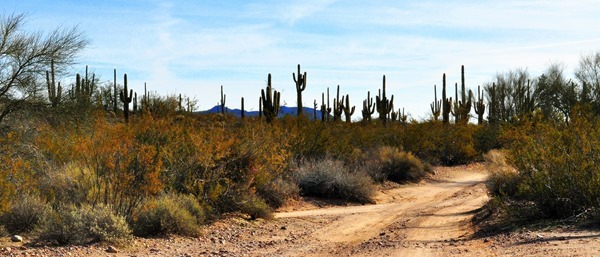
CHECKING OUT A COUPLE JEEP ROADS ALONG THE WAY
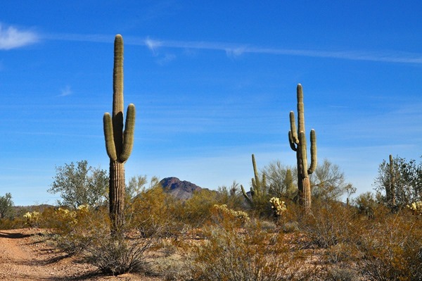
Nice sunny Saturday morning for a drive stopping a couple times along the way to check out a few Jeep roads. We were in no rush as we ambled along taking in all the scenery we could. On the southern horizon I could see great clouds of steam rising from the Palo Verde power plant south of Tonopah & figured if we got down that far we had better drop around & have us a look at that Arizona cloud making plant.

ONE OF ARIZONA’S SEVERAL CLOUD MAKING PLANTS
Main reason for heading that way though was to have us look at the Saddle Mountain area South-west of Tonopah. I remember RV Sue & Her Canine Crew boondocking somewhere around there & Ivan has also boondocked in that area these past couple of winters as well.
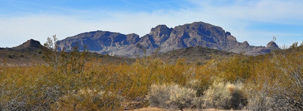
SADDLE MOUNTAIN ON THE HORIZON THROUGH MY TELEPHOTO LENS

We made our way through Tonopah & crossed over Interstate 10. I remember getting off at this exit back in January of 2007 when we had our truck & fifth wheel. It had been our first year to Quartzsite & upon leaving there we decided to overnight at an RV Park south of I-10. Pheebs & i drove right past that same park twice today.
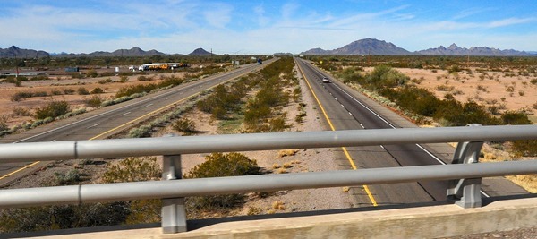
CROSSING OVER I-10 & LOOKING WEST TOWARDS QUARTZSITE WHERE WE JUST MIGHT BE A WEEK FROM TODAY

THIS IS THE RV PARK WE OVERNIGHTED AT BACK IN JANUARY 2007
I could see Saddle Back mountain to the southwest so we just followed a couple roads that lead in that direction. We had no idea which areas RV Sue or Ivan had camped in. Turned right on the Buckeye-Salome highway which led us pretty much right up to Saddle Mountain. Saw a paved highway saying Courthouse road so we turned left & headed down that-a-way for a couple miles before turning around.
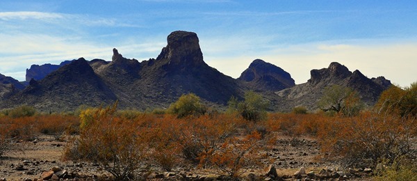
I TOOK ME A LIKING TO SADDLE MOUNTAIN
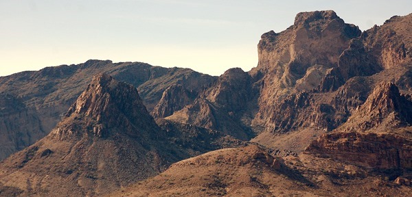


IT WAS HERE WE TURNED AROUND ON COURTHOUSE ROAD & I BELIEVE THOSE TO BE THE GILA BEND MOUNTAINS AHEAD
Must say I took a liking to Saddle Mountain because of it’s high raggety peaks & steeply sloping ridgelines. Reminded me a bit of Superstition Mountain near Apache Junction only smaller. Also reminded me of the Ajo & Kofa Mountains as well. Because of it’s distinct lines this mountain definitely had some character to it. It’s easily seen on the south side of I-10 for anyone traveling along that Interstate.

PHOTO TAKEN NORTH-EAST OF SADDLE MOUNTAIN….CAMPFIRE STONES IN THE LEFT FOREGROUND
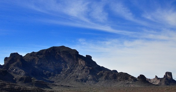

ALWAYS LOTS OF SMELLS FOR PHEEBS WHEREVER WE STOP
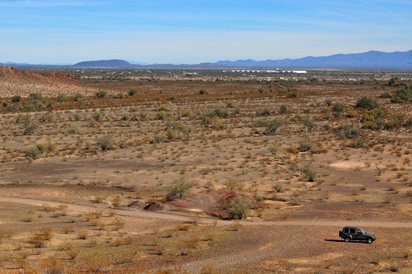
TONOPAH ON THE HORIZON & THAT’S THE WAY WE HEAD HOME

BUCKEYE & PHOENIX ARE THAT AWAY

LOOKING WEST TOWARDS QUARTZSITE WAY BEYOND THAT SMALL MOUNTAIN RANGE

THE ABOVE 2 PHOTOS ARE A GOOD EXAMPLE OF EITHER PRIORITIZING YOUR SKY OR YOUR FOREGROUND & IN THIS CASE EITHER ONE WORKS
Saw a bunch of cars gathered in the desert along Courthouse Road so pulled over & asked what was going on. Saw a lot of older folks carrying pails in what appeared to be a procession of people coming from & heading towards Saddle Mountain itself. A lady told me it was ‘Rock Hound’ group out for the day looking for & picking up different types of aggragates on the desert floor.


Made a right hand turn back onto the Salome Highway heading for Tonopah & spotted a Jeep road on the right heading off into the desert towards Saddle Mountain. We turned there & followed the road for maybe a mile. Saw lots of boondocking spots. The area was also very typically pitted with numerous mine shafts. I think there are more mine shafts in the South-west than there are craters on the Moon. Walked ourselves up a rocky hill taking a few photos along the way.

A VERY TYPICAL MINE SHAFT

AN OLD ABANDONED MINE SITE

CONCRETE FOUNDATIONS FROM LONG AGO MINING BUILDINGS
From atop the hill I could see traffic bustling along on I-10 about 2 or 3 miles to the North. Also had some good views of Saddle Mountain to the South-west. Could also see the community of Tonopah off to the North-east.
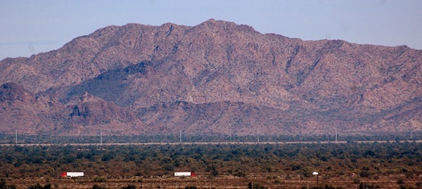
TRACTOR TRAILERS MOVING ALONG I-10 (300mm TELEPHOTO)


IT’S A RUGGED COUNTRY OUT HERE IN THE WEST

TONOPAH IN THE DISTANCE & THE WAY HOME IS WAY OVER ON THE OTHER SIDE OF THAT DISTANT MOUNTAIN RANGE
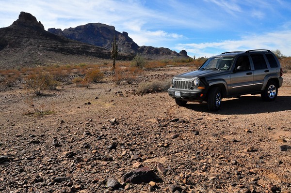
LOTS OF BOON-DOCKING SPOTS HERE IN THE SHADOW OF SADDLE MOUNTAIN
Having just passed through Tonopah an hour before I new there was a Subway right up alongside the I-10 interchange. I didn’t tell Pheebs we were headed there but soon as I came up the road & she spotted the Subway sign she went bonkers. Minutes later we had ourselves all goobed up with a 6” Tuna Sub wallowing in sweet onion sauce. It was about this time I also noticed a solid cloud cover moving in from the West.

Back overtop I-10 we went again & headed east through Tonopah. South of us I could see big plumes of cloud making steam so we turned right onto Wintersburg Road which put those plumes directly ahead of us.


ON WINTER’SBURG ROAD HEADING STRAIGHT FOR THE CLOUD MAKING PLANT

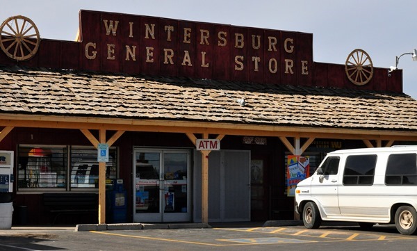
Crossed over I-10 again & 10 minutes later we drove right into the Palo Verde Nuclear Generating Station. So this is where Arizona’s clouds are made I thought. Well it wasn’t the first time I had seen one of these large power plants. While ranch sitting near McNeal Arizona years ago we would sometimes head north up through Cochise County & there was a large cloud making plant up that way as well & the highway ran right through it if I remember correctly. It was just south of I-10 as well.
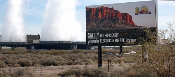
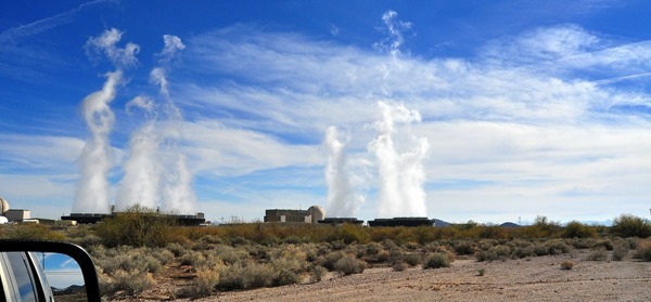


NOW I KNOW WHERE ALL THOSE MARVELOUS CLOUDY SUNRISES & SUNSETS COME FROM:))
From the Palo Verde Power Plant I swung the Jeeps nose in a Northerly direction & we set a course for home once again crossing back over I-10. On the far distant horizon maybe 30 miles away we could see Wickenburg’s Vulture Peak & over the next half hour or so it drew steadily closer. With the cloud cover over us now we had to have our windows back up & just a little snap of heat on. Winter in Arizona with no sun means no solar heat source.
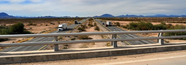
BACK OVERTOP I-10 FOR THE FOURTH & LAST TIME TODAY

PAST THIS CACTUS FARM WITH MANY OF IT’S PLANTS COVERED AGAINST THE COLD NIGHTS I SUSPECT

ACRES UPON ACRES OF SOLAR PANELS

LOOKING WEST ALONG THE ARIZONA CANAL ABOVE & LOOKING EAST BELOW

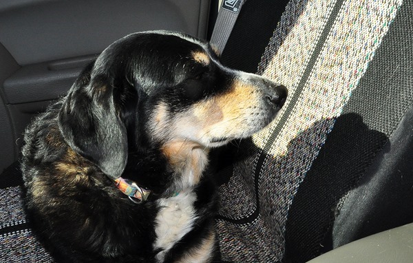
I think it was going on 3 o’clock when Pheebs & I finally got home & for sure it was our longest & farthest away day trip since being here this winter. I don’t know who was more tired, Pheebs or me. Think it was me because the little Smarty Pants had some big snoozes on the way home.

PASSING BY VULTURE PEAK ON OUR WAY TO CONGRESS

BOON-DOCKERS CAN BE SEEN RIGHT OF CENTER
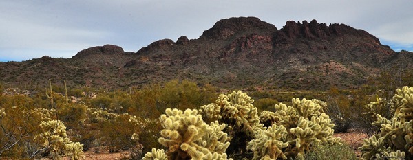
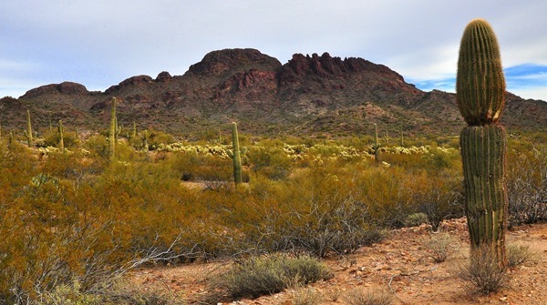
All & all it was a another good daytrip for us & I again got to scout out some new territory. I like when that happens. It’s one of my favorite things to do & I’m sure in my past ancestory there must have been some pathfinders & adventuress explorers along the way. Well at least I darn well hope there was……………………
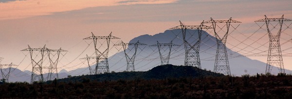
THESE POWER LINES ARE HEADED IN THE DIRECTION OF PHOENIX
GROANER’S CORNER:(( As migration approached, two elderly vultures doubted they could make the trip south, so they decided to go by airplane. When they checked their baggage, the attendant noticed that they were carrying two dead raccoons. "Do you wish to check the raccoons through as luggage?" she asked.
"No, thanks," replied the vultures. "They're carrion."
Fantastic day trip for sure. Wish I could have come along, instead of shoveling snow over here.
ReplyDeleteThat was a great day trip. More wonderful scenery.
ReplyDeleteWe have friends that manage Saddle mountain Rv Park, but have not seen them for years.
Wow! What a blog!!! Thouroughly enjoyed the journey Al. One of your better efforts and the pics were just gaze-worthy. Always enjoy your efforts. And the Subway visit was funny with Pheebs. She likes her subs.
ReplyDeleteNow that was one good explore, and you got into some rugged looking country too. You had me almost tired by the end of it! A lot of beautiful skies (unlike our neck of the woods these days).
ReplyDeleteAbsolutely beautiful, nothing like the great outdoors for taking photos.
ReplyDeleteEnjoyed the ride. Thanks
What a great ride, pretty rugged country out that way.
ReplyDeleteI am still amazed at the beautiful photos you share with all of us. I don't comment much but Sherri and I really enjoy your pictures and description of the area you are in. Hopefully we will be able to visit your great state next winter...good Lord willing we can see it first hand!
ReplyDeleteAll I remember about being in that area is that Lady would get stickers in her paws, and we were constantly stopping to remove them. The groaner was a good one. I had to read it twice before the light turned on, and then I groaned!
ReplyDeleteWe've boondocked at Saddle Mountain a couple times. It's your kind of place. Scenic, very few people and lots of dirt roads and trails to explore.
ReplyDeleteSome of the best sunsets we have seen have been over the Saddle Mountains when we stayed at Saddle Mountain RV Park
ReplyDeleteGreat road trip, love those hills and then you found the power plant containment building and turbine house. Never been a fan of those fan condensers, I like the tall concave gravity operated towers. Good theory on where clouds come from. Great Post. You even put in some solar panels for the green folks.
ReplyDelete